Map of Norway and Satellite Imagery
This map of Norway highlights its fjords, lakes, and cities. If you want a topographic map of Norway, marvel at its mountains like Galdhopiggen. Finally, the satellite map displays everything from its forests to its glaciers.
Norway map collection
You are free to use our Norway map for educational and commercial uses. Attribution is required. How to attribute?
About the map
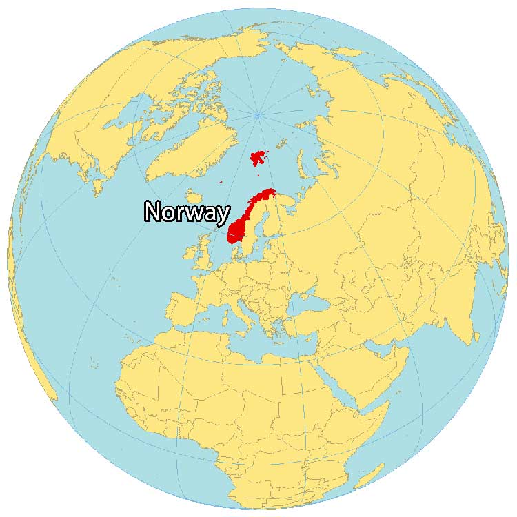
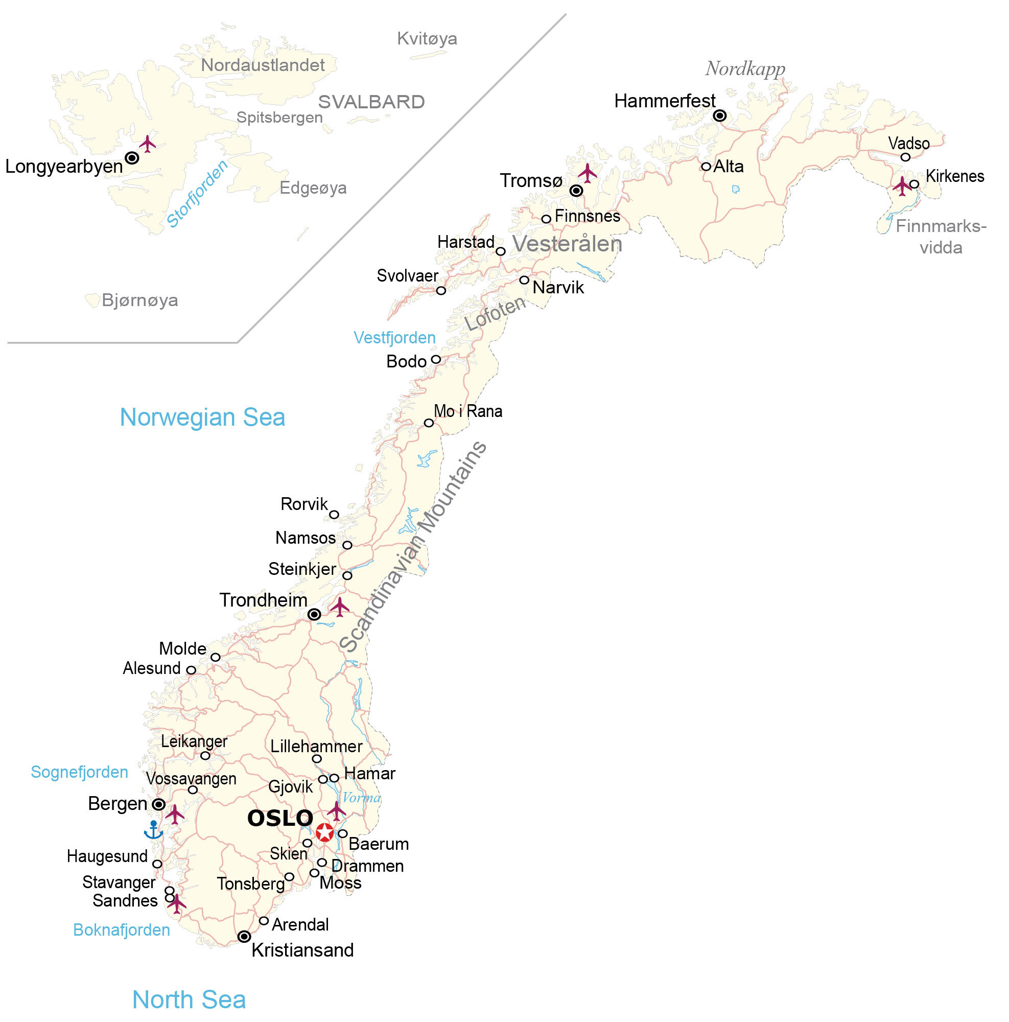
Norway is located in Northern Europe, along the North Sea, the Norwegian Sea, and the North Atlantic Ocean. It’s part of the subregion of Scandinavia with Sweden and Finland. Norway shares a land border with Sweden to the east, and Russia in the far northeast.
Norway includes the remote Arctic archipelago of Svalbard as part of its boundaries. But most of its population resides on the mainland. For example, Oslo is the capital and largest city, which is also where the Nobel Peace Prize is awarded.
Norway is also home to many mountains, including the tallest mountain in Northern Europe, Galdhøpiggen. The country has a varied landscape, with everything from forested hills to glaciers and snow-capped peaks. In the north, the climate is Arctic, with long, cold winters and short, cool summers. But in the south, the climate is more temperate, with milder winters and warmer summers.
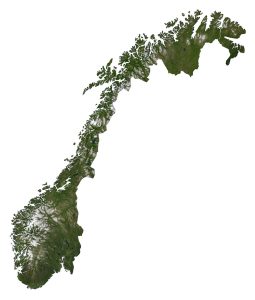
SATELLITE IMAGERY
Norway Satellite Map
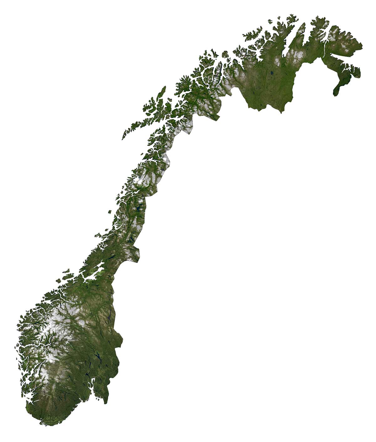
Norway is a country with diverse landscapes and terrain. The north of Norway is covered with Arctic tundra and glaciated areas. Additionally, it has the highest concentration of fjords in the world, including the Geiranger Fjord and the Nærøy Fjord, both are UNESCO World Heritage Sites.
Otherwise, it’s a mix of rugged mountains, plateaus, valleys, and plains. Specifically, the coastlines in Norway are extremely long and rugged. Beerenberg is Norway’s only active volcano on Jan Mayen Island.
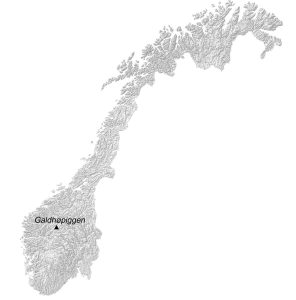
PHYSICAL MAP
Norway Elevation Map
The most prominent mountain chain in Norway is the Scandinavian Mountains, which mostly form a border with Sweden to the east. These mountains stretch through most of the Scandinavian Peninsula and form its fjords.
Galdhopiggen is Norway’s highest mountain peak at 2,469 meters above sea level. Its peak is situated in the south-central region of Norway in the Jotunheimen mountain area.

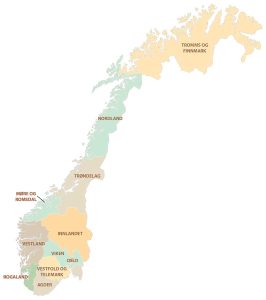
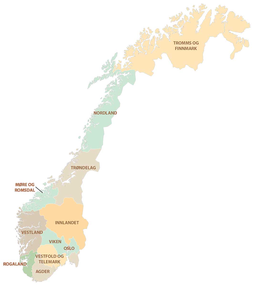
POLITICAL MAP
Norway Counties Map
There are 11 counties in Norway, which are divided administratively and geographically. Counties are the first-level administrative unit but they can be divided further into municipalities.
The 11 counties of Norway consist of Agder, Viken, Troms og Finnmark, Vestland, Trøndelag, Innlandet, Vestfold og Telemark, Rogaland, Møre og Romsdal, and Nordland. Although the capital city of Oslo is a country, it’s also considered a municipality as well.
Capital City
Oslo
Major cities
Alesund
Bergen
Drammen
Fredrikstad
Kristiansand
Sandnes
Skien
Stavanger
Tromso
Trondheim
Cities, towns and villages
Alta
Arendal
Baerum
Bodo
Finnsnes
Gjovik
Hamar
Hammerfest
Harstad
Haugesund
Kirkenes
Leikanger
Lillehammer
Longyearbyen
Molde
Moss
Narvik
Nordkapp
Rorvik
Steinkjer
Svolvaer
Tonsberg
Vadso
Vossavangen
Fjords, seas and rivers
Boknafjorden Fjord
North Sea
Norwegian Sea
Sognefjorden Fjord
Storfjorden Fjord
Vestfjorden Fjord
Vorma River
Islands
Bjornoya (Bear Island)
Edgeoya
Nordaustlandet
Kvitoya
Spitsbergen
Svalbard
Vesterålen
Lofoten
Landforms and mountains
Finnmarksvidda Plateau
Scandinavian Mountains