Massachusetts County Map
This Massachusetts county map displays its 14 counties. Middlesex, Worcester and Suffolk County are the most populated counties in Massachusetts.
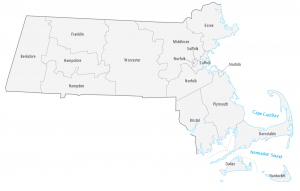
This Massachusetts county map displays its 14 counties. Middlesex, Worcester and Suffolk County are the most populated counties in Massachusetts.
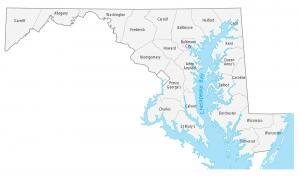
This Maryland county map displays its 23 counties and one independent city. Montgomery, Prince George and Baltimore are the most populated counties.
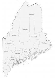
This Maine county map displays its 16 counties. Cumberland, York and Penobscot are some of the largest counties in Maine in terms of population.
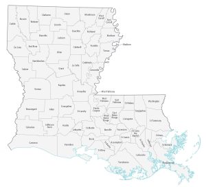
This Louisiana parish map displays its 64 parishes. East Baton Rouge, Jefferson and Orleans are some of the most populated counties in Louisiana.
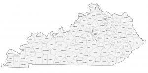
This Kentucky county map displays its 120 counties like Jefferson, Fayette and Kenton county. Each county is labeled with its administration name.
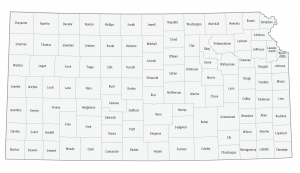
This Kansas county map displays its 105 counties. Johnson, Sedgwick and Shawnee County are the largest counties in Kansas in terms of population.
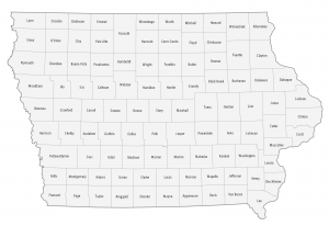
This Iowa county map displays its 99 counties. Polk, Linn and Scott county are some of the largest counties in Iowa in terms of population.
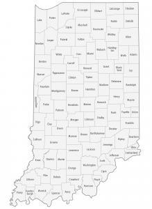
This Indiana county map displays its 92 counties. Marion, Lake and Allen are some of the largest counties in Indiana for highest population.
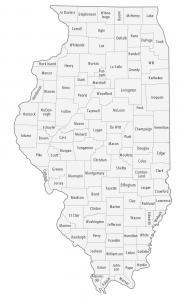
An Illinois county map that displays its 102 counties. For instance, Cook, DuPage and Lake county are the most populated counties in Illinois.
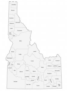
This Idaho county map displays its 44 counties. Ada, Canton and Kootenai are some of the largest counties in Idaho in terms of population.