Connecticut County Map
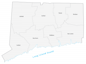
This Connecticut county map geographically displays its 8 counties. Fairfield, New Haven and Hartford are the most populated counties in Connecticut.
This Connecticut county map geographically displays its 8 counties. Fairfield, New Haven and Hartford are the most populated counties in Connecticut.
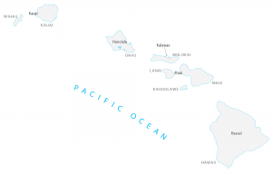
This Hawaii county map displays the 5 county divisions of Hawaii. Hawaii’s five counties include Kauai, Honolulu, Maui, Hawaii and Kalawao counties.
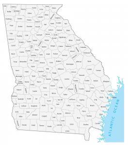
A Georgia county map that displays its 159 counties. For example, Fulton, Gwinnett and Cobb are some of the most populated counties in Georgia.
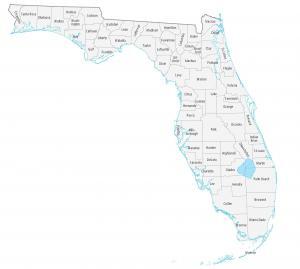
This Florida county map displays its 67 counties. Miami-Dade, Broward and Pinellas are the most populated counties in Florida.
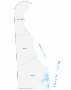
This Delaware county map displays its 3 counties. New Castle, Kent and Sussex are the only 3 counties that exits in Delaware.
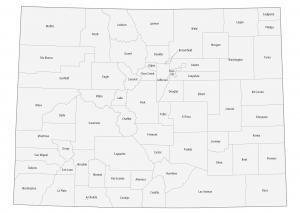
This Colorado county map displays its 64 counties. For example, Denver, El Paso and Arapahoe are the most populated in the state of Colorado.
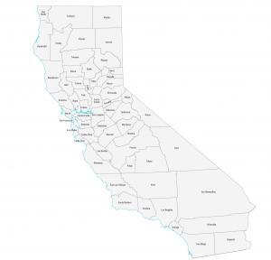
This California county map displays its 58 counties. For population, Los Angeles, San Diego and Orange county are the largest counties in California.
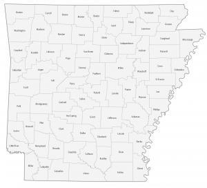
This county map of Arkansas displays the 75 counties in Arkansas. For example, it includes Pulaski, Benton and Washington county.
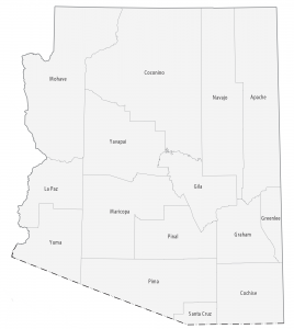
In this Arizona county map, it displays its 15 counties. Maricopa, Pima and Pinal are some of the largest counties in Arizona in terms of population.
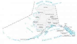
This Alaska county map displays boroughs, census areas, cities and municipalities. There are 29 administrative areas in total for the state of Alaska.