15 Free Satellite Imagery Data Sources

Free Satellite Imagery From Authoritative Sources
The secret is there are dozens of authoritative sources with high-quality satellite imagery.
But wait there’s more.
Not only can you download the latest, greatest satellite imagery… but it’s all FREE.
All you need to know is where to find them. Read below to see our go-to list of free satellite imagery sources.
And remember – if you just want to look at satellite imagery without downloading the data, check out our list of 25 satellite maps.
1. USGS Earth Explorer
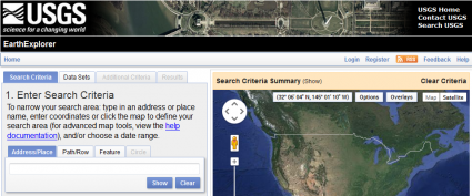
Unlock the power of the USGS Earth Explorer because it’s not just for the United States. No matter where you live, the USGS Earth Explorer offers the latest satellite view like:
- LANDSAT: Silently, Landsat has been circling our planet archiving historical satellite imagery. As early as today, it uploads it to the USGS Earth Explorer.
- SPY SATELLITES: Imagine being able to look back more than 50+ years in the past. How much would that be worth? Spy satellite imagery like CORONA has been declassified over the years and is completely available to the public.
- HYPERSPECTRAL: If you don’t know what hyperspectral imagery is, it’s like having spectral detail on steroids. Hyperion was the experimental instrument imagined by NASA. Now, Earth Explorer is the only place where you can download this hyperspectral imagery.
USGS Earth Explorer is a world-class source of data. If you’re not familiar with how to use it, here’s a guide on how to download free Landsat imagery from the USGS Earth Explorer to help you get started.
2. Sentinel Copernicus Browser
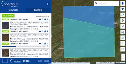
Sentinel-2 is the start of a new and exciting era in open and free satellite imagery. It’s not just because coverage spans the entire globe. But it’s also because Sentinel-2 has some of the most current satellite photos available to download at a high resolution.
The Copernicus Browser is the official headquarters to download Sentinel imagery. It’s a bit quirky to get used to, so check out our guide for how to download Sentinel-2 imagery.
- SENTINEL-2: Two satellites make Sentinel-2. Due to its popularity, there will be 2 more satellites in the coming years. Sentinel-2 has a 10-meter resolution in red, green, blue, and near-infrared. Its 12 spectral bands ranging from coastal to SWIR bands. It’s just been 5 years since its launch. But demand has soared, making it one of the most popular free satellite imagery available.
- SENTINEL-1: If you need synthetic aperture radar (SAR) imagery, Sentinel-1 is C-band. The potential for SAR is endless. But you don’t get the pretty picture like Sentinel-2.
After you download Sentinel imagery, how do you use it? Download the ESA’s open source Sentinel-2 Toolbox. All toolboxes give you the framework to embrace a rich set of analysis, visualization, and processing tools.
3. NASA Earthdata Search
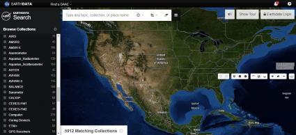
There’s a lot to like about NASA’s Earthdata Search, specifically for Earth science data discovery. Especially, the choices of satellite imagery are incredible.
- DERIVED DATA: Most of NASA’s Earth Data is an analysis product for the study of Earth Science. For example, it’s anything from the biosphere, cryosphere, hydrosphere or atmosphere. Most products come from a data and applications center (DAAC).
- LAND COVER: NASA Earthdata is also an excellent source of global land use and cover. But it’s not just your typical land cover classes. It has specialized satellite-derived data like permafrost and wetland types.
Our suggestion is to start with a simple search. Then, change the time range criteria to narrow down your search. Finally, download your free satellite imagery. You’ll get the hang of it after a couple of tries. This NASA’s EarthData Search Usage Tutorial will help.
4. NOAA Data Access Viewer
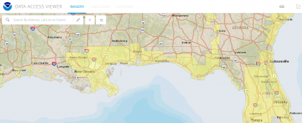
NOAA replaced its aerial photography ordering system with the NOAA Data Access Viewer. Now, it’s where you discover authoritative datasets along the coasts. But it’s not only for satellite imagery. You can download:
- AERIAL/SATELLITE IMAGERY: The NOAA Data Access Viewer holds satellite, aerial and LiDAR imagery. First, enter your area of interest. Once you do this, all the available data sets will appear in the right-side pane. From here, all you have to do is download.
NOAA Data Access Viewer is out of beta mode now. But the download speeds are still slow and sluggish. Overall, this is a great option for coastal areas like California, Florida, and New York.
5. Maxar Open Data Program
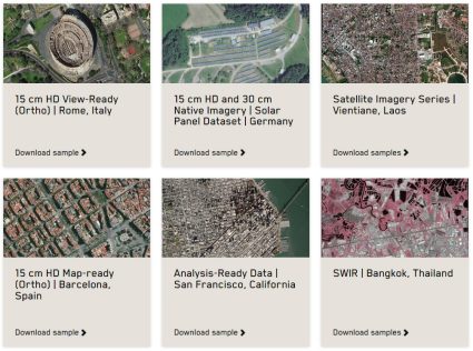
If you want high-resolution satellite imagery in the world, try harnessing the power of Maxar. In fact, it’s so sharp that you can almost see license plates.
By no means, you can download the entire Maxar library of 30cm imagery for free. Instead, you can download free satellite imagery from Maxar in two ways:
- OPEN DATA PROGRAM: For any natural disaster, Maxar’s Open Data Program supplies satellite imagery for relief. For example, fires, floods, hurricanes, typhoons, and earthquakes are part of this list. They release data into the public domain under a Creative Commons 4.0 license. Take a look at any recent natural disaster event, and I’ll bet you it’s there.
- SAMPLE DATA: If you want to simply experiment, try downloading from their sample imagery. For example, it has building footprints, elevation, stereo, and true color imagery.
These are examples of high-resolution satellite imagery. If you couldn’t find what you were looking for here, the next option is your second best choice.
6. Geo-Airbus Defense

Just like Maxar, Geo-Airbus Defense is a commercial vendor. SPOT, Pleiades, and RapidEye are some of the best in class.
- SAMPLE IMAGERY: Geo Airbus Defense Systems offers 140+ sample images for experimentation. For optical imagery, it gets as finer as 1.5 meters with SPOT. Radar imagery from TerraSAR-X is as sharp as 3 meters. Finally, you can get a cut of the unrivaled 12-meter WorldDEM. This is much finer and more accurate than ASTER and SRTM global DEMs.
Geo-Airbus Defense also has a collection of sample imagery. But unfortunately, their free satellite imagery selection is quite limited.
7. NASA Worldview
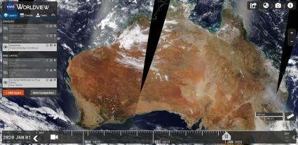
NASA Worldview isn’t very good for downloading raw data. For instance, you can’t even download the famous Blue Marble here. What it is good for is providing access to a variety of scientific products.
- SCIENTIFIC PRODUCTS: The goal of NASA Worldview is to showcase scientific products across disciplines. For example, there’s a section for hazards and disasters. Also, you can filter satellite-derived products by science discipline.
If you want to download free satellite imagery, you have to add the layer to the map. Next, you have to pick the date in the timber slider below. Finally, click the data tab in the legend and click the “Download Data” button.
8. NOAA CLASS
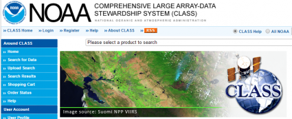
From land to our skies and oceans, it’s time to set sails with NOAA CLASS. NOAA’s library of satellite imagery is the Comprehensive Large Array-data Stewardship System (CLASS).
To access it, you have to register for an account. Then, you can log in and start downloading satellite imagery. NOAA CLASS is a bit messy. But you can categorize NOAA CLASS into 3 sections:
- OCEANIC IMAGERY: NOAA manages and protects coastlines with CoastWatch. CoastWatch is a collection of measurements such as wind, temperature, and color. All come from satellites like JASON, POES and GOES.
- ATMOSPHERIC IMAGERY: When it comes to our weather, GOES knows weather. In fact, GOES-R is the most advanced fleet of weather satellites to this day. So, these satellite imagery scenes capture everything from hurricanes to tornadoes.
- ENVIRONMENT AND CLIMATE: These products cover everything from ozone to aerosol.
Even though NOAA CLASS isn’t as intuitive as the rest, you still get to deep dive into our oceans and atmosphere. And that’s pretty good.
9. National Institute for Space Research (INPE)
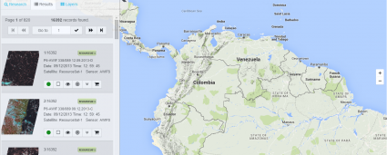
The National Institute for Space Research (INPE) is Brazil’s space research branch. They’ve developed the INPE Image Catalog which is like a library to download free satellite imagery. A big part of this catalog is satellite imagery from CBERS.
- CBERS: The partnership between Brazil and China has its own joint mission. The key data set in this catalog is China–Brazil Earth Resources (CBERS 2). According to INPE, it will include CBERS 4, ResourceSat, and UK-DMC 2 too.
The one caveat is that the data is specific to South America and Africa. If you’re OK with that, you can translate the website from Portuguese to English. Once you do that, you’ll have to create an account. Because for every request you make, INPE sends download details to your email.
Next, select your satellite and sensor. Then, choose a country in South America and Africa. Finally, add it to your cart, and click “Go Ahead”. From here, you can download your free satellite imagery from the INPE FTP site.
10. Bhuvan Indian Geo-Platform of ISRO
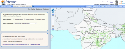
India has made tremendous strides in satellite remote sensing technology. In fact, the launch of the Indian Remote Sensing (IRS 1A) satellite dates back to 1998. Since then, data has become available on the Bhuvan Indian Geo-Platform.
The platform is well-built. But most of the data is for India only. This includes IMS-1 (Hyperspectral), Cartosat, OceanSat, and ResourceSat. All are Indian satellites. The following products are also available to download outside of India:
- NDVI: Normalized Difference Vegetation Index Global Coverage.
- CARTODEM: This 30-meter elevation model uses stereo images from overlapping Cartosat-1 images.
11. JAXA’s Global ALOS 3D World
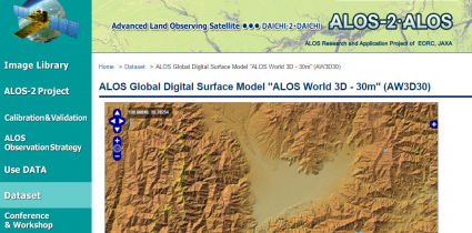
ALOS World 3D is a 30-meter spatial resolution digital surface model (DSM). JAXA built it and recently released it to the public. The neat thing about this is that it is the most precise global-scale elevation data at this time.
It uses the Advanced Land Observing Satellite “DAICHI” (ALOS) which is a type of L-band radar. If you want to download ALOS 3D, go to the JAXA Global ALOS portal. Next, you’ll have to register for an account. After approval, you can download it through the download portal.
12. VITO Vision
The VITO Vision website offers PROBA-V, SPOT-Vegetation and METOP as free satellite imagery. These coarse resolution satellites carve out vegetation patterns across the Earth’s surface.
It takes some time and effort to create an account for VITO Vision. The interface is intuitive and delivers free low-resolution satellite data at your fingertips. This type of data is good for big picture applications that don’t need the finer details.
13. NOAA Digital Coast
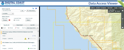
It’s all about the beautiful seashore when you’re exploring for data on NOAA’s Digital Coast. Coastal data is all you’re going to get in this imagery platform.
To download data, select your area of interest. Define your data set to download. And sift through the results. You have benthic, elevation, imagery, land cover, and socio-economic data. You get a range of free satellite imagery to choose from such as radar, infrared, and true color composites.
14. Satellite Land Cover
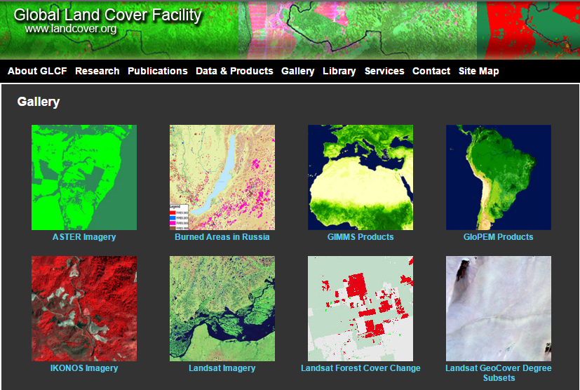
We have never had this good of a perspective of our changing planet because of satellite imagery. That’s where land cover comes in.
- LAND COVER: We list the best global land cover data sources from Landsat, MODIS, and AVHRR. Global land cover quantifies land cover change around the world. This includes vegetation, geologic, agriculture, hydrologic, and urban areas.
Some of the biggest challenges we face today are best understood through satellite land cover. This is because remote sensing covers that much more ground.
15. UNAVCO
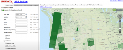
Let’s cap things off with UNAVCO. University NAVSTAR Consortium (UNAVCO) is an organization of universities. If you don’t know who UNAVCO is, here’s UNAVCO Explained in 3 Minutes.
- SYNTHETIC APERTURE RADAR: Their platform is the UNAVCO SAR Archive Search User Interface. This website is flooded with synthetic aperture radar from satellite sources. But first, you’ll need a username and password. Then, you can finally get your hands on the data.
Their main goal is to support scientific research using geodesy technology. Because our world is all connected, UNAVCO provides access to geodesy data. For example, think of flooding, plate tectonics, and earthquakes.
Summary: 15 Free Satellite Imagery Data Sources
Satellite data has opened up new channels on how we view the planet.
Instead of spending days searching for a good base map, you can tap into this list of free satellite imagery data.
You’ve learned some of the key data centers to collect free satellite imagery from around the globe.
…But did we miss anything? Let us know below.
…And if you want to check out some of our other sources for elevation, GIS data, and LiDAR, then check out some of the links below:


Very educative
Great selection, but it lacks information about eos.com. Especially their blog articles on various topics are very informative and cool!
Nice list. Two you missed are Soar Earth and Sentinel Hub
Please can I get free data?
Hi, I need Orthophotos in geotiff file format, its for X Plane 11 Scenery editing and development in my country with the Xplane World Editor Software. How it be possible?
I want to download the images of a small area for a geological survey. How can I do this? Is it possible by without payment?
This is such a great article! There was no info missed at my view.
Great and very helpful publication
What about using Glovis https://glovis.usgs.gov/ as an image download site and free Multispec program to work with images https://engineering.purdue.edu/~biehl/MultiSpec/?
Absolutely love this list. Thank you so much for putting it together.
Is there any news about Landsat 9? What are its specs and when can we start seeing some of its data?
It looks like Landsat 9 is set to launch in September 2021. It will have similar specifications to Landsat 8. Its visible red, green, and blue bands will have a 30-meter resolution, plus one panchromatic band at 15 meters.
Landcover.org is off
How many years back are satellite images available?
Landsat-1 was launch in summer 1972 and this was the first of its kind for Earth observation satellites. So, 1972 is as far back as you can go for remote sensing satellite imagery.
More info here- https://gisgeography.com/landsat-program-satellite-imagery-bands/
My questions why in the late 1980’s to early 1990’s on the GPS Golf Course Satellite images of my golf course I could zoom into around 18″ Eighteen inches of very clear high resolution feeds? Now I can’t find anything like I had access to before. Has Big Brother put a kibosh on that type of access? I I’m using it for simple curiosity viewing. Any suggestions on any foreign technology that doesn’t have big brother keeping control of its robots? Why don’t people question the satellites that have been in space for 60 plus years using solar and battery technology that is still working, why do we not have access to those types of batteries? Another, just because I’m curious question.
Just in 2014, the US government softened restrictions for sharper imagery available to the public. Now, the general public can obtain 50cm (0.5m) satellite imagery.
If you’re interested in imagery viewers online, here are some historical imagery viewers where you can select through a timeline of available images. Unfortunately, they are not open to download in most cases. https://gisgeography.com/free-historical-imagery-viewers/
Do any of these options display property boundaries?
Hi! I’m looking for my dog in north of Norway, but I cant find any updated satellite images from 19-20th of April 2019. Do you have any recommendations?
Hi, unfortunately none of these satellites will be able to help you. The best resolution available commercially is Worldview-3 at 0.31m resolution. If you bring out a tape measure to the ground, you can see how large that pixel is.
Due to a gyro failure. Worldview-4 is no longer an option.
Sorry, my earlier comment is missing an important word:
This is a very impressive list. What would be the best source to detect FIRE globally as fast as possible?
Here’s an article we have with 3 sources of active fire maps in the world. NASA and Copernicus both have data available for real-time fires – https://gisgeography.com/active-fire-maps-real-time-wildfires/
I use to utilize Arc2Earth to bring Googlemaps right into my GIS projects as background imagery. Imagery was sharp and loaded quickly. Unfortunately Arc2Earth went out of business and no one seems to have replaced them. I think there was licensing problems with Google. Where can I access imagery as good as Google for a decent cost? I am not interested in downloading data/tiles for every project. Right now I am using Bing maps thru ArcGIS online. Their imagery seems to be not as sharp as Google in most cases.
You may want to have a look at the GeoViewer of VITO?
https://proba-v-mep.esa.int/applications/geo-viewer/app/
I want to download the hyperspectral images of some urban areas. which sensor/satellite should I use.
Is there any satellites which gives past images of any structure/locations?
Hi Ann – Yes, please see the following article on free historical ortho and satellite imagery viewers. https://gisgeography.com/free-historical-imagery-viewers/
Hi; Which would be the best site to download imagery for a golf course guide?
The number 1 option for free satellite imagery would be Sentinel-2. However, the best pixel resolution would be 10 meters.
Are historical satellite images available for free, or is it just current imagery?
Yes, there are historical images for free. For example, some of the old spy satellite images are free. See CORONA on this list – https://gisgeography.com/earth-satellite-list/
There are others. Look into USGS Earth Explorer for more details.
Ummmmm, I don’t know where you are from, but in my neck of the woods, a license plate is about half of 30 cm long, so at best, it would occupy ~1/4 of a pixel or 1/8 to 1/16 of 2-4 pixels. That is assuming it is laying face up…..
Ain’t no way that is “almost able to read”, not even close. You can not even see that there is a plate there.
Regardless, great information.
This is vital and reliable
Hi I’m looking for photos of particular time from an event that happened to my family putting them in danger, can you advise how to get these images?
Regards
Jamie Clermont
Here’s a guide that should help you download Landsat and various other satellite imagery available on USGS Earth Explorer – https://gisgeography.com/usgs-earth-explorer-download-free-landsat-imagery/
Actually the best satellite seems to be just plain old google maps.
is there any hyper-spectral resolution free satellite images?
Yes there is Hyperion from the EO-1 mission
Hello, I am looking for high quality imagery of Nassau, Bahamas in order to convert it into flight simulation scenery (FSX and P3D). The US Earth Explorer has none. Do you know which source I can use for that and also be free? Thanks
Very good list, thank you.
But just to be clear, the highest resolution, completely free satellite imagery I or anyone is going to find is still the Sentinel 2a&b 10m images, correct?
These 1.5m-30cm images are tantalizing, but I’ve contacted some of those sites in the recent past and the prices for imagery already on hand is astronomical. Sigh.
Thanks.
Yes, the best freely available are Sentinel 2A & 2B
Great list of sources, Thanks
Maybe could you add the French THEIA Land Data Center, operated by CNES (https://theia.cnes.fr/), which distributes free data from several satellites :
– Spot World Heritage : CNES started reprocessing the whole SPOT archive. It is a long term project, but already nearly 100 000 SPOT archive images from various sites are available, ortho rectified and expressed in TOA reflectance. Several siltes are available all over the world.
– LANDSAT L2A : surface reflectance Landsat data are systematically produced and distributed over France, since 2009.
– SPOT (Take5) : SPOT4 and SPOT5 satellites, at the end of their operational life, were used to produce time series of images above 190 sites, with a repetitivity of 5 days, similar to the repetitivity that will be provided by Sentinel-2 images when the second satellite is operational.
Olivier
What’s the name of the magazine that had a recent article about treasure/, oin & archeaological (sic) hunters, (the most recent find of ancient coins in England?) They had searched through satellite and found, or saw from the sky, ancient Middle-Aged furrows on a farm in England, Is it Discovery Magazine? Or is it National Geographic? This article also had a list of free websites for explorers and “legal” hunters of ancient coins & artifacts.
Yes, they are available for Africa – see here for an overview map: http://maps.mundialis.de/
Awesome…great site…but one question please. Is the ESA sentinel data available for Africa
Airbus World DEM provides…
Pole-to-pole coverage: Homogenous standardised DEM for any spot on Earth
Unique quality: Superior elevation information anywhere on Earth
Unrivalled accuracy: 2m (relative) / 4m (absolute) vertical accuracy in a 12m x 12m raster
Digital Surface Models and Terrain Models available
Easy access
For free samples see http://www.geo-airbusds.com/worlddem-sampledata/
Thanks that’s very helpful …….
Great site! I have a couple of links you can use for the NOAA Data Access Viewer in Item 9 and the NOAA Digital Coast in Item 11. The correct link for the NOAA Data Access Viewer in Item 9 is https://coast.noaa.gov/dataviewer/#. The Data Access Viewer is fully operational, and we also provide a link to the new Beta version when you open the Data Access Viewer. Item 11 actually links to the Data Access Viewer. The correct link for the NOAA Digital Coast is https://coast.noaa.gov/digitalcoast/. Thanks