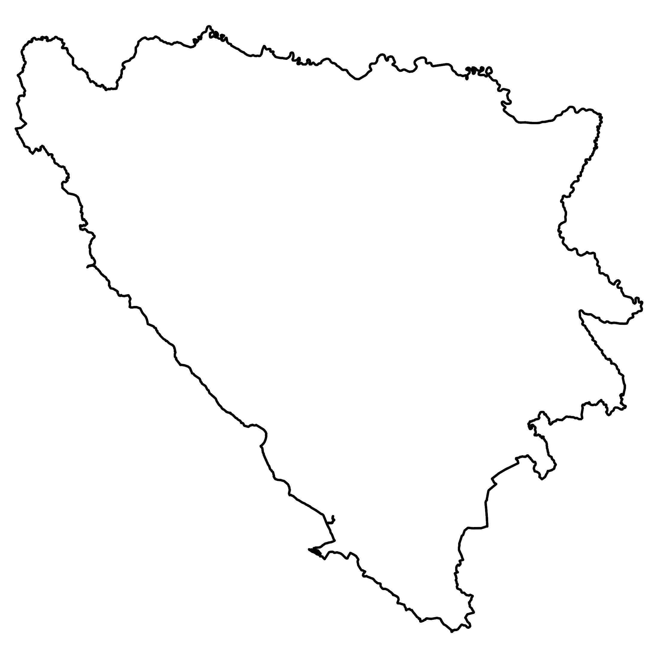
Bosnia and Herzegovina Map
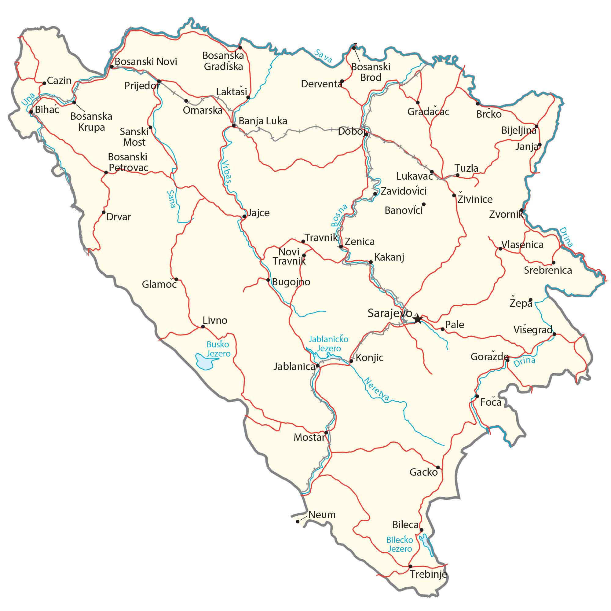
Our map of Bosnia and Herzegovina (B&H) displays major cities, towns, roads, and rivers. It includes a satellite and physical map to see its diverse topography like the Dinaric Alps.
Bosnia and Herzegovina map collection
You are free to use our Bosnia and Herzegovina map for educational and commercial uses. Attribution is required. How to attribute?
About the map
Bosnia and Herzegovina (B&H) is located in Southeast Europe within the Balkans. It borders 3 other European countries. First, Croatia wraps around from the west to the north. Then, Serbia and Montenegro border the east side of the country.
Bosnia and Herzegovina is not entirely landlocked because the western tip reaches the Adriatic Sea with about 20 kilometers of coastline at the town of Neum.
Also, it’s a relatively newer country and was founded in 1992 (formerly Bosnia). Sarajevo is the capital and largest city in the country. Sarajevo, with its rich history and blend of cultures, showcases architecture that reflects both its Ottoman and Austro-Hungarian influences.
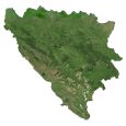
SATELLITE IMAGERY
Bosnia and Herzegovina Satellite Map
Bosnia and Herzegovina occupies an area of 51,129 square kilometers (19,741 sq mi), which is almost identical in size to Croatia.
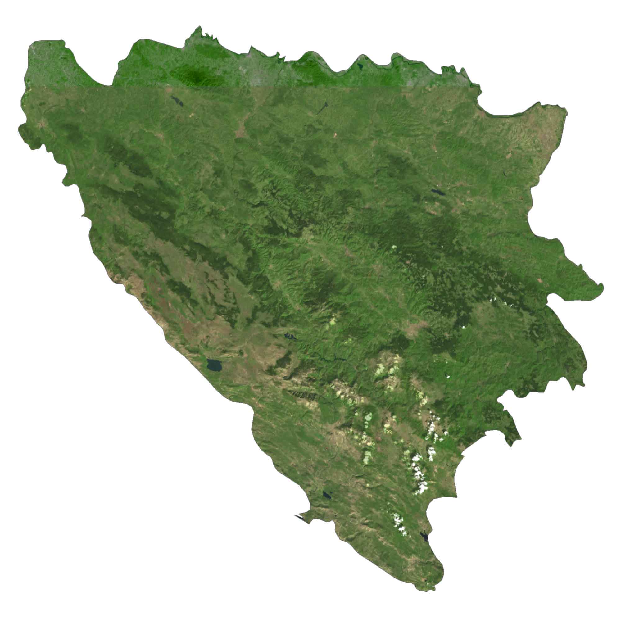
The terrain is a mix of mountainous, hilly, and flatlands. Specifically, the central and eastern regions are mountainous. Whereas, it transitions to moderate hills to the northwest and flatlands to the northeast.
According to the FAO, forests cover more than 40% of Bosnia and Herzegovina. Water fills approximately one-tenth of a percent with Buško Blato as the largest lake at 56.7 square kilometers.
PHYSICAL MAP
Bosnia and Herzegovina Elevation Map
The terrain of Bosnia and Herzegovina is a mix of mountains, valleys, and plains scattered throughout the country. Its major mountain chain is the Dinaric Alps along its western boundary with Croatia.
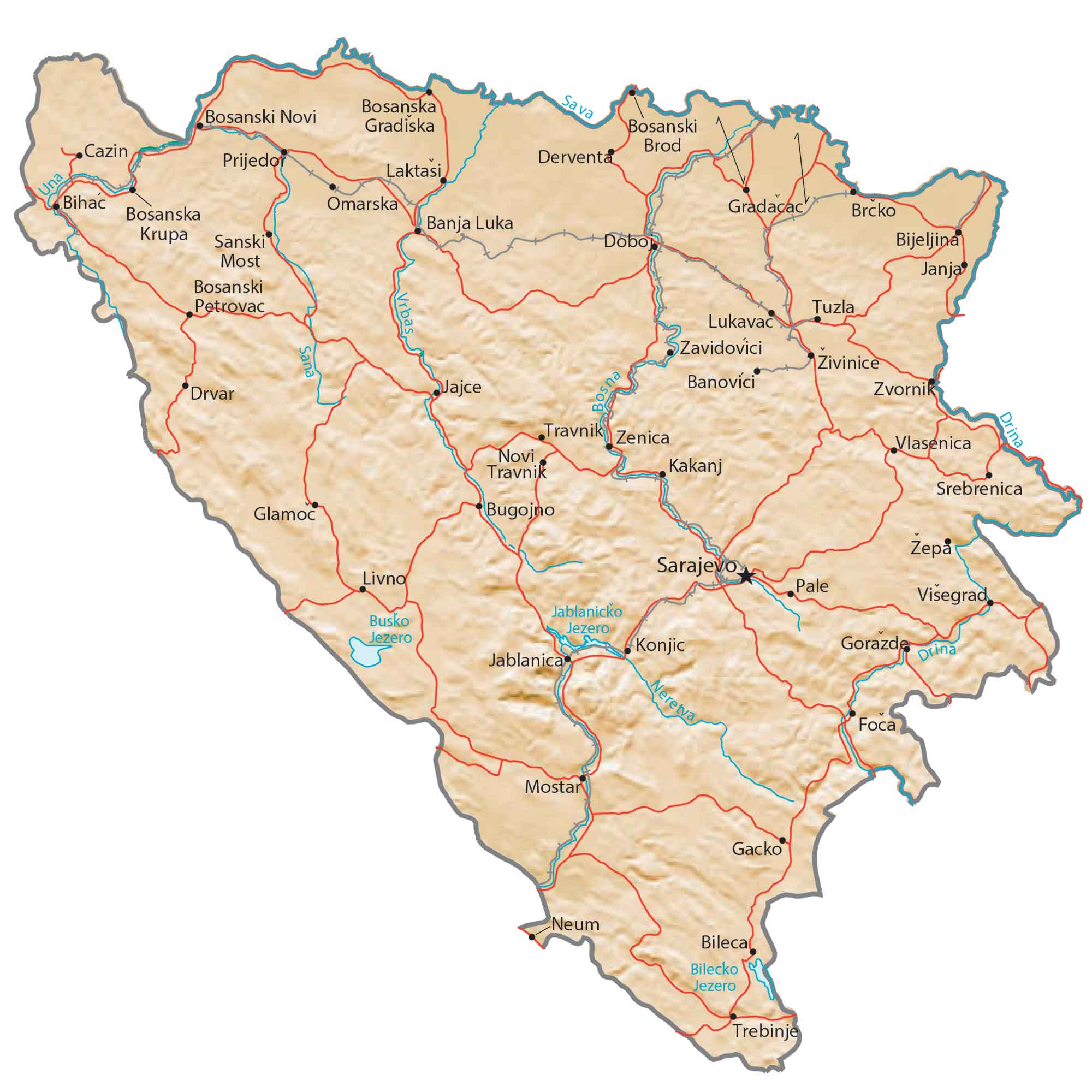
Whereas the northeastern region is characterized by the Pannonian Basin. Its highest point is Maglić in the southeast of Bosnia and Herzegovina, reaching as high as 2,386 meters (7,828 ft).
Capital City
Sarajevo
Major cities and towns
Banja Luka
Tuzla
Zenica
Mostar
Bugojno
Bijeljina
Prijedor
Trebinje
Travnik
Doboj
Cazin
Cities, towns and villages
Derventa
Laktasi
Bihac
Omarska
Gradacac
Brcko
Krupa
Sanski
Janja
Petrovac
Lukavac
Zavidovici
Zivinice
Jajce
Drvar
Banovici
Zvornik
Vlasenica
Novi
Kakanj
Srebrenica
Glamoc
Zepa
Livno
Pale
Visegrad
Konjic
Gorazde
Gacko
Neum
Bileca
Bilecko
Foca
Lakes, rivers and creeks
Lake Jablanica
Busko Lake
Drina River
Neretva River
Sana River
Una River
Sava River
Vrbas River


