Google Earth Engine: A Quick Guide for Beginners
What is Google Earth Engine (GEE)?
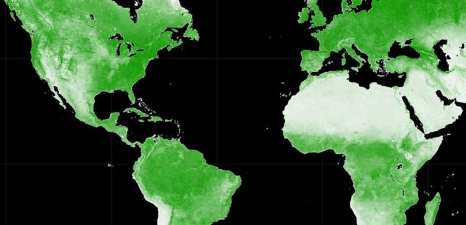
Google Earth Engine (GEE) is a cloud-based platform that delivers a multi-petabyte catalog of satellite imagery for planetary-scale analysis.
Not only do you gain access to remote sensing data from satellites, airborne, digital elevation models, and more…
But you can also turn this geospatial data into actionable insights through the platform’s fast computations and 1000+ types of operators for analysis.
Now, do you really want to know the best part? If you want to use it for research, education, or nonprofit use, then it’s completely free to use.
In this article, you’ll learn about the Google Earth Engine platform and explore how to use it for data exploration and analysis.
A Multi-Petabyte Data Catalog
Google Earth Engine contains an almost incalculable amount of remote sensing data. By exposing the data to users through APIs, the world is in your hands with the following:
From land use to weather data, it’s through its vast (and growing) catalog of remote sensing data that you can see the world through a different lens. Here are some of the key datasets that you can access on this platform.
- Landsat (30m)
- Sentinel-2 (10-30m)
- MODIS (250m daily)
- Sentinel-1 (Radar)
- Land cover
- Weather and Climate (NOAA)
- and more
But keep in mind that you can also work with private data through Google Earth Engine and it’s just a matter of uploading them.
What Can Google Earth Engine Do?
Google Earth Engine tackles the challenge of open analysis in remote sensing with a focus on getting results. It’s able to avoid any bottlenecks because it’s able to adjust the size of its clusters based on how much demand there is for a data product.
But once you have access to the data, what are some of the capabilities that you can leverage in GEE? Here is a list of some of the most common reasons why people turn to Google Earth Engine.
| Functionality | Description |
|---|---|
| Downloading an Image | If you’re looking to simply download an image, you can pick an extent, projection, data type, band, date, and resolution. |
| Performing Library Functions | Once you know the data you want to work with, you can chain algorithms together for further analysis such as a band combination function. |
| Filtering a Collection | If you don’t want to work with an entire collection, you can use the metadata to filter everything from the amount of cloud cover to the type of sensor. |
| Mapping an Algorithm to an Image Collection | Instead of applying an algorithm to a single image, you can apply it to a full collection like the entire United States with a batch computation. |
| Computing Aggregate Statistics | You can calculate the amount of area within an extent to check if it meets certain criteria. |
| Building Tabular Reports | You can create tabular reports to show specific information in a table format such as summarizing a detailed list of data, highlighting specific metrics, or showing comparisons between different sets of data. |
Geospatial Processing Functions
Google Earth Engine contains more than 1000 data types and operators to help lay a solid foundation for any type of remote sensing analysis. Here are some of the basic tools that you can perform analysis within Google Earth Explorer.
In addition to these analysis tools, there are other specialty types of algorithms. For instance, cloud and shadow filtering algorithms help remove artifacts so you can focus your analysis on the Earth’s surface.
But one of the most exciting areas of development in GEE is a shift to machine learning algorithms and deep neural networks. Already, you can leverage powerful AI tools to flex even more muscle in your analysis. Specifically, here are some of the machine learning tools available.
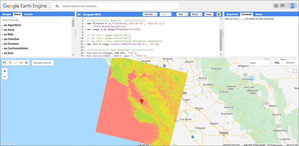
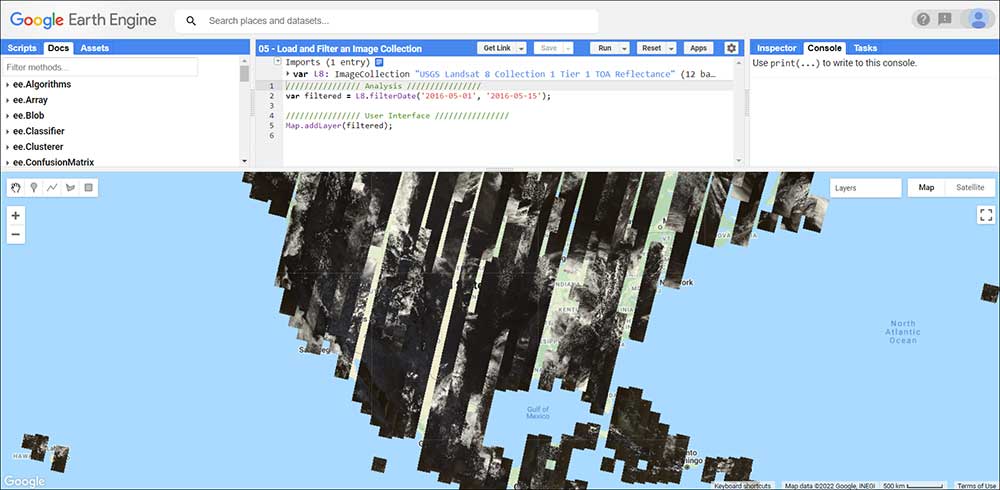
GEE Code Editor and Python
The Code Editor and Python API are a one-two combo that really gives life to your data and analysis. But there are distinctions between the two.
CODE EDITOR – The Code Editor is an interactive window docked at the top of Google Earth Engine. Overall, it’s a good place to start because it provides a GUI to manipulate code and interact with data on a map. Altogether, it contains a window for coding, algorithms, and debugging. By the way, check out this YouTube video at about the 25-minute mark for code editor examples.
PYTHON API – You will likely use the Python API for anything you want to provide as a working tool for others. Because at the end of the day, you will want to produce applications without showing the code editor. So by using the Python API, you can show just the necessary tools for decision-makers and hide the code editor to avoid confusion.
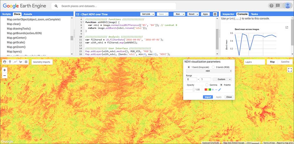
This image example below shows how you can perform a simple NDVI analysis for a single Landsat scene.
How To Set Up Earth Engine
Now, that you have a bit of background on what Google Earth Engine is all about, how do you get started?
CREATE AN ACCOUNT: First, you need a Google account. If you don’t have a Google account, you will need to create an account.
REGISTER FOR GOOGLE EARTH ENGINE: Secondly, you will have to register for a GEE account by using the following signup page – earthengine.google.com/signup
FILL IN THE REGISTRATION FORM: Third, you are required to fill in your name and explain how you will use the product. As mentioned before, GEE is completely free for research, education, or nonprofit use. During your registration, you will have to confirm that you are not using it for commercial use. If you do want to use it for commercial purposes, then you will have to provide background on this as well.
Finally, you will get a confirmation email that you have successfully registered. The confirmation email will contain links to the GEE Explorer, Code Editor, and API reference guide.
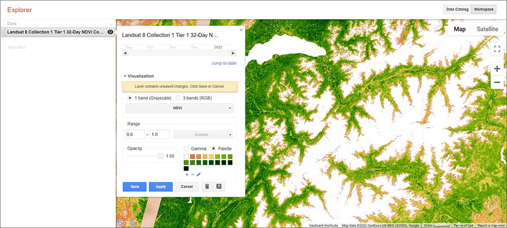
Google Earth Engine Explorer
The Google Earth Engine Explorer is a powerful tool that allows you to search through vast quantities of satellite imagery. There are two main sections in the GEE Explorer
DATA CATALOG: First, the Data Catalog gives you the familiar search interface that you are accustomed to through Google. You can either search by place or keyword. For example, if you want to find Sentinel data, just type it into the search bar and click enter. All of the available products will pop up in your search results. Simply, click the item for more information. If you want to add it to GEE Explorer, then click the button “Open in workspace”.
WORKSPACE: Secondly, the Workspace allows users to visualize any datasets from the Data Catalog in a browser. After you add a dataset to your workspace, you will have to check that fits the appropriate time range for your data. In addition, you have the option to change the visualization from 1 band (greyscale) to 3 bands (RGB). Plus, you can adjust the color palette and opacity to best suit your needs.
GEE Explorer also supports projections on the fly so you don’t have to work about projecting your data.
REST API and App Development
Think of the REST API as an access point. This is what gives you direct access to Earth Engine servers through HTTP requests and responses.
With the Google Earth Engine API, anyone can access world data and analyze it in their own programming projects. Don’t forget that the GEE Developer Guide provides tutorials and examples on how to integrate JavaScript, Python, and REST APIs.
Because GEE exposes the data to users through APIs, specifically the JavaScript API, it allows you to create dynamic and publicly accessible applications powered by Google Earth Engine.
GEE Web Application Examples and Use Cases
From time-lapse imagery to global forest change web maps, here are some examples of the Earth Engine App. Each one demonstrates its powerful computing and how it can lead to making informed decisions for the environment.
1. Ocean Timelapse
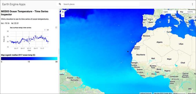
One of the most powerful features of Google Earth Engine is its vast amount of temporal data. With over 35+ years of imagery, it’s like you’re traveling back in time on an interactive map of the ocean.
2. Linked Maps
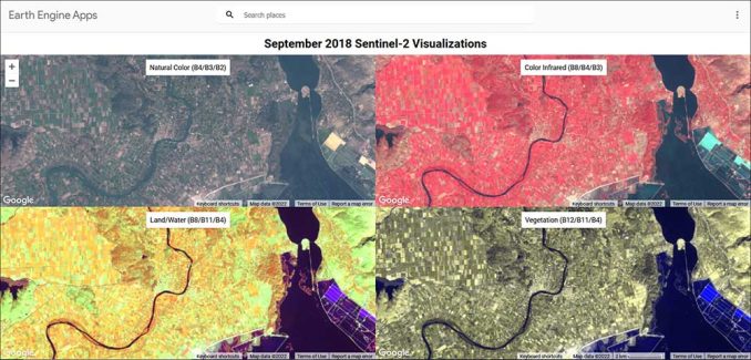
The Linked Maps app shows separate viewports with different band combinations. While the natural color is similar to what the human eye sees, the color-infrared, Land/Water, and Vegetation viewport highlights other land use features.
3. Split Panel
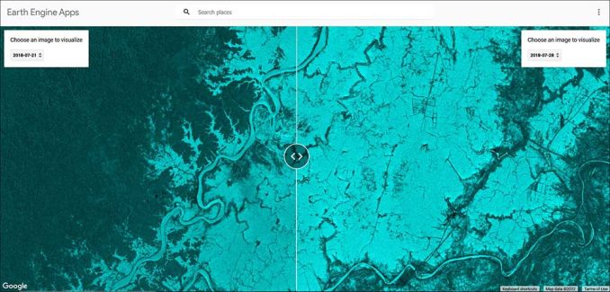
The Split Panel app contains a slider with two separate images side-by-side. Users can compare two images from different dates beside each other to easily check for the differences between them.
4. Collection Mosaic
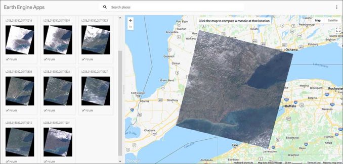
The Collection Mosaic Editor app allows you to select from a group of Landsat-8 images. Then, based on your selection, the application will generate a mosaic using the median values.
5. Global Population Explorer
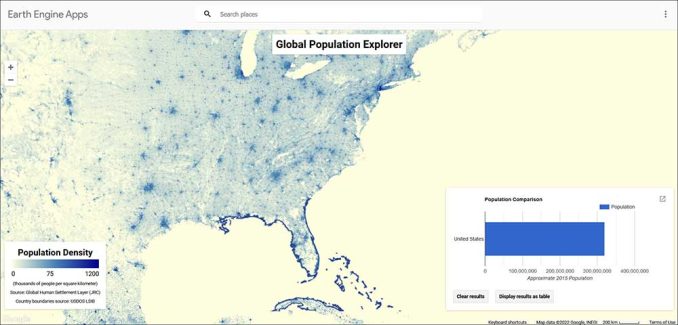
The Global Population Explorer app prompts users to select a country. Then, it dynamically creates a graph or table with the population density of that specific country on the fly.
6. Global Forest Change
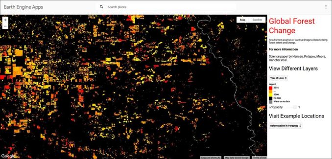
This app shows the results of global forest change using Landsat imagery between 2000 and 2016. Users can interactively pan and zoom around in the Global Forest Change app. Plus, they can symbolize deforestation based on the year of the loss or by the percent of tree cover.
What’s Next for Google Earth Engine?
Long story short. Google Earth Engine is a great resource for anyone who wants to explore the world through satellite imagery.
Google Earth Engine is a platform for data scientists and engineers who want to process satellite data and generate analytics.
It is used in fields such as natural resources, public health, urban planning, and environmental monitoring. Read more about our 100 remote sensing uses and applications.
How do you use Google Earth Engine? Please let us know what you think of this Earth observation platform in the comment section below.


Awesome, mindboggling, extremely useful.
good explanation about GEE
Very helpful and useful
Very practical tool
A great introduction to GEE, powerful and simplified.
Extremely useful.