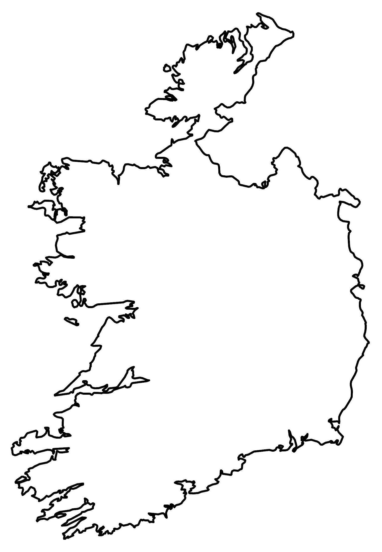
Republic of Ireland Map
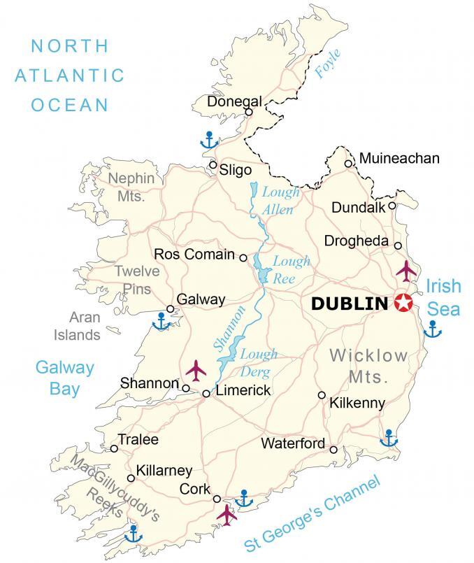
This map of the Republic of Ireland displays major cities, highways, lakes, rivers, and airports. A satellite and elevation map highlights the unique topography in Ireland including its various mountain ranges.

You are free to use our Republic of Ireland map for educational and commercial uses. Attribution is required. How to attribute?
About the map
The Republic of Ireland is part of an island in Western Europe with Northern Ireland, which is part of the United Kingdom. It’s located along the Irish Sea to the east, the Celtic Sea to the south, and is enveloped by the North Atlantic Ocean to the west.
St. George’s Channel separates Ireland from Wales, which is also part of the United Kingdom. Dublin is the capital of Ireland, with 40% of the country’s entire population living within 100 kilometers of the city. Other major cities include Cork, Limerick and Galway.
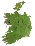
SATELLITE IMAGERY
Republic of Ireland Satellite Map
Ireland occupies an area of 84,421 square kilometers (32,595 sq mi), which is similar in size to the Czech Republic or Georgia (in Europe). One key feature in the Republic of Ireland is the Shannon River which flows 161 miles in a southerly direction to the North Atlantic Ocean. Not only is it the longest river in Ireland, but it’s also the longest in all of the United Kingdom.
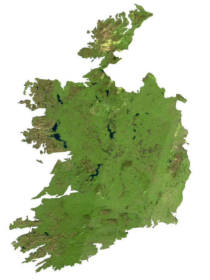
Along the Shannon River, three main lakes flow within its path. First, the uppermost is Lough Allen near the source of the Shannon River. Next, Lough Ree is the middle and second-largest lake. Finally, Lough Derg is the southernmost of the three major lakes on the Shannon River and the third-largest in Ireland.
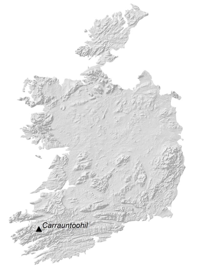
PHYSICAL MAP
Republic of Ireland Elevation Map
The terrain in the Republic of Ireland is mostly flat. But it becomes more hilly along the west coast. For example, the Nephin Mountains, Twelve Pins, and MacGillycuddy’s Reeks are all situated on the west coast of Ireland.
Specifically, the Carrauntoohil is the highest mountain in the Republic of Ireland at 1,041 meters in height and is part of the MacGillycuddy’s Reeks. On the east coast, the most prominent mountain range is the Wicklow Mountains, which contain the largest continuous upland region in the country.
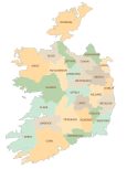
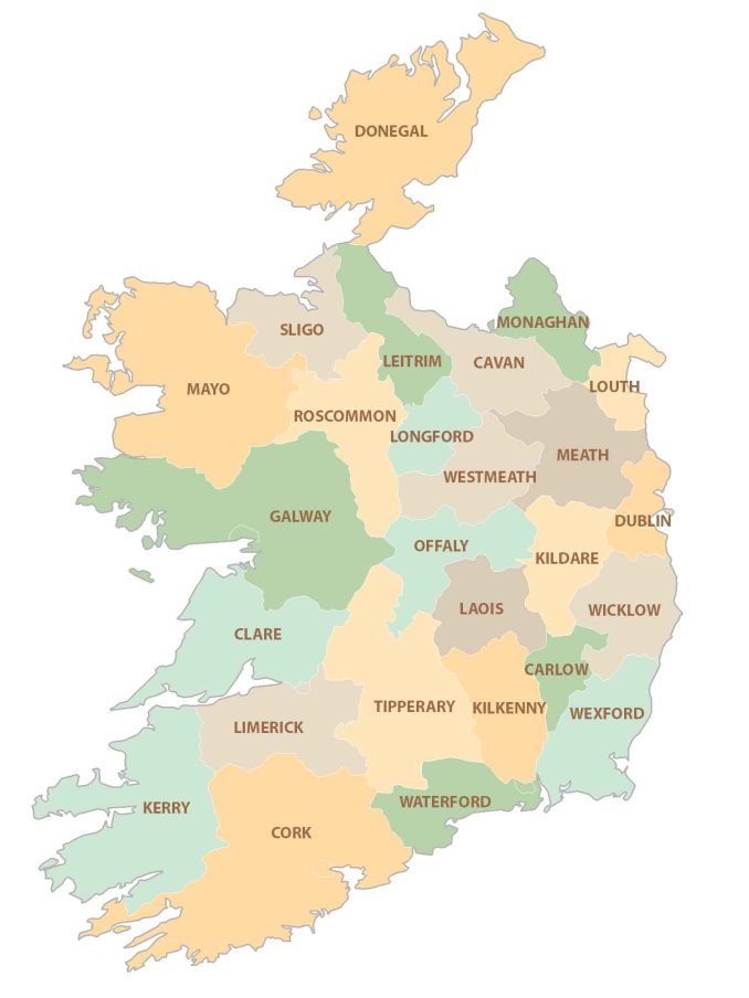
POLITICAL MAP
Republic of Ireland County Map
While the Republic of Ireland is made up of 26 counties, Northern Ireland is made up of 6 counties – not shown on the map. The largest county in terms of size is Cork in the south, followed by Galway. The county of Dublin is the most populous and more than doubles the second-largest county of Antrim.
Capital City
Dublin
Major cities and towns
Cork
Donegal
Drogheda
Dundalk
Galway
Kilkenny
Limerick
Muineachan
Ros Comain
Shannon
Sligo
Tralee
Waterford
Rivers, lakes and water
Foyle River
Galway Bay
Irish Sea
Lough Allen
Lough Derg
Lough Ree
North Atlantic Ocean
Shannon River
St George’s Channel
Geographic landforms
Aran Islands
Carrauntoohil
MacGillycuddy’s Reeks
Nephin Mountains
Twelve Pins
Wicklow Mountains
Counties
Carlow
Cavan
Clare
Cork
Donegal
Dublin
Fingal
Galway
Kerry
Kildare
Kilkenny
Laoighis
Leitrim
Limerick
Longford
Louth
Mayo
Meath
Monaghan
North Tipperary
Offaly
Roscommon
Sligo
South Tipperary
Waterford
Westmeath
Wexford
Wicklow