Windward Islands Map
Are you wondering where the Windward Islands are located? Well, maybe this Windward Islands map collection can help.
Download any of these maps to find out the islands that are part of the Windward Islands, located in the Lesser Antilles in the Caribbean.
You are free to use our maps of the Windward Islands for educational and commercial uses. Attribution is required. How to attribute?
Detailed Map of the Windward Islands
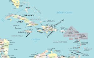
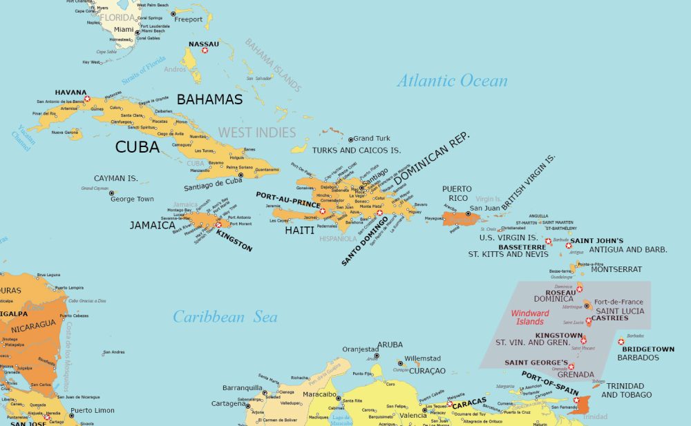
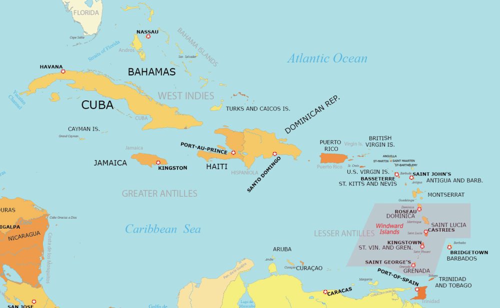
From north to south, the Windward Islands consist of Dominica, Saint Lucia, Saint Vincent and the Grenadines, and Grenada. Please note that Barbados is sometimes considered a part of the Windward Islands as well.
This detailed map shows features like populated places, capital cities, island names, and countries. Highlighted in pink, we’ve marked and labeled the subregion of the Windward Islands on the map.
Windward Islands Simple Map
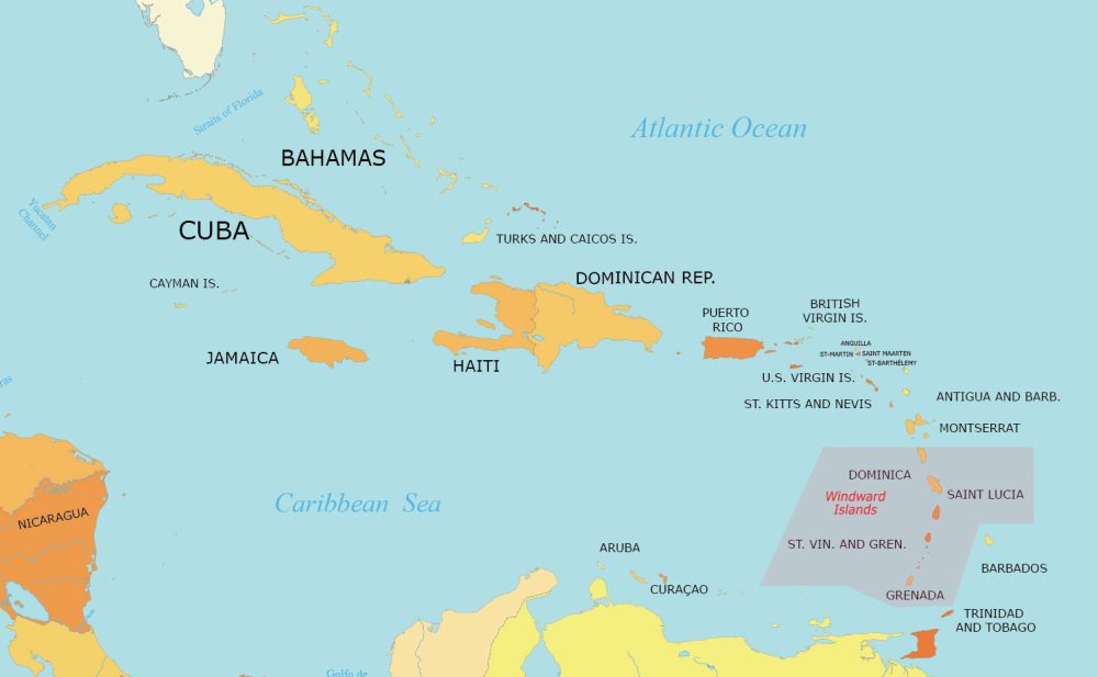
Are you looking for something a bit easier to read? Try out this map, which displays key countries and islands in the Caribbean.
You’ll also find several island names. Important water bodies are labeled including the Caribbean Sea and Atlantic Ocean.
Physical Map of the Windward Islands
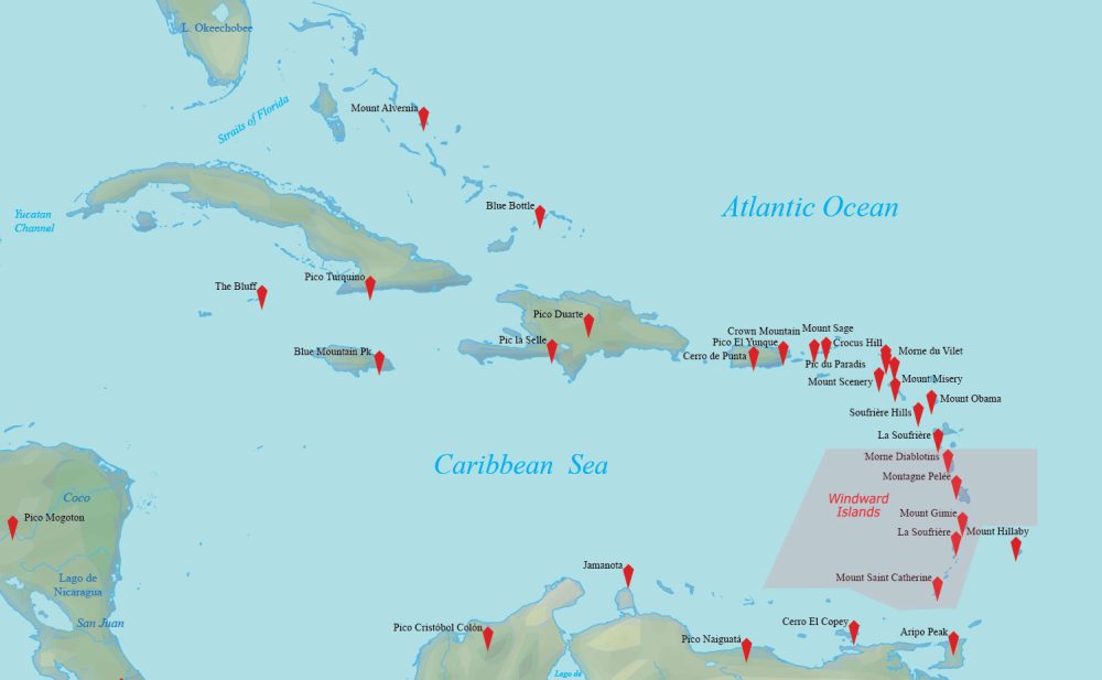
For those looking for a physical map, this map shows mountain peaks. The Windward Islands are known for their mountainous terrain and volcanic activity.
Many of the islands in this chain were formed through volcanic activity. As a result, they feature rugged, mountainous landscapes and volcanoes like La Soufrière and Mount Saint Catherine.
Administration Map of the Windward Islands
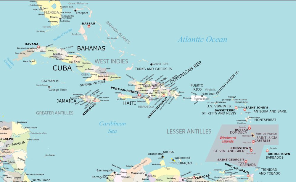
This map specializes in displaying the administrative boundaries of the various countries in the Caribbean Sea.
It also includes a high level of detail by showing island names and country capitals. Similar to the maps, the Windward Islands are marked in pink.
Windward Islands Capitals Map
This map is a remix of the original detailed map. Instead, this one filters out and displays only capital cities and country names.
This version provides a focused view, highlighting the locations of capital cities and the names of the countries for clear, simplified geographical reference.
World Atlas of the Windward Islands
Our World Atlas offers a detailed view of the geographically varied region in the Caribbean. As part of the Lesser Antilles, our atlas unveils the unique aspects of islands such as Grenada, Saint Vincent, Saint Lucia, and Dominica.
Windward Islands Countries and Islands
Why is it called the Windward Islands anyhow? The reason is that they are more windward than the Leeward Islands, given that they lie closer to where the prevailing winds come from.
These islands face the brunt of the trade winds, receiving more direct wind and weather systems. This has historically influenced their climate, vegetation, and seafaring conditions.
| Country | Geographic Description |
|---|---|
| Dominica | Largely covered by rainforest and home to the world’s second-largest hot spring, Boiling Lake; rugged terrain with rare plant and animal species. |
| Grenada | Southernmost island, known for its fragrant nutmeg; hilly, volcanic terrain with lush rainforests and sandy beaches. |
| Martinique | Overseas region of France; mountainous with rainforests and beaches, known for its cultural blend of French and West Indian influences. |
| Saint Lucia | Known for the Pitons, iconic twin peaks; offers rainforest, volcanic beaches, reef-diving sites, and luxury resorts. |
| Saint Vincent | Part of Saint Vincent and the Grenadines; features volcanic landscapes, rich rainforests, and the active Soufrière volcano. |
Maps of Regions of the World
Our region map collection offers a variety of types for you to explore. Simply click on any of the world region maps shown below to view them.


