ArcScene vs ArcGlobe – Esri’s 3D GIS Software Differences
***ArcGIS Pro supersedes ArcScene and ArcGlobe. However, this article remains as archival information for those wanting to familiarize themselves with this technology.***
Esri 3D Viewing Capabilities
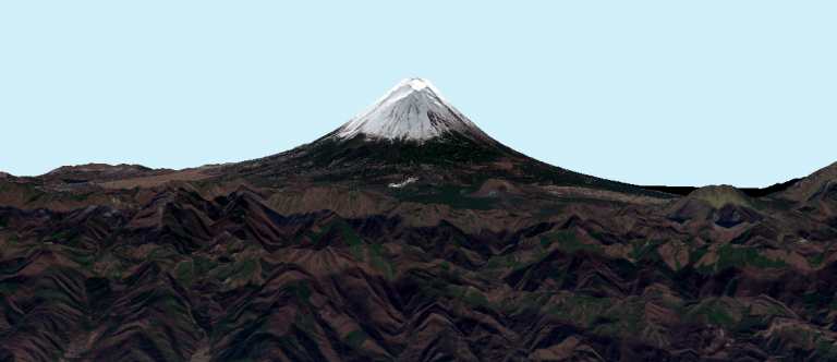
The above 3D rendering of Mount Fuji is an example of what ArcScene can do combined with free GIS data. Beautiful, isn’t it?
It combines the true color imagery from Sentinel 2 with ASTER, one of the free DEM data sets.
ArcScene and ArcGlobe belong to the Esri family of GIS software. Instead of the 2D viewing that we are accustomed to in ArcMap, ArcScene, and ArcGlobe both specialize in 3D visualization.
With a 3D Analyst extension, this 3D GIS software can display neat 3D effects. But how are they different from each other? Let’s find out what both 3D software can do!
ArcScene is for local 3D extents
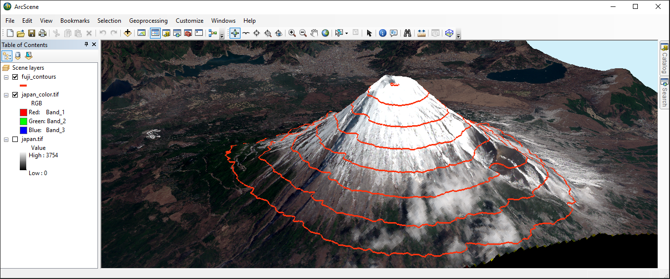
When you have a local area you want to view in 3D, then ArcScene is often the ideal choice. For example, you can see the topography of a mine site because of its small area and planar projection.
Another key difference is how vectors are not rasterized. Because vectors remain vectorized in ArcScene, this allows the user to freely extrude their symbology and set base heights.
If you have LiDAR data, ArcScene can now integrate LAS datasets and add z-value elevations in your scene. If you have photogrammetric data, it also has the capability for stereo viewing in anaglyph mode.
Lastly, in ArcScene, you can perform 3D analyses such as steepest path, line of sight, and profile graphs. Although you can perform these types of 3D operations in ArcMap, it really just makes more sense when you can see it all in three dimensions. As you’re about to find out, ArcGlobe doesn’t have the 3D analysis tools that are equipped in ArcScene.
ArcGlobe is for global 3D viewing
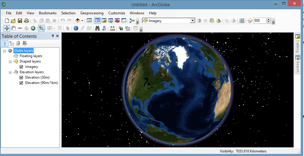
While ArcScene is for local scenes, ArcGlobe delivers more of a global perspective. This is why data is always in WGS84, in a cube map projection. and geodesic in nature.
While ArcScene maintains vectors as symbols, ArcGlobe is a raster-based application. Actually, by default, ArcGlobe rasterizes features when you add them to the application.
In this same respect, it also caches data so when you zoom to different scales, it shows different levels of detail. It’s almost as if features are draped on the surface with representation symbology. Furthermore, ArcGlobe can consume Google Earth KML, terrain data sets, and ArcGIS services.
If you want to display the extent of a country, you will most likely use ArcGlobe. Unless the country is small in area, this is an ideal usage for ArcGlobe is meant for.
ArcScene vs ArcGlobe
Both 3D software specialize in two separate aspects. The primary difference is how they work at different scales.
You are going to use ArcScene when working at a local scale, especially if you want to analyze your 3D data. It is better equipped with tools such as line of sight and terrain profiling. Because your data remains in vector format, you can extrude features and set base heights.
ArcGlobe is better suited for global viewing of the Earth. On a national extent, ArcGlobe is ideal because of how it caches data. You can freely zoom to different levels, where it renders your rasterized features.
Now, ArcGIS Pro is the newest member of Esri’s 3D family software to accompany ArcScene and ArcGlobe. With ArcGIS Pro making rapid strides in the 3D GIS world of visualization, will there still be a need for ArcScene or ArcGlobe at all?
READ MORE: 17 Reasons to Map Like a Pro with Esri ArcGIS Pro
15 Best Remote Sensing Software
5 Best Web Mapping Platforms – The Battle of Web GIS
3D Maps: A Complete Guide To See Earth in 3D
The Hidden Powers of QGIS 3: Features and Plugins
13 Free GIS Software Options: Map the World in Open Source
30 Best GIS Software Applications [Rankings]
5 Best Free LiDAR Software Tools and Viewers
10 GPS Apps For Navigation [Android and iOS]