ILWIS – Integrated Land and Water Information Management
Free GIS software users rejoice. Once commercial GIS software, now turned open source (GNU General Public License). ILWIS, short for Integrated Land and Water Information System, was developed in the Netherlands for commercial use.
But this user-friendly software product is now (and has been for a while) downloadable for free from 52 North. ILWIS has a couple of nice features for your everyday GIS needs. We’re here to let you know what those features are.
Pros/Cons of ILWIS
Here are some of the advantages and disadvantages of using ILWIS compared to other GIS software applications.
PROS
CONS
ILWIS Ratings
Mapping
Analysis
Editing
Data Support
Ranked #20 from 30 GIS Software
Visualization in 3D and Animation
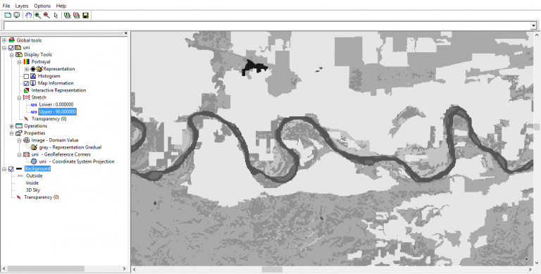
Over the years, ILWIS has improved significantly Notably, its visualization had a massive upgrade in version 3.8 for overall performance in maps. The most significant upgrade is how the performance of Its drawing speed increased.
As part of this upgrade, maps have the capability to display transparencies at many levels (whole maps, selections, individual elements, or properties). Furthermore, almost all the elements can be made transparent.
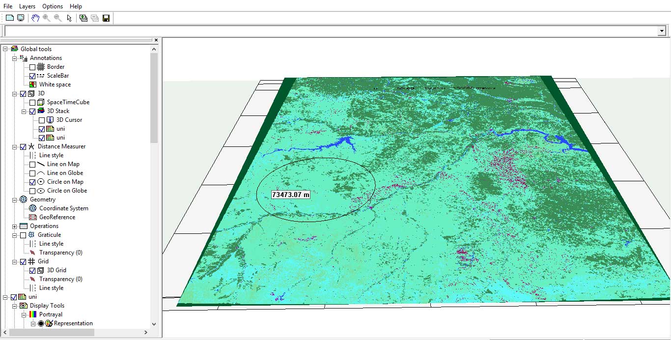
ILWIS supports 3D visualization with interactive zooming, rotation, and panning. Despite Digital Elevation Models (DEM) being the most popular source of height information, you can add multiple types of sources for height. With 3D visualization, you can interactively incorporate space-time cubes for a spatial-temporal context.
It has better support for time series with the possibility of synchronizing different animations. All animations are available in a map window. Lastly, it supports on-the-fly re-projection, annotation functions, printable outputs, and import/export through the GDAL library.
Remote Sensing Tools
As mentioned earlier, remote sensing has always been a strong point for ILWIS. This is why we’ve included it in our top 10 list of open source remote sensing software.
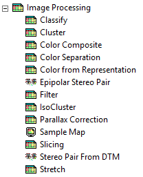
It is equipped with stereoscopy and anaglyph tools to create stereo pairs from two aerial photographs. From here, DTM operations can create a stereo pair from a single raster map and a Digital Terrain Model (DTM).
If you have satellite data, ILWIS has image classification techniques to create land cover classes. You can also import based on the satellite sensor.
All things considered, it has all the necessary tools for raster mosaics, cross-section visualization, and spectral band manipulation.
Basic and Advanced Analysis
ILWIS has all the vector basics – digitizing, editing, and geoprocessing. Actually, it’s similar in many respects to GRASS GIS software with its vector, raster and practical tools.
It has most of the advanced modeling and spatial data analysis you’ll need. For example, you can perform hydrologic flow operations such as drainage network extraction, catchment extraction, and Horton statistics. You can calculate the number of streams, the average stream length, and catchment areas for Strahler stream orders
It’s rare to find geostatistics in open source software. But ILWIS has kriging and co-kriging for your interpolation needs. Lastly, it also has Spatial Multiple Criteria Evaluation (SMCE) and surface energy balance operations through the SEBS module.
Overall, this open source GIS and remote sensing software has some extensive documentation as well.
ILWIS Next Generation (NG) Roadmap
What’s coming down the pipe for ILWIS Open? This is best understood by looking at its Road Map.
ILWIS is currently available natively only on Microsoft Windows. However, soon it will become cross-platform and web-enabled. The long-term goal is to be able to deploy ILWIS Next Generation-based apps on all major mobile platforms.
It plans to enhance its plug-in architecture for ILWIS extensions. This means it will invite the development of new functionality by the user community through plugins. In other words, one can extend applications without changing anything to the main application.
Another potential change is the implementation of a processing server for computationally intensive tasks. Finally, it aims to be a connection hub between various heterogeneous data and processing sources (local-remote).
There are more potential plans for ILWIS Next Generation, which can be found on the 52 North website.
What’s Next?
The extinction-proof ILWIS is free GIS software for planners, biologists, water managers, and geospatial users around the world for their GIS needs.
It’s quite popular in the remote sensing industry as well.
What do you think of this open source GIS software?
How do you use it in your work? What would you like to see in future versions?


Hello from Tanzania!
I want to process GRACE and GLDAS data in ILWIS 3.8.5 to study groundwater storage changes. I need the Drought.sav (IDL script) tool to be able to continue with the task. Please, any one with the help on how I can go about it!
Thanks
My simple comment is that eventually ILWIS will be exposed with an opportunity to face and expand on its delivery performance level when it comes to spatial hydro logical and land use/cove analysis under a climate extremely changing environment with very week adaptation strategies!
My comments are all the set of issues that I want to be assisted by IL
Any thing else you need to respond whether and how ILWIS can assist?
I’ve worked with ILWIS before at the Land and Water FAO Project at INIA in Mozambique with the likes of Berendina Spiers. Now, I Work for the Limpopo Water Course Commission (LIMCOM) and we intend to establish a trans-boundary land and water information management system, connecting all the four riparian states (Mozambique; South Africa; Zimbabwe and Botswana). We need a real functional & reliable toll that can assist us in flood forecasting and flooded warning risk areas across the entire basin, particularly along the lower basin for the various flood magnitudes; potential settlements & infrastructure to be inundated; number of people to be affected and rescued;farming land areas; options for rescue operations (evacuation areas) for the different flood magnitudes; operating roles of existing dams (private and state managed) impacts in the generation of flood impact magnitudes; roles of prevailing land use/cover changes on flood dynamics across the entire basin; quasi-real time flood warning! Considering the nature of this complex basin, reverse questions apply for the case of droughts situations that are also quite extreme. Last but not least,better understanding of the dynamics of sea and freshwater interaction as relatated to upstream salt water intrusion.
I’ve worked with ILWIS before at the Land and Water FAO Project with the likes of Berendina Spiers. Now I Work for the Limpopo Water Course Commission and we inter to establish a trans boundary land and water information management system. A toll that can assist us in flood forecasting and flooded warning risk areas across the entire basin, particularly along the lower basin; potential settlements & infrastructure to be inundated depending on flow magnitudes; options for rescue operations (evacuation areas) for the different flood magnitudes; roles of existing dams (private and state managed) and operating rules in the generation of flood impact magnitudes; roles of prevailing land use/cover on flood dynamics across the entire basin; quasi-real time flood warning! Considering the nature of this complex basin, reverse questions apply for the case of droughts.
Please someone should help with the steps on how to classified image using ilwis software thanks.
Hello from Neplal. I am new to this softawre. My raster image does not open properly . It shows continious lines for a map instead. Can you help with detail steps? I am trying to work on Hortons ratio of a catchment.
Very nice indeed. I studied at ITC and am very well familiar with the tools, so Iit was nice to see that people are writing about it. Just one note, last line on the ILWIS NG, you say North54 and should say 52
Thanks very much, I fixed it