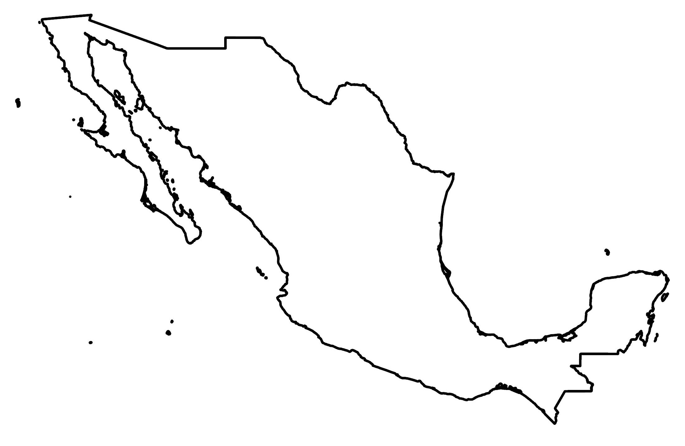
Map of Mexico
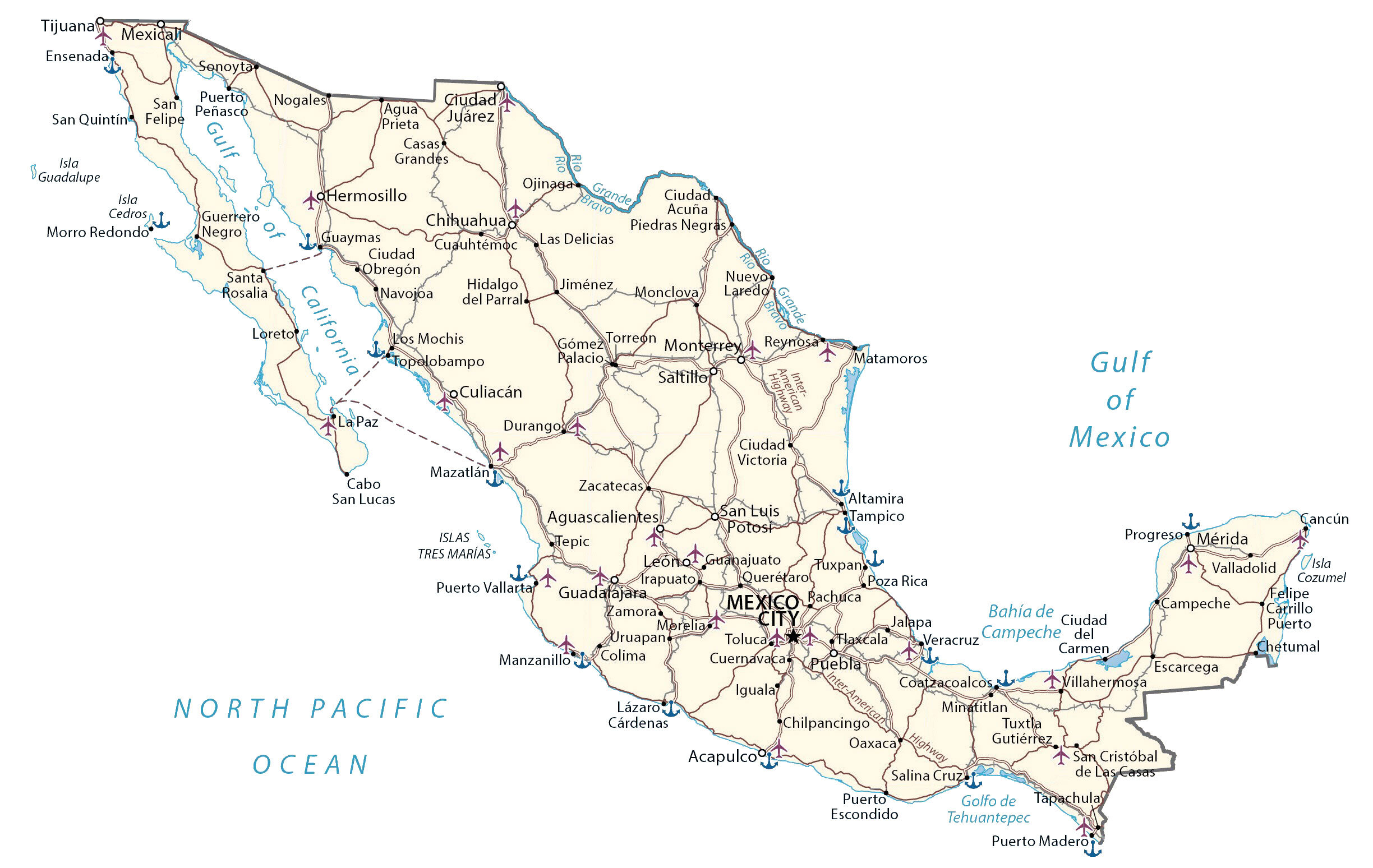
This map of Mexico contains major cities, roads, islands, lakes, and rivers. An elevation map and satellite imagery highlight its Central Plateau (Mexican Altiplano) to its desert and rainforests.
Mexico map collection

You are free to use our Mexico map for educational and commercial uses. Attribution is required. How to attribute?
About the map
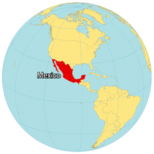
Mexico is located in North America, along the Pacific Ocean. Altogether, it borders 3 countries including Belize and Guatemala to the southeast. Also, it borders California, Arizona, New Mexico, and Texas with the United States to the north.
Over 128 million people live in Mexico, the 10th most populous country. In fact, Mexico City is bigger in size and population compared to New York City. The country is known for its Aztec people, festivals like the Day of the Dead, and the largest population of Spanish speakers in the world.
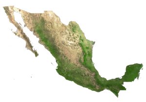
SATELLITE IMAGERY
Mexico Satellite Map
Mexico occupies an area of 1,972,550 square kilometers (761,610 sq mi), which makes it the 13th largest in the world. To the northwest, the Baja Peninsula is an elongated extension and is separated by the Gulf of California. It includes several islands like Revillagigedo Islands, Guadeloupe Island, and Socorro Island.

Overall, Mexico has a tropical climate and is home to two main desert regions – the Sonoran Desert and the Chihuahuan Desert. Then, it transitions to dense rainforests to the southeast. While the longest river is the Rio Grande, Mexico’s largest lake is Lake Chapala.
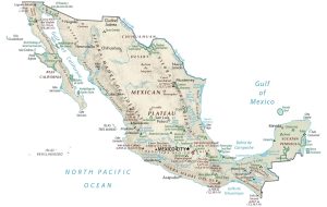
PHYSICAL MAP
Mexico Physical Map
The terrain in Mexico is a mix of rugged mountains, low coastal plains, deep canyons, and high plateaus. While the Sierra Madre Occidental Mountains lie in the west, the Sierra Madre Oriental is situated to the east. Between the two mountain chains, the Central Plateau (Mexican Altiplano) spans from the United States to the central region of Mexico.
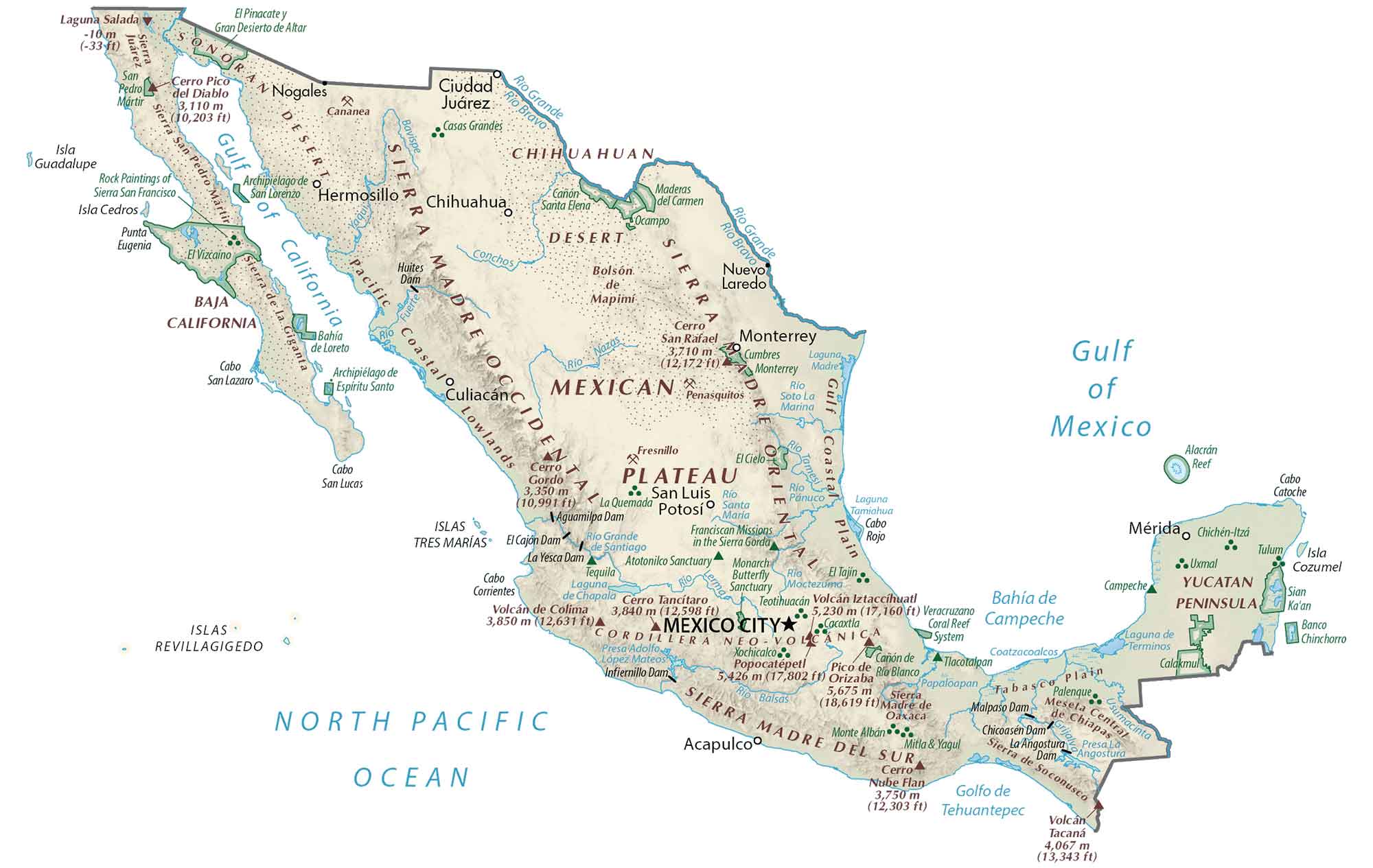
The highest point in Mexico is Pico de Orizaba, which is the highest volcanic summit in North America at 5,636 meters (18,491 ft) in height. The lowest point is Laguna Salada at 10 meters below sea level. Also, the world’s smallest volcano (Cuexcomate) is in Mexico.
POLITICAL MAP
Mexico States Map
States are the first-level administrative units in Mexico that are divided geographically and administratively. Currently, there are 31 states within Mexico. Additionally, there is the capital city of Mexico City, which is its own federal entity.
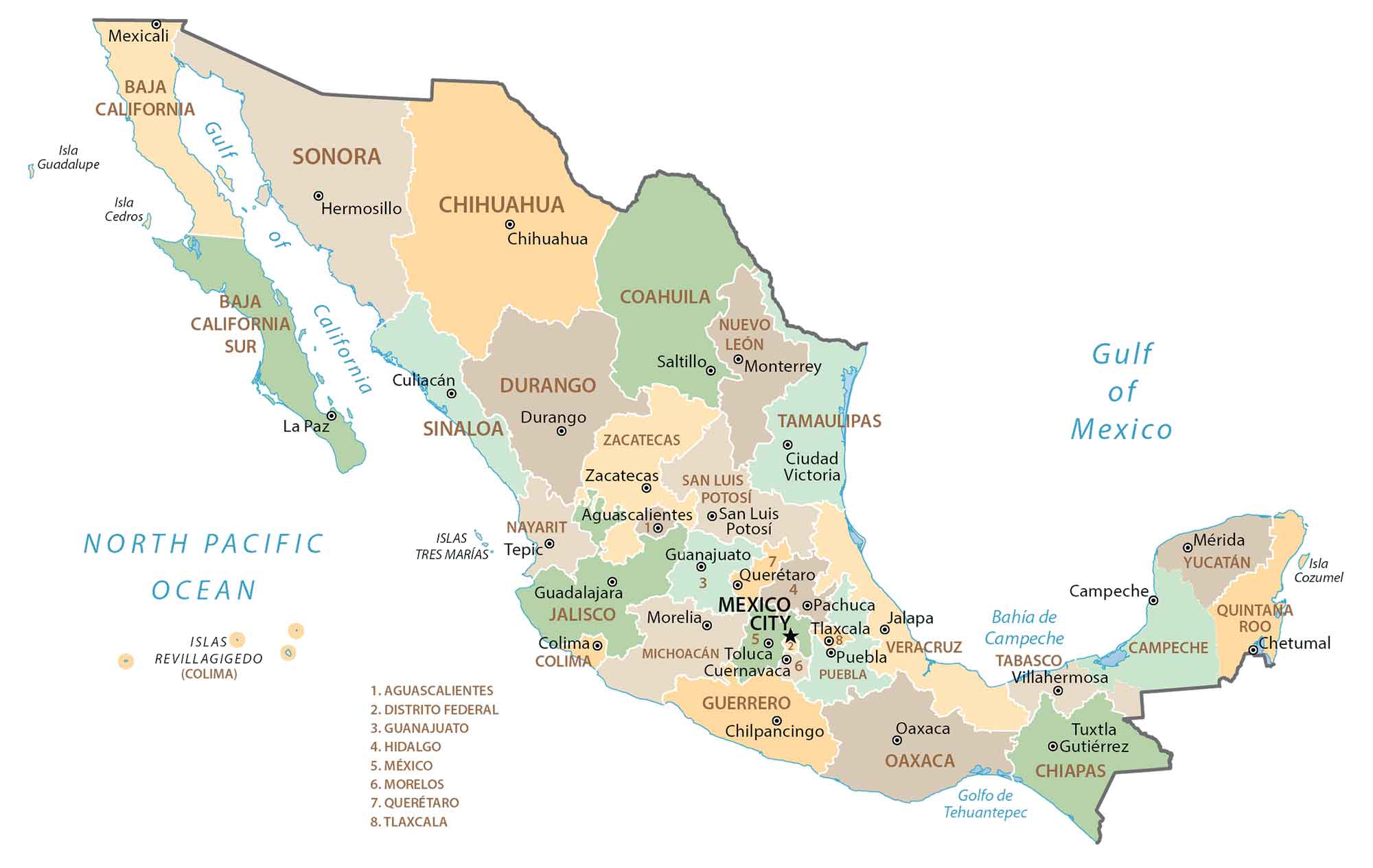
Mexico divides states into municipalities, which are the second-level administration unit. But the capital of Mexico City contains boroughs, instead of municipalities.
Capital City
Mexico City
Major cities
Cancún
Ciudad Juárez
Guadalajara
Mérida
Monterrey
Puebla
Tijuana
Toluca
Cities, towns and villages
Acapulco
Agua Prieta
Aguascalientes
Altamira
Arapuato
Cabo San Lucas
Campeche
Casas Grandes
Chetumal
Chilpancingo
Ciudad Acuña
Ciudad Victoria
Coatzacoalcos
Colima
Cuernavaca
Culiacán
Cuauhtémoc
Durango
Ensenada
Escarcega
Gómez Palacio
Guadalupe
Guerrero
Guanajuato
Guaymas
Hermosillo
Hidalgo del Parral
Iguala
Jalapa
Jiménez
La Paz
Laredo
Las Delicias
Lázaro Cárdenas
Los Mochis
Manzanillo
Matamoros
Mazatlán
Mexicali
Minatitlan
Monclova
Morelia
Morro Redondo
Navojoa
Nogales
Nuevo Casas Grandes
Ojinaga
Oaxaca
Pachuca
Piedras Negras
Poza Rica
Progreso
Puerto Carmen
Puerto Escondido
Puerto Madero
Puerto Peñasco
Puerto Vallarta
Querétaro
Reynosa
Saltillo
San Cristóbal de Las Casas
San Felipe
San Luis Potos
San Quintín
Santa Rosalia
Sonoyta
Tapachula
Tampico
Tepic
Tlaxcala
Topolobampo
Torreon
Tuxtla Gutiérrez
Tuxpan
Valladolid
Veracruz
Villahermosa
Zacatecas
Zamora
Gulfs, rivers and bays
Bahía de Campeche
Bravo River
Rio Grande
Gulf of California
Gulf of Tehuantepec
Negro River
North Pacific Ocean
Islands
Cedros Island
Cozumel Island
Guadalupe Island
Tres Marías Island
San Felipe Island
Landforms and geography
Gulf Coastal Plain
Mexican Plateau
Pacific Coastal Lowlands
Sierra Madre Del Sur
Sierra Madre Oriental
Sonoran Desert
Yucatan Peninsula
Other features
Inter-American Highway