United States Map with Capitals
You are free to use our United States map with capitals for educational and commercial uses. Attribution is required. How to attribute?
About the map
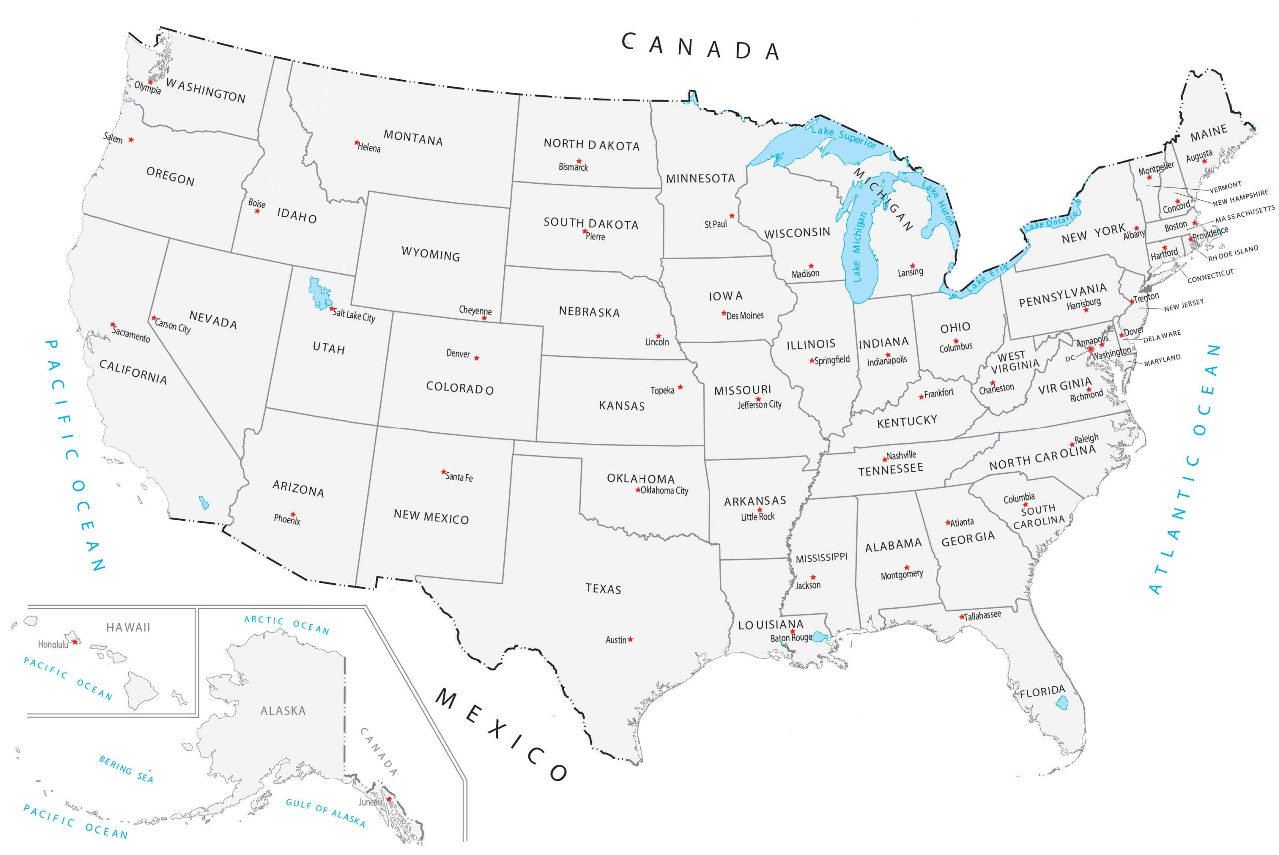
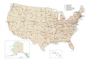
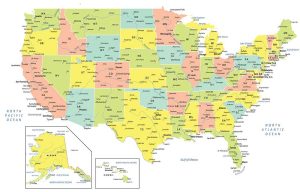
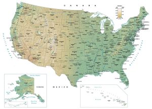
If you want to find all the capitals of America, check out this United States Map with Capitals.
It displays all 50 states and capital cities, including the nation’s capital city of Washington, DC. Both Hawaii and Alaska are inset maps.
First, we list out all 50 states below in alphabetical order. Then, each state has its respective capital in brackets next to the state.
United States Capital
District of Columbia (Washington)
State Capitals
Alabama (Montgomery)
Alaska (Juneau)
Arizona (Phoenix)
Arkansas (Little Rock)
California (Sacramento)
Colorado (Denver)
Connecticut (Hartford)
Delaware (Dover)
Florida (Tallahassee)
Georgia (Atlanta)
Hawaii (Honolulu)
Idaho (Boise)
Illinois (Springfield)
Indiana (Indianapolis)
Iowa (Des Moines)
Kansas (Topeka)
Kentucky (Frankfort)
Louisiana (Baton Rouge)
Maine (Augusta)
Maryland (Annapolis)
Massachusetts (Boston)
Michigan (Lansing)
Minnesota (Saint Paul)
Mississippi (Jackson)
Missouri (Jefferson City)
Montana (Helena)
Nebraska (Lincoln)
Nevada (Carson City)
New Hampshire (Concord)
New Jersey (Trenton)
New Mexico (Santa Fe)
New York (Albany)
North Carolina (Raleigh)
North Dakota (Bismarck)
Ohio (Columbus)
Oklahoma (Oklahoma City)
Oregon (Salem)
Pennsylvania (Harrisburg)
Rhode Island (Providence)
South Carolina (Columbia)
South Dakota (Pierre)
Tennessee (Nashville)
Texas (Austin)
Utah (Salt Lake City)
Vermont (Montpelier)
Virginia (Richmond)
Washington (Olympia)
West Virginia (Charleston)
Wisconsin (Madison)
Wyoming (Cheyenne)

Hey. Is there a way to make it bigger? Otherwise this is a 10 star map. Thank you so much!
You’ll have to download it and zoom in
Is there a map with the rivers on it
Yes, we have this one here – https://gisgeography.com/lakes-rivers-map-united-states/
Your map needs a correction. There is no island adjacent to/right of the Big Island, Hawai’i.
very very very helpful.
thank you for your help and Mary christmas
You misspelled “Merry”
Amazing
It helped a lot with work and knowing the states of the United States of America
Is there a way to get my hermanos tacos back without having to hop the border?
Not sure what that is :)
Which one has Capitals again? This one just has random cities.
These are the capitals of each US state
This Is a Great Map and I love it. Do you have a capital one?
Thanks. Yes, this is the one with capitals on it.
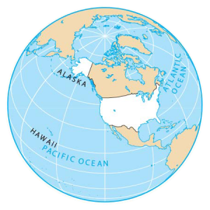
Is there a 3D globe of the world somewhere?
Google Earth has an interactive 3D globe. There’s also ArcGIS Earth and many more
My dog crossed the border.
wow cool.
Thank you for this map
Why do you indicate that the Great Lakes are in The States only. This is not accurate. Half of each of the Lakes other than Lake Michigan are in Canada. Please correct the border.
Hi Sharon. Yes, you’re correct that there are parts of the 5 Great Lakes in Canada. This map clips to the extent of the US border. That’s why we don’t see the part of Lake Superior, Huron, Erie and Ontario that are in Canada. It is accurate, the data is just clipped.
Is there any scale information about the Map? Thank you!
This is just a simplified version so I don’t have the scale on the map
Nice, this is in the right order. Good job.
USA map with capitals
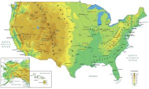
Do you guys have any maps for mountains and stuff? I have some state regions report thingy for school and google is very unhelpful.