The Presidential Election Map Collection of America
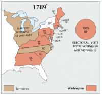
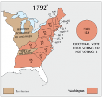
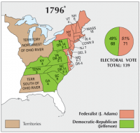
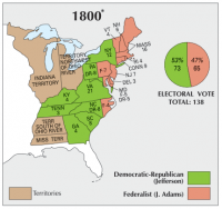
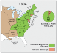
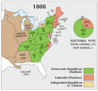
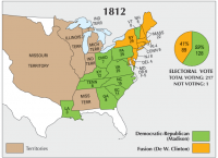
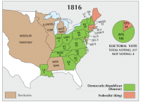
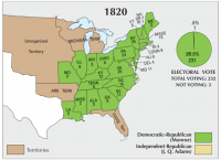
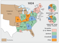
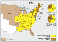
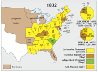
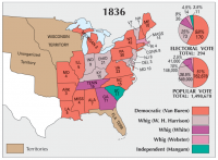
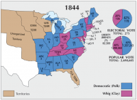
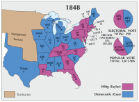
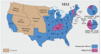
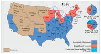
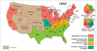
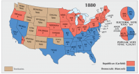
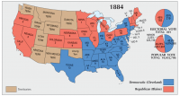
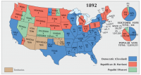
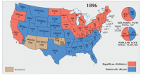
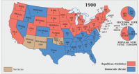
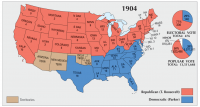
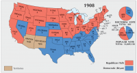
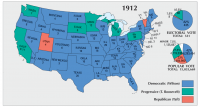
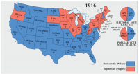
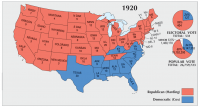
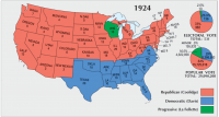
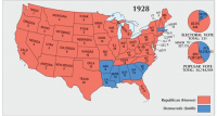
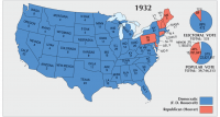
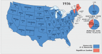
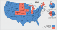
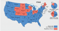
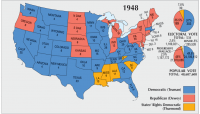
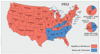
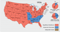
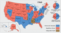
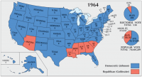
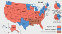
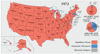
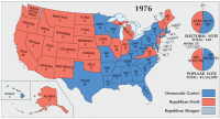
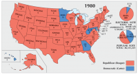
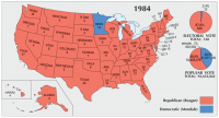
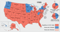
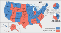
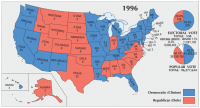
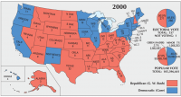
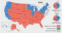
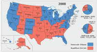
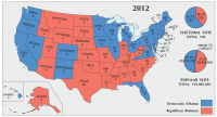
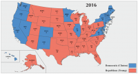
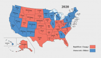
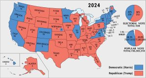
In this US election map collection, you will find the history of presidential elections from 1789 to 2020. Each presidential election shows the electoral, popular, and total votes as percentages.
It marks when territories became states in the history of the United States. Also, it shows the party that each state votes for during the election year. Starting with George Washington in 1789, click on an election map to see who became president of the United States of America.
You are free to use our Presidential Election Map Collection of America for educational and commercial uses. Attribution is required. How to attribute?

You have errors in several of your synopses of various Presidential races. Most notably, you ascribe tradition, declining popularity or health as reasons why some relatively recent Presidents did not run for a third term.
The 22nd Amendment to the US Constitution, passed by Congress in 1947 and ratified in 1951 prohibits anyone from serving more than 2 terms as President. No one since Truman had the option of running for a 3rd term.
Thank you for the maps, they are helpful and informative.