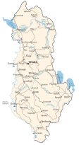
Map of Albania – Cities and Roads

This map of Albania displays major cities, towns, roads, and rivers. It includes a satellite and physical map to view its mountainous terrain to the east and a vast stretch of plains to the west.
Albania map collection
You are free to use our Albania map for educational and commercial uses. Attribution is required. How to attribute?
About the map
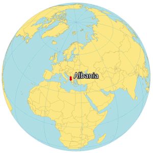
Albania is a country in Southeastern Europe, along the Adriatic Sea and the Ionian Sea. It borders 4 other countries including Montenegro to the north, Greece to the southeast, as well as Kosovo and North Macedonia to the east.
Tirana is Albania’s capital and largest city in the west-central region. One key characteristic of Albania is its war bunkers, which were built for militaristic preparation. Although the war bunkers were never used in combat, there are still over 173,000 throughout the country.
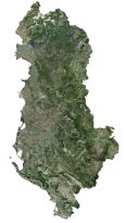
SATELLITE IMAGERY
Albania Satellite Map
Albania occupies an area of 28,748 square kilometers (11,100 sq mi), which is similar in size to Armenia. According to the FAO, forests cover about 36% of the total land area of Albania. Other types of landscapes in Albania are its rolling green hills, freshwater lakes, and temperate beaches along the west coast. But agriculture is one of the most prominent sectors in Albania.
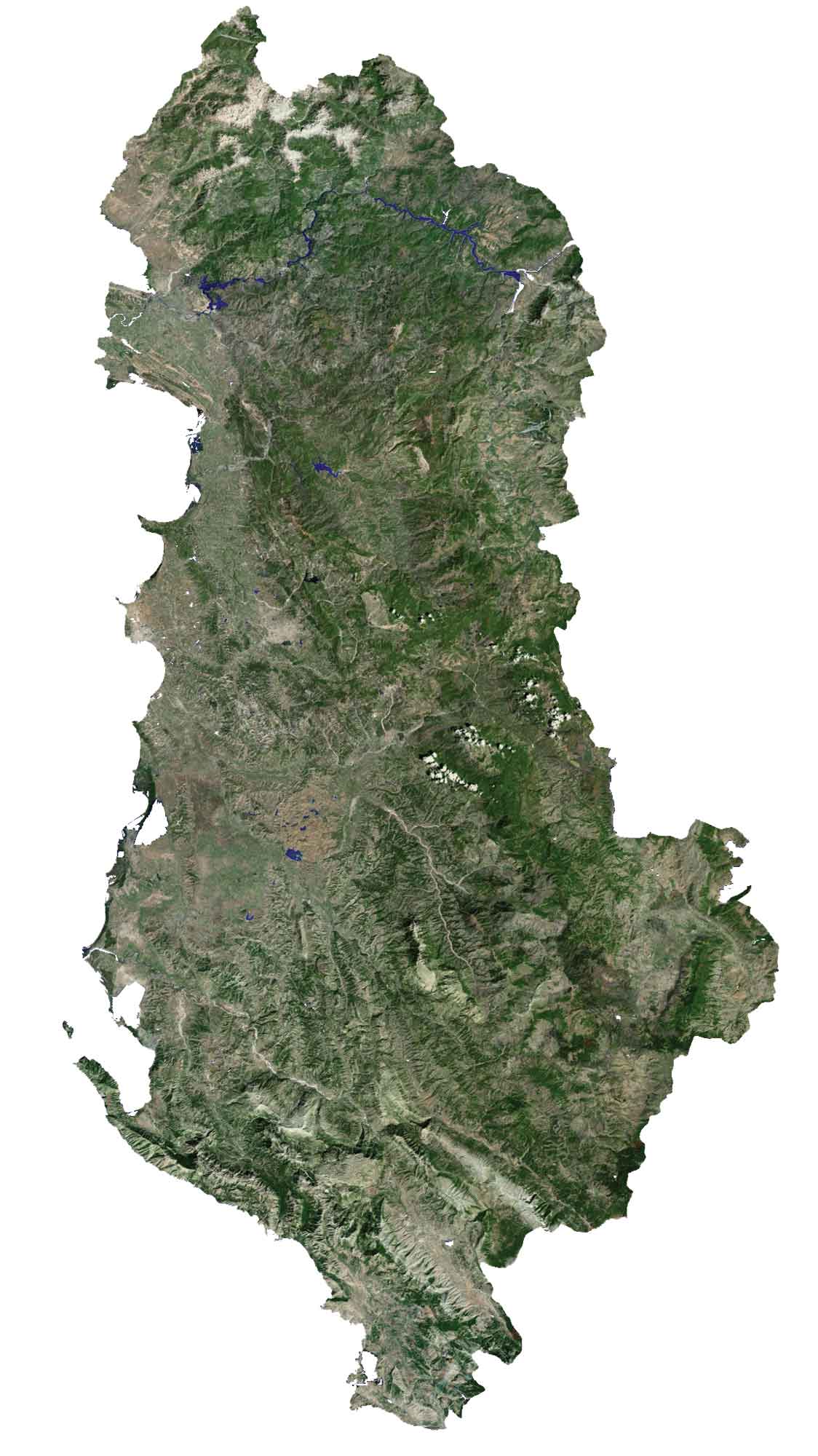
For example, it’s a major producer of tobacco and medicinal plants. Three of its largest lakes lie on its boundaries including Lake Scutari, Lake Ohrid, and Lake Prespa. These lakes not only provide essential habitats for diverse ecosystems but also create picturesque landscapes that attract visitors from around the world.
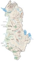
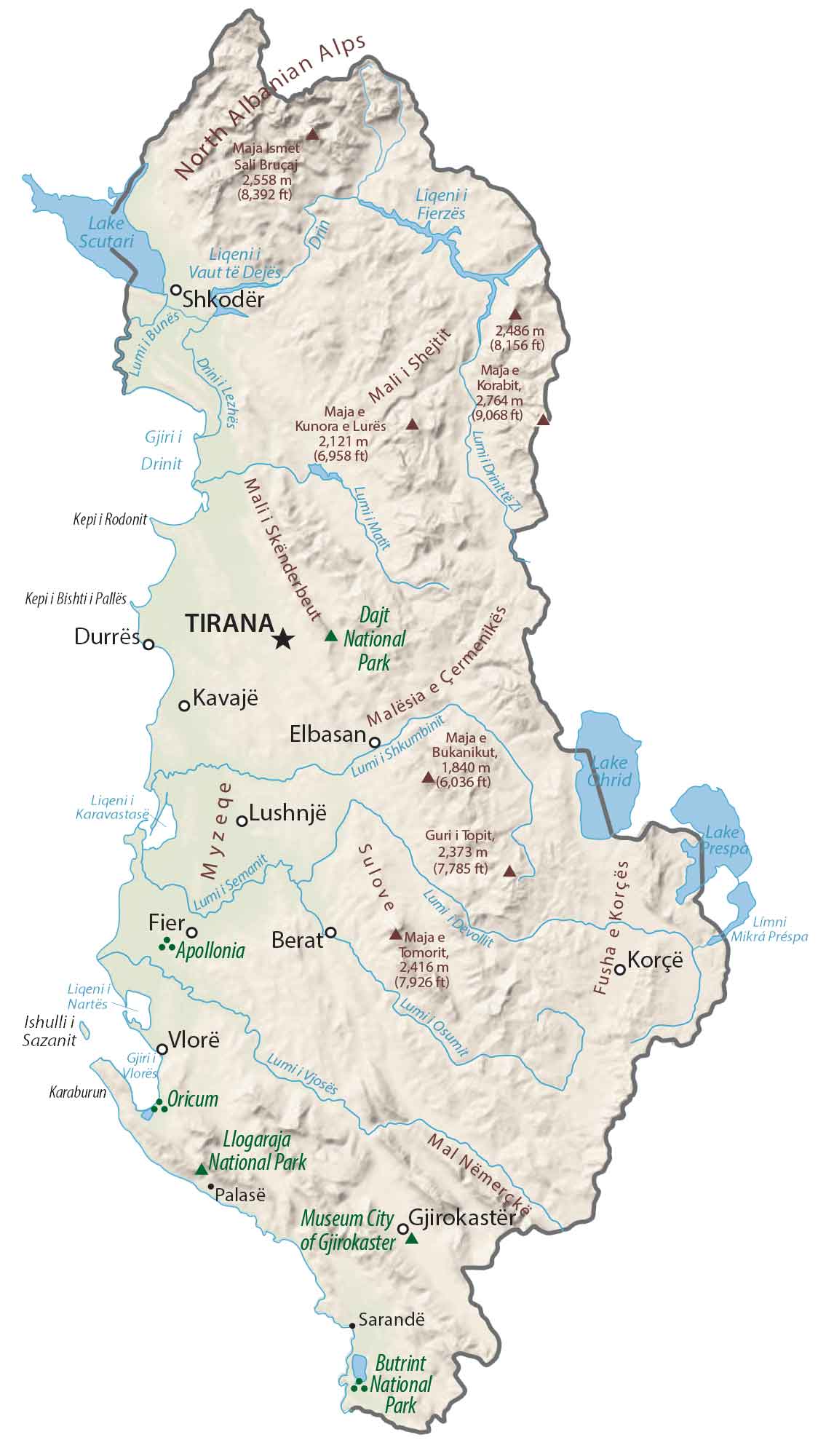
PHYSICAL MAP
Albania Physical Map
The terrain in Albania is mostly mountains with plains along the coasts. Specifically, it’s mostly mountainous in the eastern region such as the Albanian Alps, Skanderbeg, Pindus, and Ceraunian Mountains.
Whereas the west Myzeqeis has the largest and widest plain in Albania. At 2,764 meters (9,068 ft) in height, the highest point in Albania is Mount Korab along its eastern border with North Macedonia.
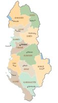
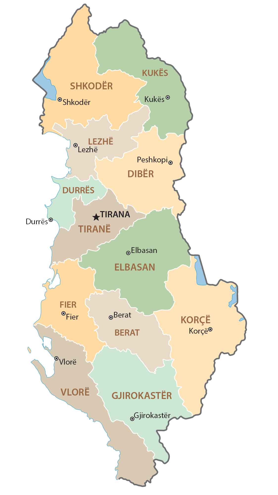
POLITICAL MAP
Albania Counties Map
Since its independence, Albania has undergone reforms in its administrative divisions 21 times. First, counties are the first level of government. Since 2000, there have been a total of 12 counties in total. If you break down Albania a level further, the next level is municipalities.
Finally, you can divide municipalities further into units which is the finest level of governance in Albania. The Presidential Office is located in the capital city of Tirana. Tirana’s mix of modern and historic architecture reflects Albania’s journey from its communist past to a dynamic present.
Capital City
Tirana
Major cities and towns
Durrës
Fier
Elbasan
Korçë
Shkodër
Vlorë
Berat
Lushnjë
Kavajë
Cities and towns
Valbonë
Hani Hotit
Bajram Curri
Krumë
Pukë
Kukës
Shëngjin
Lezhë
Rrëshen
Peshkopi
Laç
Burrel
Klos
Kruje
Bulqizë
Shijak
Librazhd
Rrogozhinë
Peqin
Cërrik
Gramsh
Pogradec
Kuçovë
Maliq
Ballsh
Selenicë
Çorovodë
Mavrovë
Tepelenë
Këlcyrë
Përmet
Gjirokastër
Delvinë
Sarandë
Bilisht
Ersekë
Lakes, rivers and creeks
Lake Scutari
Lake Chrid
Lake Prespa
Lake Fierza
Buna River
Drin River
Shkumbin River
Seman River
Devoll River
Osum River
Vjosë River
Islands
Ishulli Sazanit
Landmarks and Parks
Daji National Park
Apollonia
Orikum
Butrint National Park
Llogara National Park
Museum-City of Gjirokastra
Physical Geography
North Albanian Alps
Myzeqe


