How Does Geotagging Work?
DEFINITION:
Geotagging is the process of adding location information (like GPS coordinates) to digital content such as photos, videos, or media files.
What is Geotagging?
When you take a photo and enable your GPS, it stores the physical location where the photo was taken. Geotagging is the process of assigning coordinates to photos.
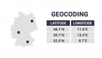
In general, these coordinates are in latitude and longitude and in decimal degrees, which can be used to pinpoint the location of the media on a map.
Geotagging can also include other data such as altitude, bearing, and place names.
When you look at the properties of a digital photograph, you can find these GPS positions in the EXIF metadata of your photos.
Applications and uses of geotagging
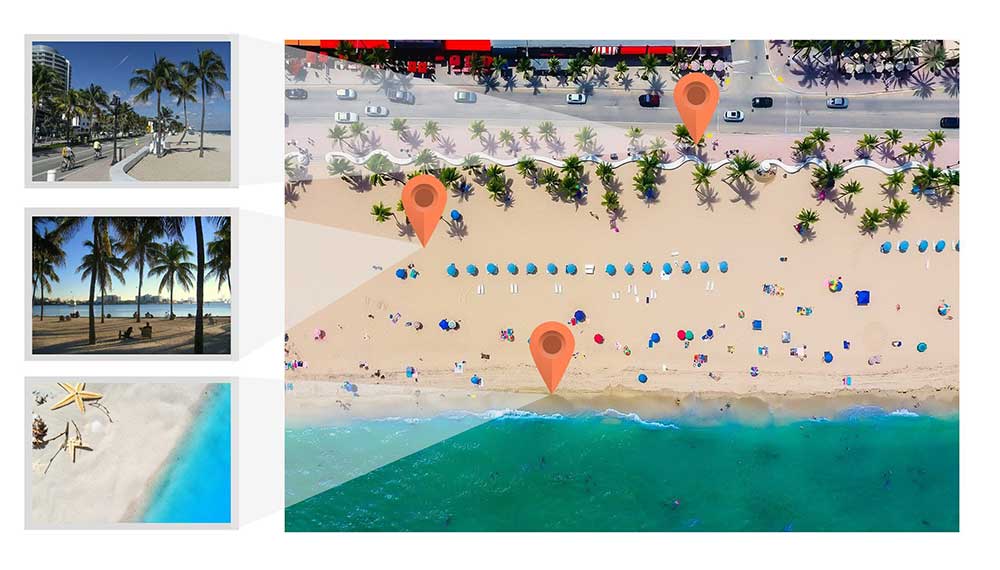
Because geotagged photos have locations, we often incorporate them into a web map for broader audiences to consume. For example, here are some examples of using geotagged photos:
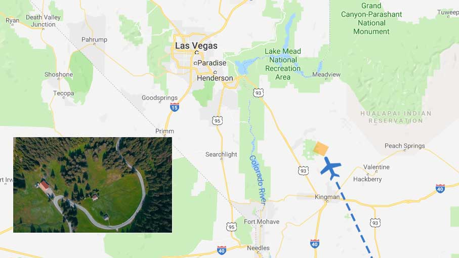
- For tracking a trip or vacation, users take photos at different landmarks and sites. Then, the traveler can take these geotagged photos and put them on a web map to see where each photo was captured.
- For site reconnaissance, photos can be worth a thousand words. Not only can you check site conditions with the photo, but you also have the photo coordinates for geolocation.
- NASA is running a campaign “Adopt a Pixel” to acquire ground-based photos to improve land cover derived from satellite imagery. If you add geotagging for each photo, you can better track locations by knowing the GPS coordinates where the photographs were taken from[1].
Each example takes advantage of how geotagging uses geolocation properties for capturing photographs.
Geotagging vs georeferencing
Although some use these terms interchangeably, georeferencing is a completely different process than geotagging.
Geotagging simply means a photo (often ground-based photographs) has a single coordinate point associated with it.
Instead, georeferencing takes an aerial photograph and assigns coordinates to each pixel in the raster. By georeferencing, it overlays the entire image in the real world.
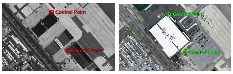
This process of orthorectification geometrically corrects any distortion. In the end, the aerial photo becomes an orthophoto so that its scale is uniform.
How to extract coordinates from geocoded photos
After you take geotagged photos with a phone or camera, how do you transfer them to physical locations on a map?
If you want to use GIS software, you can either use:
- QGIS Import Geotagged Photos from the Vector Creation Toolbox
- ArcGIS Geotagged Photos to Points [2]
The best part about these is that they both enable you to build custom web maps for a larger audience to view.
If you don’t want to publish a web map, we suggest using Google Earth. Here is a quick tutorial on how to geotag photos on Google Earth:


