27 Differences Between ArcGIS and QGIS
The Differences Between QGIS and ArcGIS
You probably grew up using ArcGIS… or QGIS…
And every day, you sit down at your computer desk
…and you do the same thing:
You open up the same ArcGIS software…or QGIS software (albeit a newer version) because that’s what you know best.
But have you ever asked yourself:
Can I get MORE from using different GIS mapping software?
This is the most epic GIS software battle in GIS history.
We navigate you through the differences between ArcGIS and QGIS because you’ll be a more efficient and advanced GIS user. It’s a head-to-head GIS software showdown with the star-studded lineup in the GIS industry – ArcGIS vs QGIS.
READ MORE: 35 Differences Between ArcGIS Pro and QGIS 3
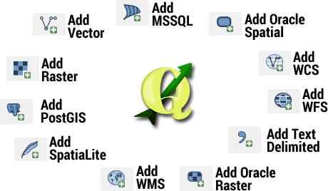
1. QGIS mind-blowingly consumes all types of data

ArcGIS has broken more hearts than anyone for consuming data.
No questions asked. QGIS has the edge for consuming data. QGIS is versatile. It’s cutting edge when it comes to consuming data.
QGIS uses the GDAL/OGR library to read and write GIS data formats. Over 70 vector formats are supported.
QGIS was born to work with PostGIS. But the list goes on for GIS format consumption… ENC, shapefile, geodatabase, MapInfo formats, Microstation file formats, AutoCAD DXF, SpatiaLite, Oracle Spatial, MSSQL Spatial databases, WellKnownText (WKT)…
Instead of pounding the pavement to load your NetCDF files, QGIS will consume it for YOU.
Instead of wasting time trying to add space-delimited files, the QGIS interface lets you roll it in 24 hours a day. (Because setting custom delimiters in QGIS is even better than Microsoft Office.)
And instead of poring over piles of conflicting and confusing GIS formats, simply consume it with QGIS.
ArcGIS has broken more hearts than anyone for consuming data.

While QGIS has won my heart.
READ MORE: The Ultimate List of GIS Formats – Geospatial File Extensions
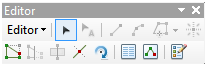
2. Simplicity is beauty for user experience
You never realized how powerful the ArcGIS “Add Data” could be, did you?
Yes, this “Add Data” button:

You laugh now, but think about it:
This simple button simplifies adding data because it recognizes all GIS formats.
Do you want to add a spreadsheet? Do you want to add a raster? Push the “Add Data” button. It’s that easy.
In QGIS, do you want to add a spreadsheet?
Click the “Add Vector” button. Select the “all data” formats drop-down.
The separate buttons in QGIS (add vector, add raster, and PostGIS, add SpatialLite, etc) add confusion.
Another instant crush is the splash screen in ArcMap that displays your latest map documents. Retrieve old MXDs because we all have to return to unfinished business. This feature is available in QGIS by selecting Project > Open Recent.
Simplicity is a thing of beauty for use experience.
And ArcGIS execution is genius.
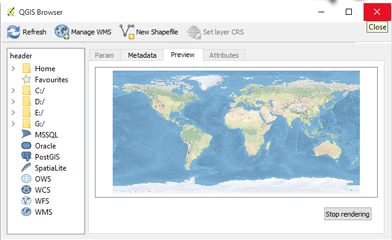
3. Explore your geodata with ArcCatalog and QGIS Browser
QGIS Browser and ArcCatalog are stand-alone GIS data management applications.
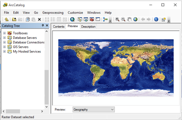
These applications help many manage their raster, vector, and GIS data. They give basic preview functions but the focus is on data access and organization.
Pin down missing data sets by using the filter and search tools. It’s like your own personal Google search engine. With ArcCatalog, it’s not only for data but also maps, models, and tools.
A part of managing data is creating metadata. When was it created? Who is the creator? How was it made? The answers can be found in the metadata.
Over the years, metadata has evolved into a variety of formats (ISO, FGDC, INSPIRE, and NAP). ArcCatalog rises to the occasion giving users the option to select their own metadata standards.
Both the QGIS Browser and ArcCatalog help to easily navigate in your filesystem and manage geodata…
The edge goes to ArcCatalog because of its options.
READ MORE: 10 Free GIS Data Sources: Best Global Raster and Vector Datasets
4. Fearlessly join tables in ArcMap and QGIS
When you join a table to spatial data, you’re putting each row on the map.
Creating table joins is intuitive in ArcGIS. In ArcMap, you can right-click a layer and select ‘join’. You can also join via the layer properties.
And it’s really just as simple in QGIS. In QGIS, you can join tables with the layer properties.
When you make a “table join” in QGIS, it gives the option to rename the prefix of that specific join. With multiple “joins”, this is a useful feature.
But both are winners in my books.
5. ArcGIS and QGIS hit the bullseye for coordinate systems and projections
The first data set you add to ArcMap determines your coordinate system.
When other data sets are added in other coordinate systems, ArcGIS will project the data “on the fly”. This means the layer will match the initial layer and the data frame’s coordinate system.
An ‘Unknown Spatial Reference’ means there’s a datum conflict. In this case, ‘unknown units’ will appear in the bottom right corner of ArcMap and you should use the Define Projection tool.
QGIS has support for 2,700 known coordinate reference systems (CRS). It allows you to define global and project-wide CRS for layers without a pre-defined CRS. It also allows you to define custom CRS and supports on-the-fly projection of vector and raster layers.
Both ArcGIS and QGIS handle CRS in a user-friendly way. Issues have arisen with PRJ in QGIS. But that’s a thing of the past.
READ MORE: Map Projections: Flatten the Sphere
6. ArcGIS Online loads your arsenal with real-world GIS data
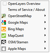
QGIS gives you a couple basemaps with the OpenLayers plugin.
But it’s nowhere close to ArcGIS Online.
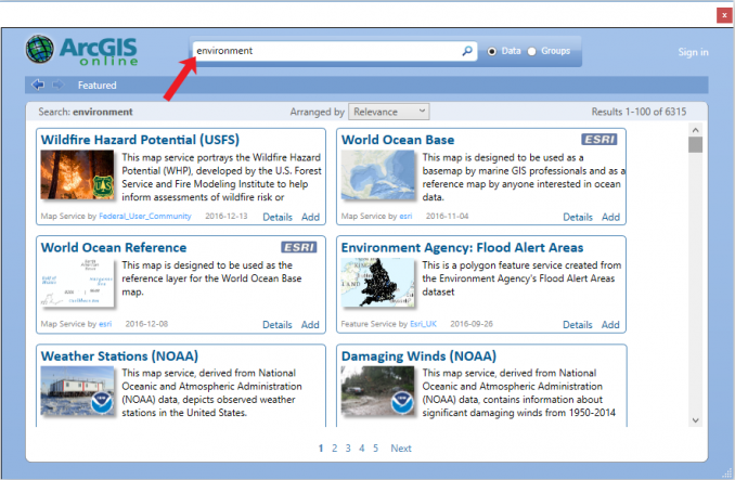
When you open ArcGIS Online’s data catalog, you’ll feel like a kid on Christmas. Unwrap thousands of gifts like government data, detailed base maps, and crowd-sourced information.
The basic ArcGIS license gives you access to ArcGIS Online – a GIS data goldmine.
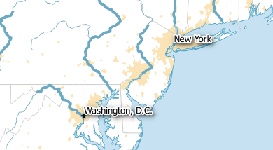
A generic search for “environment” returns over 2887 GIS datasets. 2887. For example, it included USDA Wildfires, NOAA Damaging Winds, and World Climate Total Annual Precipitation. This would make any environmental researcher squeal in delight.
The bottom line is that ArcGIS Online (AGOL) is a rich source of GIS data. It helps you analyze and make even more powerful and knowledgeable decisions.
Remember that with great power comes responsibility. Use the power wisely, my friend.
7. Licensed to geoprocess
“Licensed to geoprocess” sounds like a really bad movie. ArcGIS is the villain forcing you to connect to your license. QGIS is the open source hero.
ArcGIS has a very good geoprocessing framework. Very solid. Very extensive. But your license level determines which tools you can use in ArcGIS.
A basic license still gives you access to a large number of powerful tools. An advanced license gives you access to everything.
Now, this part is important:
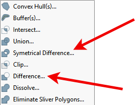
There are no license levels in QGIS. Open source QGIS software does not limit which tools can be used.
If you want to use the erase tool in ArcGIS 10, you’d have to turn on the advanced license. If there are no available advanced licenses, it means you can’t use the erase tool. (You could use the free trial of ET GeoWizards).
Now, take this to the bank:
The erase tool is readily available in QGIS in the Vector Analysis toolbox. (It’s the Difference tool). Same as the symmetrical difference tool, which isn’t available with a basic ArcGIS license.
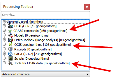
There’s tool integration with GRASS GIS and SAGA GIS, which gives you the necessary horsepower at your disposal to solve almost every geospatial problem.
QGIS is working on its geoprocessing framework which is already impressive. But in the end, you really are licensed to geoprocess in ArcGIS. It’s like a bad horror movie with the inconvenient 999999 error.
This makes QGIS a dominant winner in this category.
READ MORE: 13 Free GIS Software Options: Map the World in Open Source
8. Have no fear, the plugins are here
Sorry, you thought we were talking about QGIS, didn’t you?
We all know you can engineer specialized analyses with plugins. QGIS has boatloads of plugins to solve everyday GIS problems. Nearly 500 of them.
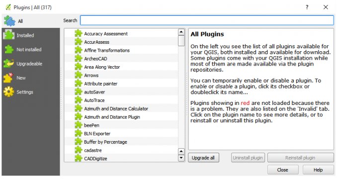
But what you may not have known is that ArcGIS has plugins too. There are solutions for practically EVERY GIS problem.
There is free integration with R stats using GME, Marine Tools add-on, NetCDF interoperability, ET GeoWizards, and ArcGIS Patch Analyst. Then, with Esri’s latest addition for an app store of their own – ArcGIS Marketplace, even more plugins will be rolling out like clockwork.
There are paid (and free) solutions for almost any spatial problem you can think of. Esri has nailed every corner of the market including gardening. You have to understand how scalable and unique Esri is to solve your geospatial problem.
QGIS is a lean-mean vector processing machine.
But it just doesn’t have the variety of specialized tools available in Esri.
9. Raster processing in both QGIS and ArcGIS are crazy, stupid useful
The Spatial Analyst extension packs the most punch for raster data manipulation.
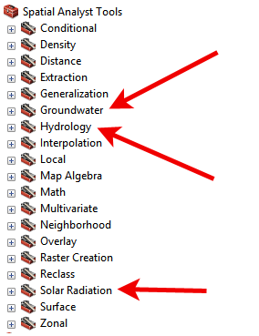
Whether it’s simple math (map algebra and conditional toolset), statistics (multivariate, neighborhood, or zonal statistics), or generating value surfaces (interpolation, density, or overlays),
ArcGIS raster-based tools are rock-solid. The Spatial Analysis tools also offer specialized tools for groundwater, hydrology, and solar radiation. Other options are to filter (reclass or extraction toolsets) or simplify data (generalization toolset).
In QGIS, the raster calculator tool performs map algebra with a little less math and trigonometry functions. QGIS has multiple ways to perform interpolation. Ordinary and universal kriging are separate tools in QGIS, but in ArcGIS, there’s a radio button under the kriging tool.
GRASS r.cost is for cost surfaces. QGIS wins for more filtering options. There are groundwater and solar radiation tools in QGIS, but not like ArcGIS
We could continue. But choose not to bore you. It’s difficult here to pin down a winner, as both stand out for having a plethora of raster manipulating options.
10. ArcGIS Geostatistical Toolbox is crowned winner because it teaches you stats
Have you ever tried to assemble furniture without the instruction manual? Practically impossible, right?
When you run tools in the ArcGIS Geostatistics Toolbox, the instructions and output explanations are so clear that a child can understand the results.
For example:
When you run Moran’s I, the report output delivers a concise explanation. You know if your data is auto-correlated or not.
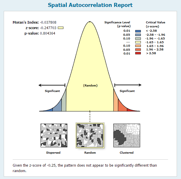
In QGIS, you need a good understanding of the tool beforehand. This isn’t necessarily a bad thing. But you don’t get the silver platter like ArcGIS 10.
The exploratory regression tools in ArcGIS are well-made because the outputs allow users to connect statistics with their data. This saves time for analysts.
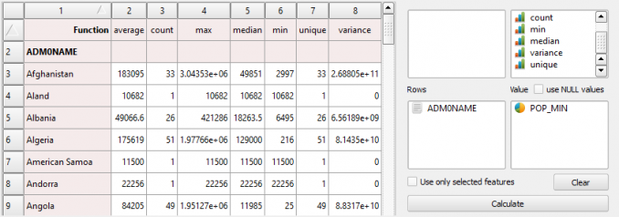
The Group Stats plugin in QGIS is neat. It’s like an interactive pivot table creator integrated into QGIS. The columns are your statistics types (average, minimum, variance, etc). Rows are categorical fields such as place names or watersheds. Add a value field and push calculate. Voila, your pivot table is generated.
When you can make difficult concepts straightforward, you become a winner in my book. And ArcGIS is best at teaching geostatistics.
11. You have x-ray vision using QGIS remote sensing tools
Silently, satellites collect data of our planet with active and passive remote sensing. Satellites like Sentinel 2 and Landsat 8 are the exciting ones making data more ubiquitous to GIS analysts.
QGIS and ArcGIS present a myriad of tools for remote sensing. Some of these are like hand tools, like a chisel. Others are like power tools, like an electric drill.
For example:
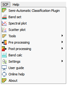
- The QGIS semi-automatic classification plugin lets you perform image classification in a semi-automatic way.
- The Orfeo toolbox delivers a range of tools to filter, process, and manipulate raster data.
- LASTools can be integrated to handle LiDAR. We found it difficult to set up. But LASTools has always been solid for LiDAR handling.
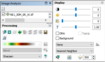
When ArcGIS 10 added the image analysis toolbar, it instantly provided remote sensing analysts with the necessary tools to create samples and perform unsupervised and supervised classification. Pansharpen, perform NDVI, orthorectify and interactively change the brightness, contrast, and transparency. The LAS Dataset (LASD) is an awkward way to work with LiDAR. It still gets the job done.
No standouts. But QGIS deserves an edge for remote sensing.
READ MORE: What is Remote Sensing? A Guide to Earth Observation
12. Route your next fishing trip with ArcGIS network analyst
Almost everyone has needed a routing analysis in their life.
- Where’s the closest beer store?
- What’s the fastest route to that beer store?
Here’s Las Vegas to the Grand Canyon:
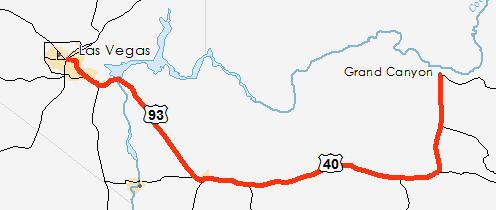
In ArcGIS, flick on the network analyst switch. Add your data to a network data set. Building a clean topological road dataset is a challenge. But after this, you’re ready to go.
Using the “Road Graph” plugin, QGIS calculates the shortest path. QGIS lacks some of the tools found in ArcGIS network analyst – location-allocation, new OD cost matrix, etc.
The ArcGIS network analyst extension is the networking extension of champions.
13. Direct workflow (like a boss) using ArcGIS Model Builder
Have you ever wanted to put your workflow on auto-pilot?
Think about it for a second:
When you run redundant tasks as a scheduled model, you can sit at home in your bathrobe all day long (and still get work done.)
And ArcGIS Model Builder is the most intuitive, rock-solid, pragmatic way to automate geoprocessing jobs.
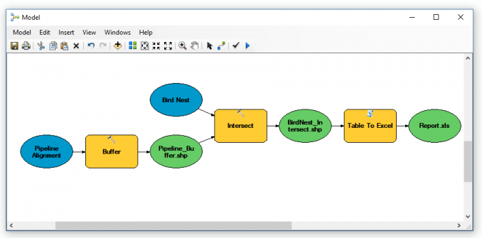
You string together sets of tools in Model Builder to automate processes. It has iterators to do “for” and “while” loops. Drop tools in your Model Builder Diagram and connect them. It’s easy.
Go one step further:
Export your model and share it with others. Or export it as a Python script and customize it.
ArcGIS scripting is almost all run through the ArcPy module. ArcPy coding is incredibly easy because almost every tool in ArcGIS has a scripting tool of the same name already created (which you can easily copy and paste from Esri’s website). Automate everything.
READ MORE: ArcGIS Model Builder: How to Create a Custom Toolbox and Export as a Python Script
QGIS has the same functionality as ArcGIS Model Builder and it’s called Graphical Modeler. You graphically develop sets of tools in a specified order using QGIS Graphical Modeler.
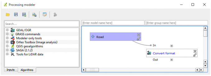
QGIS tends to crash often when using QGIS Modeler. It’s shaky so save often.
For QGIS, you have PyQGIS. There is no QGIS module and you will be using GDAL a lot. You will also be using a bunch of other modules as needed for different projects. It can be difficult to figure out what to use and where it all is.
Despite the bugs, in the end, you can achieve the desired results.
We love ArcGIS ModelBuilder. We love ArcPy. These are two of the brightest spots of ArcGIS.
READ MORE: Free GIS Programming Tutorials: Learn How to Code
14. Design a cartographical masterpiece in ArcGIS and QGIS
Open source skeptics think that ArcGIS is the only way you can create beautiful maps.
But QGIS is a viable option to create cartographic masterpieces. QGIS mapping interface is called ‘Print Composer’. It acts almost like another application.
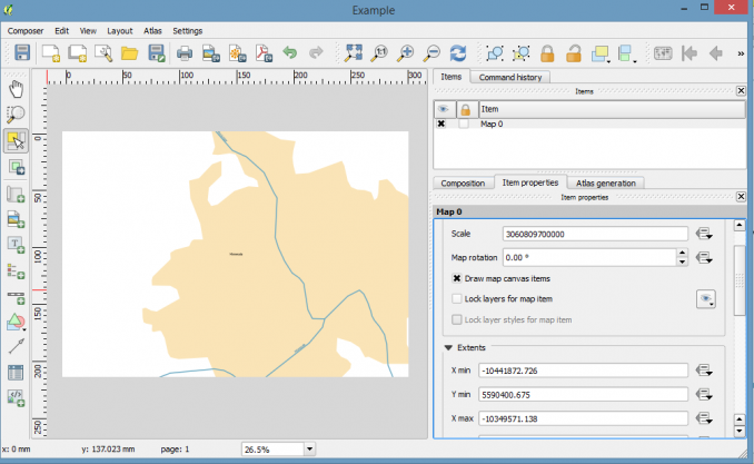
… But once you symbolize and label features in your layout, this is when you realize that QGIS is a cartographer’s dream.
ArcGIS layout view is how to set up map templates and export map products. ArcGIS experts in various formats like PDF, JPG, SVG, AI, PNG, EPS, and EMF. The ArcGIS layout view is practical. It has tools to pinpoint your labels, set up mapbooks, and link data frames with easy extent rectangles.
We like both QGIS and ArcGIS for all-purpose mapping.
15. Create symbology that rocks your readers’ world in QGIS
ArcGIS is loaded with stunning symbology on startup. We like the symbology by discipline (transportation, real estate, soils, weather, etc.). It’s great for point, line, and polygon styles. The existing symbology in ArcMap is beautiful, useful, and plentiful.
QGIS misses the beat on pre-existing choices. Life would be easier in QGIS if it came equipped with symbology like railways and hatched polygons. Keep in mind: you can download and load them to your symbology palette.
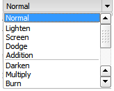
Where QGIS sputters, it makes up the ground for its Adobe Photoshop-like array of fill options. It has more blending options than a symbology bakery: lighten, screen, dodge, addition, darken, multiply, burn, overlay, soft light, hard light, and difference.
Gradient fills make QGIS a cartographer’s paradise. You can create simple gradients with two or multiple colors. Add the different types-linear, radial, and conical. Save as a QGIS layer style file (*.QML).
But the icing on the cake is the “Color Picker”. It’s such a simple idea for selecting colors. You no longer have to write an RGB code again.
QGIS has some really advanced symbology. ArcGIS is practical and puts symbols in the hands of the cartographer. Both are winners in my books.
16. Design dynamite labels & annotation in QGIS
Labeling is fantastic in QGIS. QGIS is a whole new level of style.
- Buffer text with a flaring glow.
- Add drop shadows for style points.
- Set transparencies, blending modes, and offsets
These subtle differences give your labels serious pop.
While ArcGIS lacks some of the beauty of QGIS labeling, you can get surgical for placing labels with ArcGIS maplex labeling engine. Gain full control of exactly how and where you want to label features. Set label location and scale dependency. Curved and parallel labeling is easy in ArcGIS. It’s smart.
The drawing toolbar is how to control annotation groups in ArcGIS. It’s not intuitive. Make a separate toolbar for annotations. But with a little practice, you can control which annotation group labels belong to.
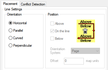
The upside is QGIS beautiful labels. But placement properties and annotation favor ArcGIS.
READ MORE: 33 Map Elements to Include in Cartographic Design: A ‘How to’ Guide to Map Making
17. Become a map automation quarterback with Data Driven Pages
If you’re in the map-making business, you should use data driven pages in ArcGIS. It is your complete arsenal for automated map production.
The index layer is used to create each page. The Data-Driven Pages toolbar and the Cartographer Toolbox are the one-two punch combo for mapbooks.
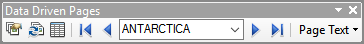
The Cartographer Toolbox is how to create strip maps. If your map spans multiple projections, use the Calculate UTM zone tool.
QGIS’ Composer has the ability to create an “Atlas” built-in, and it works very well.

Using QGIS Atlas, select your coverage layer which contains geometries and fields. For each geometry in the coverage layer, a new output will be generated. Fields associated with this geometry can be used within text labels. A page will be generated for each feature.
Atlas works well. QGIS atlas and ArcGIS data-driven pages are for quantity.
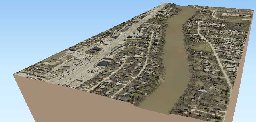
18. Hoist the anchor and sail away from two dimensions in ArcGlobe & ArcScene
It’s time to hoist the anchor and sail away from two dimensions.
ArcGlobe and ArcScene are stand-alone programs using the 3D analyst extension. These applications give you a chance like no other to enter a world in 3D.
ArcScene is for small study area scenes. Extrude objects with amazing vertical exaggeration. Z-factor is your friend.
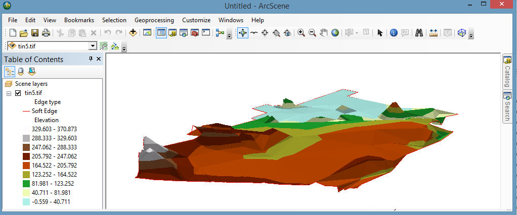
ArcGlobe is for data that spans the whole globe. Make your data come to life. Perform wicked fly-throughs.
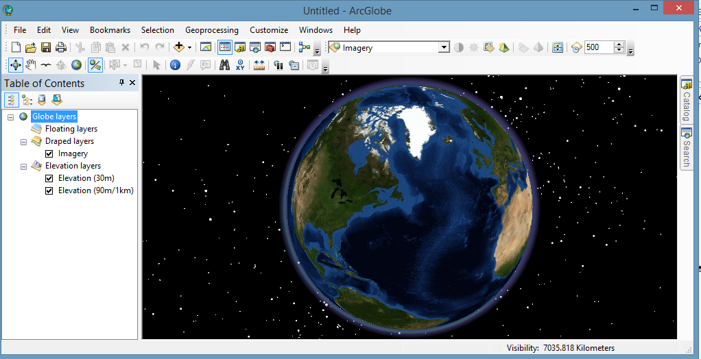
Just make sure you enable your 3D analyst license beforehand.
QGIS lacks decent 3D support. The Qgis2threejs plugin can catapult you into three dimensions. The Qgis2threejs plugin exports terrain data, map canvas images and vector data to your web browser.
But just don’t expect something as polished as ArcGlobe or ArcScene. Ya, ArcGIS is much better than QGIS for your 3D needs.
19. Design epic webmaps and tell your story
Web maps are on the uptrend. The news industry, governments, and businesses are using web maps because they tell a story.
Web mapping is easy in ArcGIS. Cartographers send data to the web via ArcGIS Online. ArcGIS Online for web maps is where the online maps are held on Esri’s GIS cloud.
A cool trend is ArcGIS story maps because everyone has a story to tell. With ArcGIS, you can harness the power of maps to tell yours
QGIS Server provides a web map service (WMS). The WMS uses the same libraries as the Quantum GIS (QGIS) desktop application. Maps and print templates created in QGIS desktop can be published as web maps simply by copying the QGIS project file into the server directory.

For example, you can find some slick QGIS server web maps in the QGIS case studies that uses Leaflet clients as webmap examples.
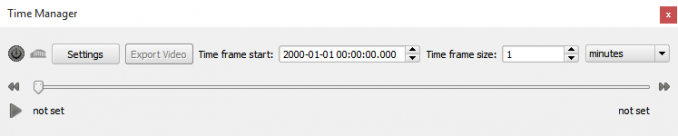
20. Sail through turbulent times with ArcGIS animations
Have you ever wanted to animate your data?
Watch polar ice caps melt over time. Display global time-aware weather patterns. ArcGIS makes it an easy process to go from static to dynamic with its animation toolbar. GIS time-series animations are easy in ArcGIS.
When you have a time-enabled field, scroll the time slider from left to right. Watch your data change over time. A little preparation is necessary but nothing too painful. Export as an AVI and impress your boss.

The TimeManager plugin adds time controls to QGIS. Using time controls, you animate vector features based on time attributes. There is also an experimental raster layer support and interpolation between point geometries. You can create animations directly in the map window and export image series.
READ MORE: Time Series Animation in ArcGIS
21. Construct color-coded thematic maps
Social scientists often construct thematic maps because they show a particular theme connected with a specific geographic area
For thematic mapping in QGIS, cartographers have a range of options. For example, there are graduated colors, proportional symbols, and dot density. Symbolize numeric data with pie, bar/column, histograms, and text diagrams.
One of the unique tools in QGIS is the heatmap display. Take a point data set and instantly create a heat map (without raster conversion). Adjust the radius, color ramp, transparency, and blending mode. In the end, the heat map renderer delivers live dynamic heatmaps for point layers.
You can symbolize multiple fields in QGIS using the “set column expression” or “rule-based expression”. But in ArcGIS, it’s fast, easy, and intuitive using unique values, and many fields. Dot density maps and stacked charts are unique qualities of ArcMap.
Using both ArcGIS and QGIS, you can become a thematic mapping legend. Not the legend you see on a map, of course.
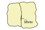
22. Create mind-blowingly detailed edits with ArcMap’s Advanced Editing tools
There are subtle differences between ArcGIS and QGIS editing. But not all editing tools are created equal.
For example:
You right-click to end a sketch in QGIS. You double-click to end a sketch in ArcGIS. You’d be surprised how refreshing it is to end a sketch with a right-click. It’s easy to mistakenly double-click when creating a lot of vertices.
QGIS offers a range of tools for editing like reshaping, splitting, and tracing (with the AutoTrace plugin). Delete rings from features and create donuts with simplicity. You snap features using snapping options. The QGIS CadTools plugin provides 13 advanced tools. One of the bright features is rolling back edits in QGIS. This can only be done in the vertex sketch properties in ArcMap. Every vertex can be moved and removed.

It’s painless to create data in ArcMap. ArcGIS has more options for advanced editing. You create features by setting up feature templates. The advanced editing enables tools like exploding multipart features, fillet/trim/extending curves and replacing geometry. The trace tool in ArcMap was sent from heaven.
23. You have 99 problems but a topology error isn’t one
- Do points overlap polygons?
- Do overlaps exist?
- Should lines touch the boundary of polygons?
The only word I can describe topology in ArcGIS is genius. This is a genius toolbar.
If you’re worried your GIS data has errors (overlaps, gaps), ArcGIS supports richer, complex error checks with their topology tools. Inspect your topology with over 30 rules with the error inspector. Resolve topology issues with automatic or manual fixes.
Once your data is in a geodatabase, you can start creating topology rules.

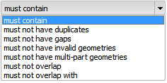
QGIS delivers a couple of rules for topology fixing: “must contain”, “must not have duplicates”, “must not have gaps”, “must not have invalid geometries”, “must not have multi-part geometries”, “must not overlap” and “must not overlap with”. You validate your geometry based on these rules, but how do you fix it?
ArcGIS topology fixing is interactive. One by one, you can go through errors and fix them.
Topology editing is a strong point in ArcGIS with a ton of options to fix editing errors.
Best of its kind.
READ MORE: Topology Rules in ArcGIS: How To Fix Digitizing Errors
24. Perform data entry like a pro
Both QGIS and ArcGIS are hard-hitting GIS data entry machines. They both provide similar functionality.
When you create a shapefile in QGIS, you are prompted to set up your fields (text, whole, decimal number, or date). With ArcGIS, you create fields (integer, float, double, text, or date) afterward – unless you’re in ArcCatalog.
When fields are created in QGIS, you can rename them using the Table Manager plugin. You probably thought in ArcGIS, you have to create a new field and copy the contents over to the new field. But the Alter Field (Data Management) can accomplish this.
In geodatabases, users can set up subtypes, domains, and default data entries. When users start entering attribute information, they can select from drop-down lists. This is how to steer clear of invalid entries when GIS analysts start going rogue.
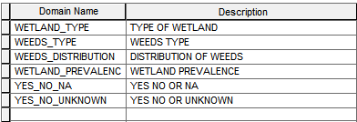
Selection by location has been improved with its interactive selection tool. When records are selected, they can be filtered even more so (selected from, added to, removed from). The field calculator supports Python and VB to execute code.
One of the many quirks in ArcGIS is that you have to stop editing to calculate a field.
This does like a champ.
25. Locate XY coordinates by geocoding addresses
What is geocoding? Geocoding is the process of giving XY values to street addresses.
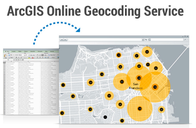
One option to geocode is through ArcGIS Online Geocoding. This is a paid service requiring credits to use.
ArcGIS Desktop has its own way to geocode using your own data. To do this, you create an address locator. Find addresses using the Geocoding Toolbar. Type the location and add a labeled point.
If you want to avoid credit systems of any form, then you have two options in QGIS. Both are good options.
The MMQGIS plugin is great for bulk geocoding. This plugin takes a spreadsheet (CSV) containing multiple addresses and adds them to the map canvas as points.
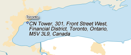
The GeoCode plugin requires an address as input. Type an address.
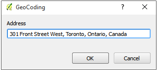
Press OK. Watch your address appear on the map.
Five for five. Boom!
We don’t like the idea of credits or paying additional costs for geocoding. Go with QGIS for geocoding.
26. Alter geometries with data conversion tools
It’s any cartographer’s bread and butter to generalize features, convert polygons to points, or vice versa. And sometimes altering features can be tricky. But with QGIS on your side, it doesn’t have to be:
In QGIS, you can convert lines to polygons, points to polygons, or anything in between.
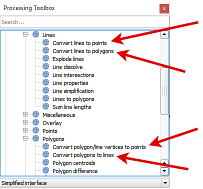
In ArcMap, it completely depends on the task. You may need an advanced license for data conversion.
QGIS has some pretty cool generalization tools too. These are used to simplify lines, aggregate points and polygons, and more.
27. ArcGIS drowns readers with rock-solid examples and documentation (in a good way)
Documentation is superb in ArcGIS. ArcGIS not only provides in-depth documentation on how to use tools. It delivers sample data for you to get hands-on experience.
This is not to say QGIS documentation isn’t good. It’s informative, well-written, and practical. But it hasn’t been rung through the dryer like ArcGIS.
Esri has Geonet.

While GIS Stack Exchange is the central community hub for QGIS users.

QGIS support is very active. A dedicated volunteer community supports QGIS newbies. The ArcGIS community consists of staff and enthusiastic users. Don’t forget to check out some of our QGIS 3 tutorials for all the essentials.
They both are hit-and-miss when it comes to supplying answers to problems.
Let’s Wrap Things Up
GIS really comes down to just 4 simple ideas:
- Create geographic data.
- Manage it.
- Analyze it and…
- Display it on a map.
These are the primordial functions and are served well in both GIS software.
You can’t go wrong with either GIS mapping software – QGIS or ArcGIS.

QGIS is free. It has multi-language support and relies on volunteer efforts which is really good. It has huge support on stack exchange. The more you work in QGIS, the more hidden gems you find like:
- Interactive pivot tables with GroupStats
- Adding CSVs with simplicity
- Stunning cartographical symbology and labeling options.
ArcGIS is one of the best GIS investments you could ever make. It’s expandable and has the biggest user community to find answers. Also, it provides tutorials with sample data for you to get hands-on experience. ModelBuilder’s automation is top caliber. The specialty software in ArcGIS extension is also a thing of beauty.
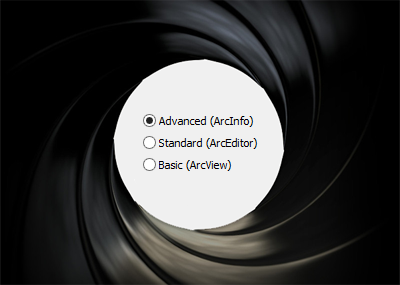
In the crudest terms, we’d rank it like this: ArcView < ArcEditor < QGIS < ArcInfo. ArcInfo is the victor.
We’ve cut through the clutter and made ArcGIS and QGIS simpler for you.
Now it’s your turn.
Where does ArcGIS triumph?
Where does QGIS have an edge?


I’ve never been using ArcGIS and QGIS for the previous years. Later-on, I was attending Pacific Adventist University in and my Introduction to GIS lecturer told me every good thing about QGIS. He told me that ArcGIS costs a lot while QGIS is offered free, so I made up my mind to download QGIS into my computer to further continue on with mapping skills in my studies.
Mega congratulations to those who fund this to happen throughout the world effectively.
Greetings from Papua New Guinea
Beggars cannot be choosers so in this respect, for them, QGIS wins hands down. And with QGIS in hand, a GIS task can now be executed. From that onwards, there can be sharing of data and knowledge.
I might have missed it in the many comments, but the main reason I use QGIS is that it runs on my Mac. QGIS also runs on Windows or Linux. ArcGIS only runs on Windows since about 20 years ago.
Any (slight) edge that ArcGIS might have over QGIS isn’t worth the money… Dude, QGIS is free! And we’re highlighting ArcGIS’s great documentation? LOL
Great article though… My training was in ArcGIS and I used it for about 7-8 years, and just transitioned fully to QGIS over the past 2 years. I didn’t know some of the QGIS features you highlighted. Thanks!
It’s time to add ArcGIS Pro to the fight!
Here it is – 35 Differences Between ArcGIS Pro and QGIS 3
Hi, if you update an old comparison, please update it properly. 6: you forget XYZ tiles. You forget temporal functionality now built into this, you forget QGIS has now a built-in 3d map. You are still talking about print composer while it is now print layout/layout manager. Anyhow, this comparison is quite silly: when applying these 27 comparisons, how much $ have you spent on Arcgis + extension packs/analysts and how much on Qgis? (>$5000 vs $0). And what about ArcGIS’s propriety file formats that make data exchange almost impossible? It is like comparing a free bus ride with an expensive Mercedes. When it comes to value for money, QGIS is unbeatable.
Hi Theo. Please take a look at our new comparison – https://gisgeography.com/arcgis-pro-vs-qgis-3/
Hi, I have a simple question for my university course. My question: Will output (file) created in QGIS be identical with one created in ArcGIS?
I have only OS X and so I cant use ArcGIS, my professor told me I can use QGIS only if the results will be identical with the ArcGIS (which school uses).
It’s for automated control, that’s why results have to be identical.
Great article on QGIS and ArcGIS
I wish I have seen it earlier but
better late than never
Though QGIS have good sides but I have only worked with ArcGIS. Arc is better than QGIS for its faster response and various options.
I cannot comment on QGIS. But as far as Arcmap goes it is chock full of bugs. ESRI’s technical support is very good, but that happens while the user is discovering a new bug or inconsistency. ESRI’s QA is very poor. I can stand stand bugs in open source software, and might be able to fix them. I cannot stand the unreliability of ARcMap at the prices that ESRI charge. I also have a very big problem with ESRI’s (non) maintainance of backwards compatibility in their add-on products. A classical example is Business Analyst, a $14K product which my company purchased with Arcmap 10.0 and became incompatible with ArcMap 10.4 in just two years. That is emphatcially not acceptable.
First of all the QGIS logo is terribly outdated (QGIS 3 is on the run for nearly a year) and at the last edit time point 2 is no longer true. Since QGIS 3, adding data works via the “Data Source Manager” (ONE button too), BUT the user has still the ability to use the various buttons as described (I prefer this for convenience…). And it should be well noted, that data adding horror in ArcMAP begins when pressing this ‘pretended simplicity’ button.
I have an article on QGIS 3 here, if interested – https://gisgeography.com/qgis-3/
Yes, it’s true. Things have gotten a bit dated. That’s the problem when you write one of these comparison types of articles. Things move at the speed of light in GIS. Even Esri has their new, shiny software ArcGIS Pro. This article will stay as it is because it’s a classic. As of today, 67 comments.
I’ll be making a similar article to this one in 2020. But it will be QGIS 3 and ArcGIS Pro. So, be on the lookout in the upcoming year.
If there was a way where ArcGIS could do polyline feature extraction from raster imagery (i.e., highways, highway ramps, even over passes), that would be the bomb. I know there has been improvement on this over the years, and am sure its not 1-2-3, but if we add up the functions there is a way. Just don’t make things so damn proprietary!!! One thing I could offer is that once I started using ArcGIS is that the Help options suck donkeys. Ranking subjects as they relate to the search terms does NOTHING at all for a rookie user or someone just wanting a simple answer on how to do something, and then to have to fumble around to find the How-To-Do stuff is equally insane. Who was hired to do this? Oh, and let’s not forget: having to constantly interact with MS Excel to do better editing of fields in databases doesn’t get you ahead in your GIS career either. Signed, 50 year old intern.
A great comparison but ArcGIS has one more very useful feature which is not available in QGIS and that is exporting the map as an Illustrator (.ai) file.
Yes, lot of cartographers use Adobe Illustrator for making graphics rich maps and for that use Avenza MAPublisher plugin with Illustrator. It is an expensive option for cartographers but there is no other viable solution which combines the CAD with GIS.
ArcGIS can export the Map Layout as an Illustrator (.ai) file with layers however QGIS just does not have any plugin which can do this job. Can any body suggest some plugin in QGIS which may be utilized for getting the formatted layered map in Illustrator.
Thanks
My biggest frustration with using and teaching GIS for earth scientists and engineers using ArcGIS at the university level is that ESRI keeps changing the software. Menus change, not necessarily for the better for my students’ data research needs, some useful tools disappear. Even the vocabulary changes: features, attributes, etc. take on different meanings. More freezes and crashes.
As a hands-on professor, I have had to completely revise the instructions almost every year or two.
The watershed moment: at last year’s ESRI conference, about 40 minutes into an hour plus Powerpoint lecture with step by step instructions for doing wonderful things with 3D analyst, the speaker (an ESRI employee) said: You’ve heard the announcement about AcrGIS Pro is coming out soon. The menus will be different then! Aarghh!
I am prepared to be wrong but your description of the “Geostatistical Analyst” is actually describing the “Spatial Statistics Module.” These are quite different tools. The first analyzes surfaces while the second analyzes spatial distributional phenomena.
Good article! Both systems ArcGIS and QGIS have advantages and disadvantages, depending on the field of use. However, I think because of the costs associated to licensing, QGIS will dominate the GIS field and probably have more worldwide use. Regarding input data formats, some are standardized in the United States and are often not used in other countries. ArcGIS predominates in the U.S. but QGIS is used in the rest of the world.
When comparing the ESRI home license keep in mind that it is not licensed for commercial use; so if you are an individual consultant or small partnership that uses GIS in its line of work then that could raise issues with ESRI legal. The biggest gap in features seems to be the complete absense of 3D in QGIS. I started using ArcInfo in 1987, have been a GISP, and have experience in multiple GIS domains including environmental, planning, local government, and as a GIS team leader for business analytics and market research at a Fortune 500 company (so I have experienced the ESRI red carpet customer treatment); but a health scare forced early retirement 10 years ago (when QGIS was interesting, but not really competitive).
Now, having survived that life event, I want to get back in the game, but don’t miss the corporate ‘rat race’. I got an ArcInfo home license a year ago to get back up to speed with software that I am familar with. However, now that I desire to do freelance consulting work, on a project or part time basis, the advances in QGIS are exciting for me. It means that I can legally offer my services without a financial overhead that competes with a mortgage. QGIS being affordable for an individual like myself opens up a realm of possibilities that I couldn’t realistically pursue with ArcInfo due to cost. As I find compensated work where I use QGIS, I will be sure to financially support QGIS going forward.
Thanks for this good blog.
ArcGIS very rarely crashes, you can analyze large files with ArcGIS. You can be sure that it is working on the background. QGIS often crashes when you try it with large files.
QGIS PostgreSQL support is legendary. ArcGIS (probably intendedly) lacks of PostgreSQL support.
ArcGIS has better documentation for tools.
UI experiment is nearly same for both. i.e. QGIS is better when it comes to set CRS, ArcGIS is better when it comes to set other layer properties etc.
Can QGIS be used to analysis SAR data
None that I know of. But ESA has an open source SAR toolbox which is pretty good. https://step.esa.int/main/
I’ve been using the QGIS/Postgis combination for about 8 years now. I absolutely love it. In my office I also use QGIS on Linux, Windows and Mac desktop stations. I’m not beholden to Windows if I don’t want to be. Lastly, for my small company, all of the machine licenses, various extensions and continuous upgrades for ArcGIS would have cost a small fortune. QGIS and Postgis are free and in many ways more capable.
I would really like to see an update to this article. Since this article was published, QGIS has been expanded significantly. I would like to see how QGIS 3.0 now rates with ArcGIS. What can QGIS do that ArcGIS cannot? What are the weaknesses to QGIS? Where does QGIS really shine?
Hi Calvin, this will happen early in 2019. QGIS 3 has now been released, see our article that talks about the benefits of making the switch – https://gisgeography.com/qgis-3/
There will be a new comprehensive differences article involving ArcGIS Pro vs QGIS 3. But I just wanted to give some time to both teams of software developers to straighten out with bug fixes and get to certain number of releases. ArcGIS Pro had a bit of a head-start as it was released much earlier than QGIS 3. So it’s best to give QGIS 3 a bit of time to at least get to their LTR 3.4, or perhaps 3.6 according to their road map – https://www.qgis.org/en/site/getinvolved/development/roadmap.html
Thanks for your response, Calvin!
Great article. It would be nice to have updates as new versions are released.
Great review! recommended it to my students
Somehow nobody have stressed the real advantage of the QGIS-PostGIS bundle – the ability to process relatively big data quite smoothly.
With the QGIS-PostGIS installed on the i7 + 16G + DDR laptop you can manage GIS layers with 1-2M features in tens of seconds and 10-15M in a minute or two. And you can browse and map these data via both QGIS and PostGIS. Automatically constructed spatial index works fine as well as spatially enabled SQL of the PostGIS. Try to reach the same performance and ease of use with the ArcGIS and compare the efforts, level of expertise and hardware you’d need.
Generally, the heavy problem of the ArcGIS is a number of very old modules that are still used by the core software. I believe they will be cleaned up eventually, as it happened with the very useful Near Table command, but we are still not there. What I do like in the ArcGIS are its extensions. Geostatistical Analyst is genius.
Good luck getting arcmap to use all cores or memory. I don’t care if it’s pro or with the 64bit extension…. qgis or grass smoke it.
“In the crudest terms, we’d rank it like this: ArcView Where does ArcGIS triumph?”
Umm, this sentence doesn’t make sense. Editing typo?
(nice overview, thanks).
I fixed it. I used the ‘less than’ symbol and it confused it for an HTML tag. Gotta wonder how long it’s been like that.
Thanks for pointing that out!
Great article I must say. I enjoyed every item of the comparison which has given me the opportunity to declare my interest on QGIS. GIS is still far from implementation for most organisations in developing countries mainly because of the cost of the software. And with this revelation that QGIS which is free can do virtually all that can be done using very expensive ESRI GIS software (ArcGIS), QGIS popularity will surely rise to become the default GIS software of the striving countries of the world. Thank you to Gisgeography.com for this wonderful and informative article. Please keep the momentum up with updates of this article as already suggested by other contributors.
Wonderful write up. It would really go a along way to introduce new users to the two softwares.
My view however is that Arcgis has more capabilities, i am not saying arcmap now, i mean arcgis(Arcmap, Arc Scene, Arc Catalog, ArcPro and Arcgis Online all of which you could get for 100 dollars. (Arcgis for Personal Use).
But looking at the cost means if it would have been free then QGIS would not have come close. there might even be no QGIS today.
That been said for an open source software, the developers have done a great job in getting it to where it is now.
Sadly, even Arcgis is no longer in that competition. This century has seen a shift in Arcgis concentrating on delivering their software as a service (SAAS) think AGOL…..which means all you need nowadays is just a laptop with internet access and of course a license.
In other words it is shifting to cater to organisation needs afterall that where the buck of the revenue comes from.
ArcGIS wins it everyday. afterall………
Would you say, Landsat 8 imagery is better than Worldview’s because its FREE and it gets your job done?
Good comments
Regarding the Landsat vs Worldview question, it depends on your needs. Some studies require high resolution imagery that you can’t accomplish with Landsat.
And it depends on your needs too for GIS software.
If you can get by with QGIS, then by all means it should be the way to go. But if you need some of the tools unavailable in QGIS (like the customization you can get with ArcGIS Online Web App Builder, topology tools, 3D rendering, City Engine, photogrammetry tools, etc) then you have no choice but to go with commercial. There are alternatives that can fill some of these gaps like our list of open source remote sensing and GIS software… But Esri is the total package, at least for the time being as QGIS 3 is landing soon
Thanks for making this very comprehensive analysis public. Excellent job!
Firstly, your point on the plug ins is quite interesting. I have been using ArcGIS for over ten years now and have really enjoyed the availability of functionality for any GIS problem. there is a plug in for almost all issues. what annoys me is the restrictions on certain plug ins which depends on your license level. For instance, I have a Basic Desktop license (ArcGIS 10.4) setup in my office and so much of the advanced 3D analysis tools are inaccessible to me.
We have now installed QGIS 2.18.6 installed in our office as an alternative to counter such restrictions.
Secondly, in point#3 you state that “QGIS is a lean-mean vector processing machine…but it just doesn’t has the variety of specialized tools available in Esri”
could you give some examples of the missing specialized tools that QGIS doesn’t have?
Excellent review and fair comparison between the two main GIS systems.
For my understanding, one aspect is to be completely ignored: The long-term perspectives and politics. We (senior) software engineers can not simply do our excellent work and generate our beautiful maps, analyses, presentations, and then say, that’s it. We have to be aware that we are embedded in a broader setting of politics and business. We can’t close our eyes for future perspectives. (I have started using ESRI 1988, QGIS 2010).
There is currently a strong trend of major IT companies towards strong market capitalization and their desire towards monopolization. Once a company has a near-monopoly, they can do whatever they want, including proprietary data formats, price policies, offer or restrictions of processing tools (often labelled as ‘user customization’), availability of data, security of personal data, enforced cloud storage (unencrypted, of course), disclosure of data etc. Watch Google, Amazon, Yahoo, Apple and the like.
Sadly to say, ESRI is on its way to this ‘elite’ with a ‘turbo-capitalistic’ market orientation. An alternative is the open-source environment, where no single company, board, corporation, country can set the rules. A large, diversified user community prevents a capitalization.
Big plus for QGIS.
Thanks for the article, I gave myself the task of proving with examples the differences arcgis and qgis, I see areas of opportunity for QGIS on arcgis, and strengths in QGIS also, considering that ARCGIS goes in version 10.5 and QGIS in version 2.18 , I believe that the development of the QGIS environment is on the right track.
Congratulations.
Greetings from Mexico.
when was this article written and who wrote it?
In 2016 by GISGeography.com
Awesome! I like the comparison. QGIS has become handy for those who cannot afford to purchase and maintain the ArcGIS license. QGIS also enables one to customize by introducing coding to solve organizational problems.
“Does QGIS offer the ability to setup Servers, an in house Portal,etc…”
Yes, QGIS project also provides a mapping server; QGIS Server, which is quite advanced. Here’s a mapping portal running on QGIS Server, Geodatenviewer Kanton Glarus, Switzerland:
https://map.geo.gl.ch/Public?visibleLayers=Karte%20grau
“And for extended support? Is there an equivalent to Professional Services?”
There are a number of 3rd party companies and consultancies that provide professional support for QGIS, database and FOSS mapping portal software, most bsed in Europe. Here’s a partial list:
https://www.qgis.org/en/site/forusers/commercial_support.html
“And Esri’s movement into directed solutions for Utilities, Local Governments, etc…”
qWat is a plugin for QGIS that adds the ability to model and manage water distribution networks e.g. the water network of city of Lucerne, Switzerland, pop. 100,000, is managed using QGIS + qWAT.
Presentation: http://diobma.udg.edu/handle/10256.1/4297
It is hoped that the project will be extended to gas and electricity distribution networks eventually.
QGIS is widely used by local authorities and city councils in Switzerland, who are important sponsors of the QGIS project.
So it is not true to say that QGIS is just a desktop software, it is far more than this. It can be part of a comprehensive FOSS GIS solution. See the OpenGeo Suite by Boundless
How can you compare a COTS and a FOSS software ?
As stated, great article.
Major area of comparison that is missing is the Enterprise component.
Does QGIS offer the ability to setup Servers, an in house Portal,etc…
And for extended support? Is there an equivalent to Professional Services?
How about extension to 3rd party applications and integration to other Enterprise solutions (AVL, SAP, Maximo, etc…) ? GeoCortex type tools available for QGIS?
It seems that for the desktop user on a budget, QGIS wins on cost alone (with the exception of the Home license but that doesn’t help the professional.) For users in an enterprise environment, Esri pretty clearly comes out on top. Are there that many production systems utilizing QGIS, other than the occasional desktop user (who is probably the same person with linux on a box somewhere… ;-) I’m talking about Server based solutions with in house maps, mobile maps, etc…
And Esri’s movement into directed solutions for Utilities, Local Governments, etc… is another step in the right direction. For a smaller organization or an org just starting into GIS, those tools can be a game changer. For more established organizations, they can provide a lot of functionality, especially moving into the mobile game. But there is always the big hump of “that’s not how we do it.”
It’s always good to have competition.
And Open Source is a thing of beauty.
But most folks who are going to dive into supporting a massive system are typically going with a commercial product that has a strong support network. Many folks might argue over Esri’s support but I have found it to be quite good. But you pay for what you get.
BTW – only argument with the above is #25. Yes, AGOL consumes credits for GeoCoding but most organizations with appropriate data sets can easily build GeoCoding tools for in house usage. And a good road network is trivial to turn into a routing solution. Esri’s Network tools are very easy to use. The work is in putting the networks together, whether road, pipe or electrical (etc…)
If you calculate cost/point QGIS wins anyway.
ArcGIS is so far ahead there’s no comparison.
Nice comparison. For the last year QGIS has been a part of my daily routine and I have almost one decade of experience with ArcGIS too. :-)
So here is one note to point no.1 for your consideration. If the user uses only ArcGIS Core and it doesn’t matter what edition is used, you are right. But it is a whole new story with the Data Interoperabilty extension. It allows you to read and write into more than 110 formats (vector files/databases and different types of nonspatial files/databases). But of course, there is the price to be paid for that luxury.
As a fulltime esri user I still find this article awesome. Great comparison. However I do object to the “license” argument. Yes professional software costs money, so does Microsoft Office, Paintshop Pro and Eagle CAD software. And lets face it, most GIS professionals usually have the budget available. For regular Joe there’s always the Home Use program where you can get a full licensed (professional level) arcgis suite including most extensions for a couple of bucks (comparatively 100 bucks is just a few bucks if you consider the full license fee ;) )
I’m a QGIS fan, it’s great in engineering projects (compare alternatives for a electric line or a road for example).
There’s little lovely details in QGIS such as copying layer style. For example, If I have roads_A.shp and roads_B.shp , I don’t need to personalize each layer style, but I personalize roads_A.shp , then “copy style”, “paste style” on roads_B.shp and there it is.
And the possibility to make lots of different maps (size, theme, orientation” with the same project and not having to make a new project for each map is beautiful.
(Now I’m reading my comment, and I realize there’s been a while since last time I had to write something in english xD)
Thanks for the input and great English!
This probably needs a bit of an update in a few places.
3. ArcCatalog is definitely a big plus, extension to the QGIS browser functionality is a fairly common feature request and it’s easy to see why. The only problem is in 10.3 it seems buggy and sporadically refuses to allow drag and drop from catalog to map.
5. I’d give Arc an edge on CRS mostly because of user friendlyness issues, mostly for newer users. Particularly for shapefiles (which newer users tend to default to) Q seems to forget what projection a file was set to on occasion and doesn’t throw warnings about using multiple CRS like Arc does. I’ve seen novice users get into a right mess in Q with about 3 different projections used in the same project for no reason at all, usually complicated by the openlayers plugin.
14. I’m surprised you didn’t mention the ability for the QGIS composer to save multiple map setups. It’s bugged me for some time that ArcGIS can’t do this, even before I’d ever tried QGIS. My general impression is that QGIS has a significant lead in this area.
16. Same for labelling, QGIS is at least equal on placement (and much faster at it) and ahead in the formatting options.
22. QGIS has gained a trace tool now, but generally the editing seems a little more coherent in ArcGIS which I think helps newer users. Editing in ArcGIS is a very consistent affair with each tool acting in the same manner. In QGIS it’s still rather hodge podge at times.
23. ties in with 22 really, the topology handling is a more assured experience in Arc.
One last thing that perhaps isn’t covered is Arcs geodatabase format. I think this is good feature for intermediate users as it provides a (relatively) much more userfriendly way of moving to using databases for storing spatial data while with Q there’s a much bigger step in geekery between dealing mostly with shapes and starting to use Spatialite or, particularly, PostGIS.
Great article. I downloaded QGIS a few years ago and taught myself how to use GIS. It has become an invaluable tool for my work as a self-employed consultant. I would not have been inclined to learn GIS had I had to pay what they were asking for an ArcGIS license.
While QGIS is offered for free, they do accept donations. QGIS is underpinned by a talented group of dedicated, passionate developers who are steadily adding new features and improving this software and I encourage anyone who has benefited from their efforts to support them.
Good Work..
Qgis is free to use. Nuff said.
And what about speed? Please add a speed rendering and computing comparison. There is no contest. QGis is way faster. Total winner. And in 2016 we can actually say it has become a fully professional software with 100% functionalities. No one would have said so 10 years ago. Well done OSGEO community. The couple Postgres Qgis gives me unachieved depth of analysis and I recommend anyone approaching to the GIS world to avoid the readymade ESRI packages to fully experience a low level analysis with a spatial database like Postgres (Postgis). Just be patient and willing to learn.
Wonderful comparison – thanks for the efforts. I learned some good things that I did not know! I will be using this to communicate the differences, etc. to my colleagues.
Always great to see a comparison.
First of all a disclaimer: I might be biased as a work for the Danish Esri reseller – but still. We encounter so often that people only compare Desktop GIS functionalities. And not the GIS platform functionalities!
ArcGIS triumph when you look at GIS as a platform and what fast value it now can bring to an entire organization and not just “GIS geek in the corner” – no doubt ArcGIS is for the GIS professional – but it is so much other as well – i don’t really see QGIS helping that non-GIS professional user that well.
With a license of ArcGIS Desktop you are entitled to ArcGIS Online (including a bunch of native mobile apps and webapplication templates) and the new generation desktop ArcGIS Pro as well. So a proper comparison would be to include these two products – or even better compare GIS platforms and what that gives you.
Great article.
One note on #24. You say: “One of the many quirks in ArcGIS is that you have to stop editing to calculate a field.”
This is not true you, can calculate fields during or outside of an edit session no problem. You have to stop editing in order to add a new field – if tha’ts what you meant.
Very nice post and fair comparation. Frankly speaking, I prefer to use open source thank commercial one. But I need time to adapt with new software. Instead pretty crapy to maintain the data we set up before.
Well done, factual and evidenced without too much bias either way.
22. I recommend to all my ArcGIS editors to never, ever double-click to stop sketching for this reason. Always choose Finish from the context menu or press F2. Oh, and stop using StickyMove Tolerance 0 peoples!
27. GeoNet is pretty disorganised and not terribly up to date, stackexchange is generally better for problem solving. The online documentation (manuals, white papers, tutorials) is ‘not bad’ but ESRI has a bad habit of getting a portal to a just usable state, then breaking it to make a new one. Google works better than it’s own search feature.
Great article
I’ve been using QGIS+PostGIS for some time now. Combining the capabilities of a fully capable relational database that is PostgreSQL, all of the spatial capabilities of PostGIS, and everything QGIS is capable of makes for truly incredible capabilities. Many times I can do all of my spatial analysis and geoprocessing by SQL in PostGIS, and then just use QGIS for visualizing. The biggest inconvenience in my life is getting data out of ESRI proprietary Personal and File Geodatabases and into PostGIS or any other open format that ogr2ogr handles better than gdb’s.
QGIS integrates perfectly with PostGIS, and the capabilities to manage database in PostGIS from QGIS Browser is improving constantly. One of my favorite updates recently was the ability to save layer styles to the database, which makes it much easier to share with coworkers or others working on the database.
How many live objects QGIS support? Just wondering.
Great, I am impressed!
Great article and I concur, you hit the nail on the head for many of the issues in both software.
The only points I would mention are that:
2. QGIS now has you previous maps on load within the main screen, along with a little screenshot.
14. With reference to cartography you should mention the in built advanced effects which QGIS has such as shadowing and burning etc….far more options than the ESRI alternative.
Very impressed, thanks for sharing!
Congratulations! Very clear and easily understandable!
I’ve used both ArcGIS and QGIS extensively. What gives ArcGIS the advantage for my work is its ability to export maps directly to Adobe Illustrator format. In QGIS, you can export to SVG, but Illustrator often has trouble reading SVGs. So if you’re working with a designer or your maps are going into a printed report, ArcGIS has an edge over QGIS.
Hi,
A great article to read and understand. I started with ESRI (good and revolutionary) but have deliberately shifted to QGIS. Simple reason….licence. I think this is the biggest reason to justify our growing geospatial data network for developing country like India.
The plugins are the real champion along with integration of GRASS and SAGA to the QGIS Framework. Thanks to open source community. This can be taken to the remotest of villages, schools and collages with efforts on training and handling QGIS.
Integration with new stuffs like Carto DB, MapBox…..and all new elements are really exciting and hope to see more and more.
Great article. I think It have some very valid points on both softwares. Also liked the idea of updating the article regularly because both software are receiving improvements every day.
Please consider the following in the next update:
6. QGIS have another plugin called QuickMapServices that along side with Open Layers gives you a variety of base maps. Still won’t win ESRI Online;
14. A huge advantage of QGIS is to allow several print compositions in one single project. Also, since version 2.8, each layer can have more than one style, and you can choose what style to use in a particular map;
19. On QGIS side it would be interesting to mention QGIS Cloud, CartoDB and Leaflet integration;
24. Don’t forget all the QGIS edit widget. One can inforce data quality in any kind of data format
Other nice stuff in QGIS:
The field calculator bar in the attribute table, it’s quite convinient, and honestly I can no longer live without it.
Virtual Fields, no longer need to put your data in geodatabase to automaticly update area and length attributes. Do an expression for that, you can even use transformation functions to calculate the area in a different Coordinate system.
DBManager, query databases using SQL including spatial operations and add the result to the Canvas. Quite priceless.
I’ve been using Maptitude, Transcad and Transmodeler — the only truly simulation 3D GIS all from Caliper corporation and can assure you how versatile and easy it is when compared with the competition.
First off, great read! As a GIS user you should use all the tools at your disposal, you shouldn’t be limited to proprietary software but mix it with FOSS, some things do things better than other things! Find the right mix for the task at hand and make time and cost efficient decisions.
QGIS integrates with GRASS and it’s 3D package NVIZ as well as directly view map data in Google Earth.
Great review! I’ve been using ESRI since 2002 and Qgis since 2011, I would like you to take note that integration of Qgis with OpenStreetMap and services like QgisCloud and CartoDB make a powerful combination for publishing online.
Good idea to keep track of changes of this well compiled post
And for now Qgis pluggins are limited, but growing, remember that Qgis is younger, much younger than ArcView.
Great review, I used both myself with great success for various jobs that pretty well follow all your criteria – I could quibble on points but all yours are tops as they are.
If you mention ArcGIS Online perhaps you should mention QGIS online, not just their web stack but also integration with the likes of AWS, or other service s.a. qgiscloud.com
Also on licensing front, why not mention ArcGIS for Home use, a reasonable annual fee that gives you ArcGIS for Desktop Advanced for research & private use.
And speaking of, ArcView, ArcEditor and ArcInfo are now ArcGIS for Desktop Basic, Standard and Advanced respectively.
Last but not least, I think ArcGIS pulled ahead with ArcGIS Pro, subject for a follow-up?
And speaking of follow-ups, another such post on ArcGIS Online vs. other web iterations?
1. QGIS had loads of geoalgorithm under the processing tools however they were never documented often leaving queries what they exactly do and how.
2. Doing a point in polygon operation on large datasets found out that ArcGIS does well, and QGIS outcome is not good always.
3. Nothing mentioned for both packages about the ability to drag and drop datasets and even aerial photo’s. By default QGIS does not present aerial photos in the correct colors.
Thanks for an excellent, well researched article. I’d expect it to be referenced by many people for years to come. As such, I encourage you to:
1. List the versions of QGIS and ArcGIS which you have reviewed, so readers can determine how current this article is when they read it.
2. Revise and update this article every 6 to 12 months, or after any major releases of the product.
but I choose QGIS for processing data.
Another point of differences to consider, is cross-platform. If the user have a mac OSX or linux operating system, QGIS will be the way to go.
2. So true !
4. … and others : you completely forget to take into account the fact that PostGIS is a key companion to QGIS, and they work really well together. While you can join tables in QGIS, doing it in the PostGIS backend simply lets you touch a brand new world of capabilities.
11. It is “Orfeo Toolbox” not “Ortheo”. You also forget to mention that ESRI is trying to push its own proprietary LIDAR format, which is really a bad move.
12. Isn’t ArcGIS network analyst a licenced extension ?
You can do location/allocation and more in QGIS thanks to GRASS.
You can also directly use PgRouting (there is a QGIS plugin for that too) if you have a database
13 : “For QGIS you have PyQGIS” not “PyGIS”. What do you mean by “there is no QGIS module” ? See “QGIS geoalgorithms”.
16. You have automatic label positioning in QGIS, and you can also do manual positioning for the ones you want to surgically pinpoint, overriding the automatic position. You can use data-defined positions too, even computed ones. And also fully data-define all label’s properties. Curved labels are available in QGIS too, even if some corner-cases could be not that good-looking (very curvy lines). This is something which will be better in future versions, do not hesitate to contribute to funding.
18. True, QGIS is not for 3D
24. What about QGIS custom widget system, which you can edit in the Layer’s properties window ?
26. … PostGIS is your friend (again)
Wrap-up : It is totally wrong to say that QGIS “relies on volunteer effort”. QGIS has a community-driven development model. But most of QGIS developers are paid developers, whereas feature development is paid by a myriad of organisms. It has a full business ecosystem attached to it, and this is also a good thing.
28. MapInfo Label Display and Position
For all the time I save using ArcGIS and QGIS I lose when it comes to label display and label positioning. The ability to select individual labels and use label style to change the anchor point, font, label line, rotation angle, offset and text in MapInfo without having to create another layer or add umpteen new fields and to maintain a consistent, logical view/connection between the mapping and layout/composer window is nirvana…unfortunately, it has few other redeeming features…maybe it’s simplicity…who needs another raster dataset in 2015?
Great comparison. I am a big fan of QGIS but do use ArcGIS at work as this is the GIS of choice for part of my company.
1. It’s GDAL or GDAL/OGR rather than OGR.
2. Oh yes!
5. I find dealing with CRS much MUCH easier in QGIS. In ArcGIS I always got lost in those absurdly complex dialogs.
7. QGIS’ license is the GPL. It is not free of any license. Instead, it comes with a license that grants you the four freedoms:
0. The freedom to run the program as you wish, for any purpose.
1. The freedom to study how the program works, and change it so it does your computing as you wish. Access to the source code is a precondition for this.
2. The freedom to redistribute copies so you can help your neighbor.
3. The freedom to distribute copies of your modified versions to others . By doing this you can give the whole community a chance to benefit from your changes. Access to the source code is a precondition for this.
See http://www.gnu.org/philosophy/free-sw.en.html
The tools used by QGIS (by default) are all free and open-source software as well.
19. Check out qgis2web and QGIS Cloud
23. Totally agree