15 LiDAR Uses and Applications
LiDAR Uses and Applications
From environmental monitoring to urban planning, LiDAR’s uses and applications are as diverse as the landscapes it maps. We’ll answer:
- How are we using LiDAR technology today?
- What are some of the uses and applications of LiDAR?
- How is it different from other types of sensors?
Today, we’re going to reveal 15+ LiDAR uses and applications. Let’s dive right in.
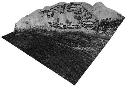
1. Uncovering lost cities
LiDAR reveals lost cities in the ground by uncovering subtle linear elevations in the ground. As you’ve learned in our guide to LiDAR, this technology peers through the forest.
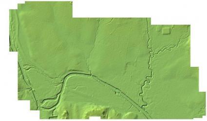
Its biggest strength is that it’s a “sampling tool”. LiDAR sends over 160,000 pulses per second from the air to the ground.
It is this dense point cloud that enables us to see archaeological artifacts. Otherwise, forests would cover them hiding them from the human eye.
2. Scanning buildings and bridges for quality control
A building scan with LiDAR makes it possible to ensure construction matches with Building Information Modeling (BIM).
Aligning the point cloud from a terrestrial scan with a BIM design ensures construction quality and is on schedule.
The biggest advantage is how real-time scanning can detect defects early in the project. Otherwise, it would be lost time and money to redo any faulty construction.
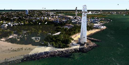
3. Exploring underwater bathymetry
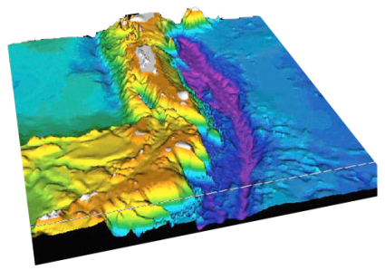
Typically, we use bathymetry soundings (or Sonar) for underwater surveys. Sonar (Sound Navigation and Ranging) emits pings of sounds and listens for an echo. Similar to LiDAR, it calculates the distance by measuring the elapsed time of the echo.
Bathymetric LiDAR is different from airborne LiDAR because it uses a green wavelength. By using this type of wavelength, underwater mapping can measure all the way to the seafloor.
Similarly, river and bathymetric surveys are capable of mapping both terrestrial and aquatic systems.
4. Farming with precision agriculture
Farmers use precision agriculture because they can reduce the amount of fertilizer applied to the field. It’s just one of many GIS applications in agriculture.
Because spraying is site-specific, it can save money on input costs. But how can farmers validate their efforts in precision farming?
By attaching LiDAR to a tractor, they can accurately measure important elements like biomass, heights, and volumes.
5. Seeing the trees from the forest
Visualizing tree structure and height in forests is an area where LiDAR really succeeds. But can LiDAR really see through the trees?
Imagine you’re standing in the middle of a forest and you look up. Can you see the sunlight? If you can see the light shining through, then LiDAR can too.
When you know the height of the tree and the height of the ground, you get a true vertical profile. But if you really want a 3D vegetation structure, terrestrial LiDAR generates realistic three-dimensional representations.
In fact, the Geoscience Laser Altimeter Systems (GLAS) was the first laser-ranging (LiDAR) instrument to map out our forests from space.
6. Driving with no hands with autonomous vehicles
Self-driving cars use 360° automotive LiDAR sensors mounted on the vehicle to gain a full perspective of its surroundings.
These LiDAR sensors emit laser pulses and measure the time it takes for them to bounce back, creating a detailed 3D map of the environment, which is essential for safe and reliable autonomous driving.
For each movement a car positions itself, it constantly scans for obstructions and safety. For example, Velodyne LiDAR is a popular model for 3D imaging in autonomous vehicles.
7. Predicting flooding before it happens
By using the bare Earth points from LiDAR, hydrologists build digital elevation models. From here, flood modelers can map out areas prone to inundation before it happens.
In this respect, LiDAR can provide an early warning system for flooding. Insurers can use this data to charge higher premiums.
This is just one of the many GIS applications in the insurance industry to assess risk accurately and efficiently.
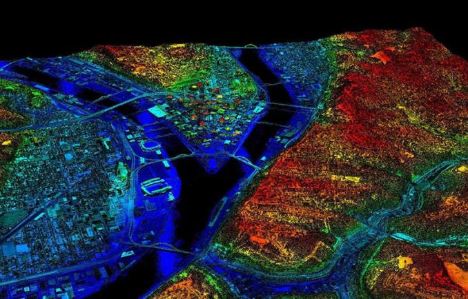
8. Determining land use
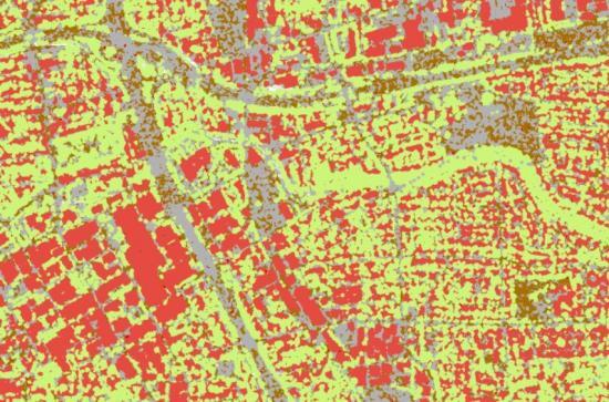
The LiDAR classification codes include ground, vegetation (low, medium, and high), buildings, overhead wires, roads, rail, and water.
If point classification falls into more than one category, vendors flag it with a secondary class.
Each code comes from the reflected laser pulse mostly in an automated way. Land cover is a staple in understanding the changing dynamics of our planet including climate change.
9. Becoming a forensics detective
In forensics, LiDAR narrows down the search for a missing or unmarked grave. Similar to archaeology, LiDAR can locate subtle terrain anomalies in the ground.
These anomalies are possible locations where the body can be found. LiDAR has also been integrated into crime scene reconstruction for scanning areas of crime or automobile accidents. Photogrammetry is pretty good at doing this too.
10. Investigating landslides and slope stability
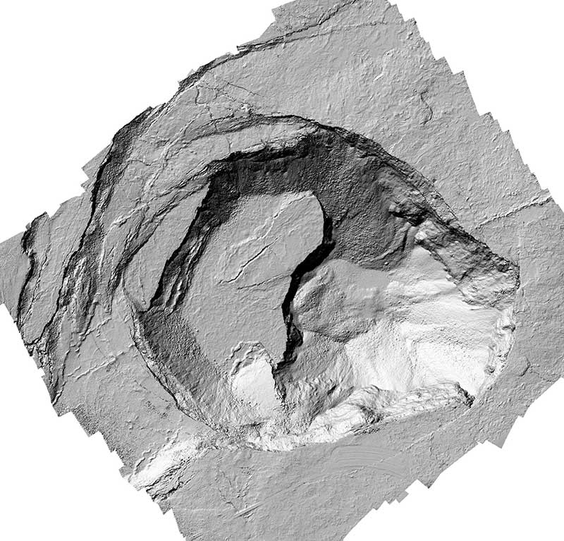
For landslides, LiDAR scans obtain a better representation of the surface in vegetated areas. From shaded relief, slope, and topographic contours, it’s possible to identify morphologic features common for landslides.
It’s in these heavily vegetated and hilly areas where topographers create landslide inventories. Overall, it can predict landslide events and better assess safety risks.
11. Measuring the atmosphere
For atmospheric studies, there are several developed techniques:
- Doppler LiDAR – Instead of Doppler Radar, this technique uses light to measure wind speeds.
- Raman LiDAR – Measuring water vapor and aerosols.
- Differential Absorption LiDAR (DIAL) – Measurements of ozone and water vapor.
For local and global environmental issues, remote sensing of the environment is trying to tackle these types of changes occurring in the atmosphere.
12. Managing assets with mobile LiDAR
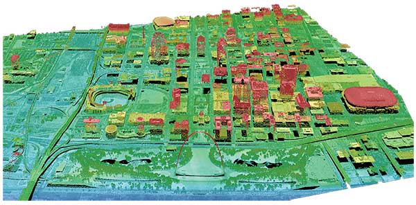
Cities are leveraging mobile LiDAR to manage assets and ensure safety standards. For example, inventories include everything from potholes, road conditions, bridge damage, utilities, billboards, and street signs.
Upon collection, scans are destined into geospatial databases. This way, they can store, analyze, and visualize each infrastructure asset – which is the primary function of a Geographic Information System (GIS).
13. Entering the cryosphere
As LiDAR widens its scope into various fields of study, measuring snow depth in the cryosphere has become an area of focus.
Because snow has significant volumetric scattering, various wavelengths of light can penetrate depths with different levels of success.
Once modeling improves for this type of LiDAR, it can be valuable in hydrology and avalanche prediction.
14. Implementing augmented reality
As LiDAR becomes more ubiquitous in smartphones, integration into gaming is now becoming a reality. Augmented reality, that is – pardon the pun.
It’s Augmented Reality that enables you to interact with the outside world by using your smartphone’s display.
LiDAR adds depth-sensing to make this possible. But this doesn’t only apply to gaming. Think about the placement of transmission towers, wind turbines, and solar panels.
15. Detecting dangerous tree encroachment
For right-of-way management, LiDAR uncovers tree encroachment which can cause a disruption in transmission line systems.
By using the dense point cloud classification of LiDAR data, it discerns between the overhead wire and medium to tall vegetation.
It can also help lower the risk of dead or dying trees falling into nearby utility lines, significantly improving safety.
More LiDAR Uses and Applications
Here are a couple more LiDAR use cases and applications:
MILITARY – The military uses airborne LiDAR to map out the battlefield terrain and build viewsheds.
MOON TOPOGRAPHY – NASA used LiDAR all the way back in 1971 to estimate heights on the lunar surface.
GEOLOGY – Geologists use it to measure and map out the variations in slope, aspect, and elevation and study landforms.
SHORELINE EROSION – Temporal studies along shorelines can quantify the amount of erosion at floodplains.
ECOLOGY – As habitats and the environment are essential to ecologists, they use this technology for land cover and vegetation structure.
MINING – The mining industry used LiDAR for monitoring the extraction process and mineral exploration.
SOILS – Soil scientists use LiDAR for surface roughness, erosion control, and soil management.
HYDROLOGY – By using the bare earth elevation, hydrologists can model flow direction and accumulation.
Summary: LiDAR Uses and Applications
As you’ve learned, LiDAR is used for more than just self-driving cars.
In fact, the technology isn’t new.
But it’s been growing so much lately that even your smartphone has a LiDAR sensor.
Have we missed any uses of LiDAR? Please let us know in our comment section below.


Can LIDAR laser scan get sensor accuracy less 2mm?
Police radar/lidar devices use this technology in a state with no datasets. Massachusetts for speeders in cars
Can the geodetic surveyor’s cost be lowered if we provide them with a lidar image?
Nice Info