Map of Serbia and Satellite Image
A map of Serbia that contains cities, towns, highways, roads, rivers, and districts. Satellite imagery and a physical map display its rugged topography like the Carpathian Mountains.
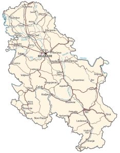
Serbia map collection
You are free to use our Serbia map for educational and commercial uses. Attribution is required. How to attribute?
About the map

Serbia is a landlocked country located in southeastern Europe. It borders several European countries. This includes Bosnia and Herzegovina, Croatia, Hungary, Romania, Bulgaria, Kosovo, North Macedonia, and Montenegro.
In the 20th century, Serbia was a part of Yugoslavia. But after World War II, the country was subdivided and it wasn’t until 2006 that Montenegro voted to secede from Serbia.
This makes Serbia one of the youngest countries in the world, finally gaining its independence as early as 2006. Currently, Belgrade is its capital and largest city.
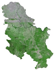
SATELLITE IMAGERY
Serbia Satellite Map
If you exclude Kosovo’s land area, Serbia occupies an area of 77,474 square kilometers (29,913 sq mi). In comparison, this makes the country similar in area to the Czech Republic. The Danube River flows 588 kilometers through the northern region of Serbia. Whereas the Morava River is a tributary of the Danube which flows through the southern mountainous region.
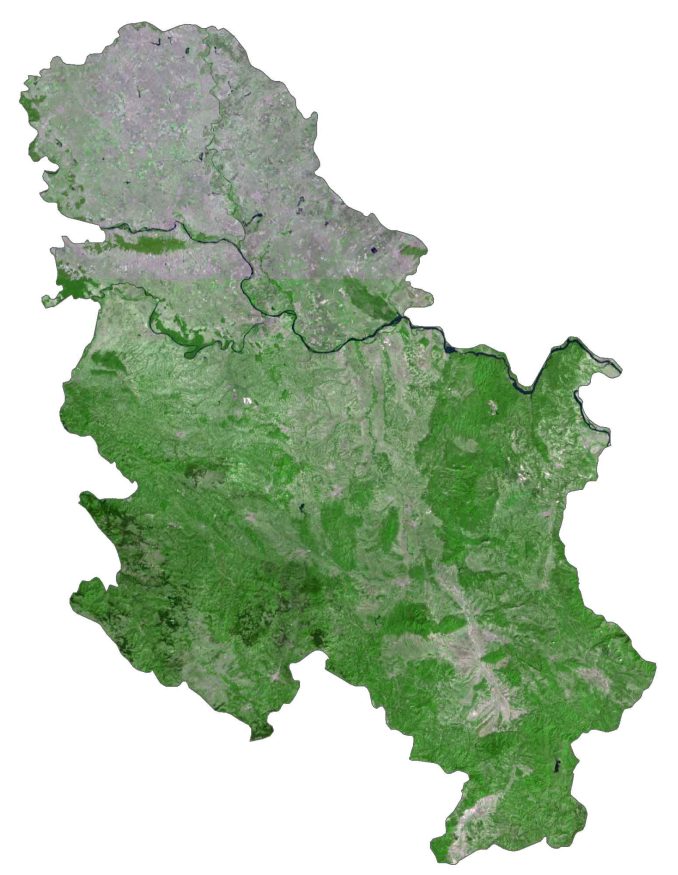
There aren’t many natural lakes in Serbia. But one prominent natural lake is Lake Palić in the north, close to Hungary. The country lies between 42°N and 46°N latitude so its climate is moderate continental with some local variation. Overall, forests cover 31% of the land area.
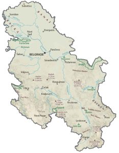
PHYSICAL MAP
Serbia Physical Map
The terrain in Serbia is a mix of plains in the north and hilly mountains in the southeast. For example, two major mountain chains are the Dinarides in the southwest and the Carpathian Mountains, which are located in the east. Additionally, both the Rhodopes and Balkan Mountains are in the southeast.
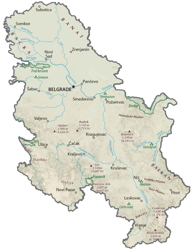
Along its border with Bulgaria, Serbia’s highest peak in the Balkan Mountains, Midžor, stands at 2,169 meters (7,116 ft) tall. Otherwise, the northern region of Vojvodina consists of low-lying, fertile plains. Specifically, the Pannonian Plain is one of the flattest parts in all of Europe, which extends to the west.
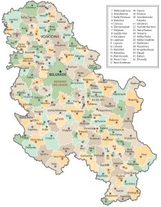
POLITICAL MAP
Serbia Districts Map
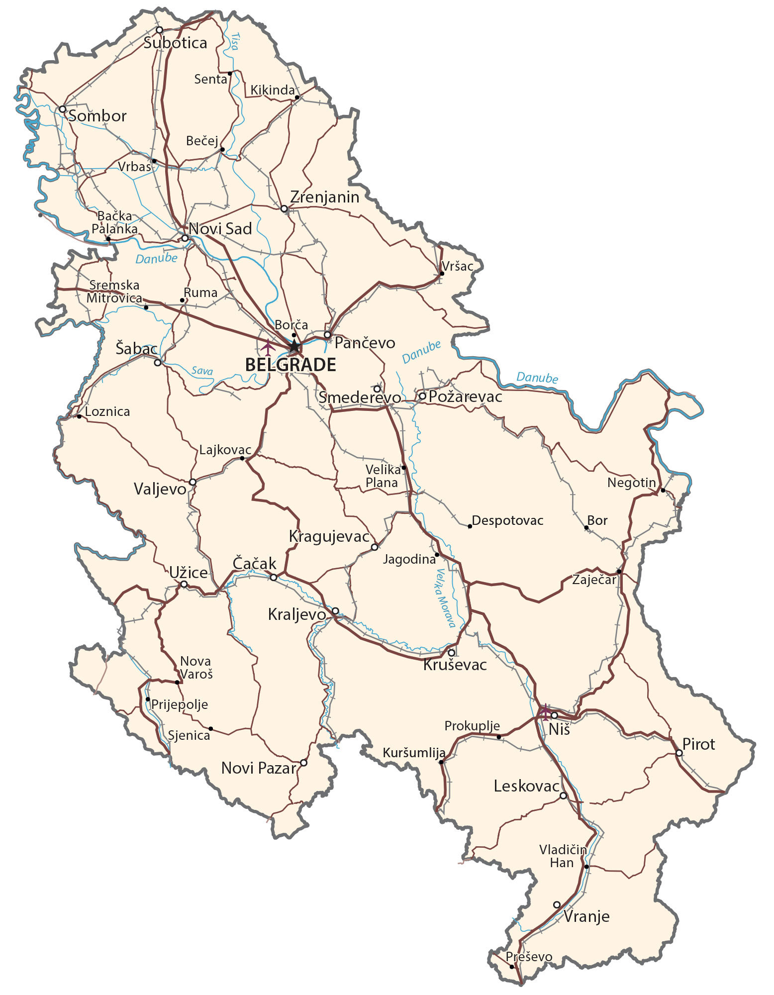
Districts or “okrugs” are the first-level administrative units in Serbia. Currently, there are 24 districts and the City of Belgrade. If you include Kosovo, then there are 29 in total. Then, Serbia can be divided into municipalities and cities, which are the second-level administrative units.

Capital City
Belgrade
Major cities and towns
Čačak
Kragujevac
Kraljevo
Kruševac
Leskovac
Niš
Novi Pazar
Novi Sad
Požarevac
Šabac
Smederevo
Sombor
Subotica
Užice
Valjevo
Zrenjanin
Cities, towns and villages
Bačka Palanka
Bečej
Bor
Borča
Despotovac
Jagodina
Kikinda
Kuršumlija
Lajkovac
Loznica
Negotin
Nova Varoš
Pančevo
Pirot
Prijepolje
Prokuplje
Ruma
Senta
Sjenica
Sremska Mitrovica
Velika Plana
Vladičin Han
Vrbas
Vranje
Vršac
Zaječar
Rivers
Danube River
Sava River
Tisa River
Velika Morava River


Thanks for this .