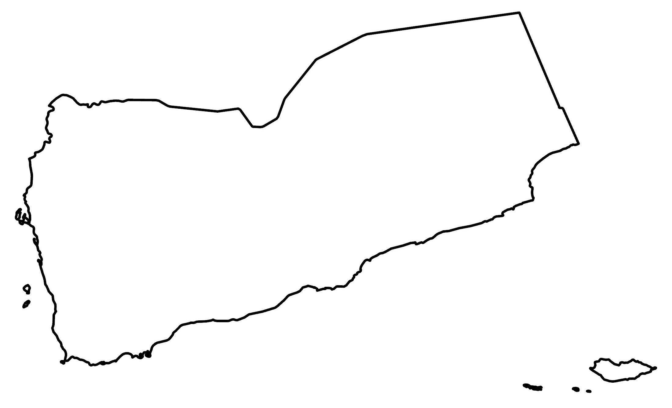
Map of Yemen
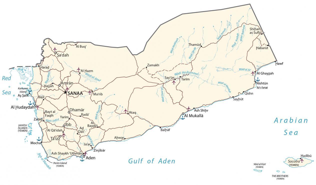
This map of Yemen contains cities, towns, highways, roads, lakes, and rivers. This Yemen map collection holds a physical map, satellite imagery, and an administrative map of Yemen.
Yemen map collection

About the map
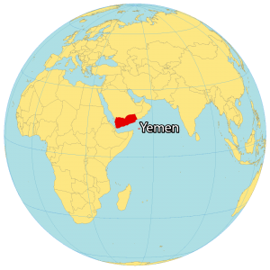
Yemen is located in the Middle East, along the Gulf of Aden to the south and the Red Sea to the west. It borders just 2 countries including Oman to the east and Saudi Arabia to the north. Yemen is known for its ancient kingdoms, large desert, and being the origin of coffee.
Sanaa is the capital and largest city of Yemen. But since 2015, Aden has been the temporary capital and is one of the world’s oldest continuously inhabited cities. Other major cities are Al Hudaydah, Ta’izz, and Mukalla.
You are free to use our Yemen map for educational and commercial uses. Attribution is required. How to attribute?
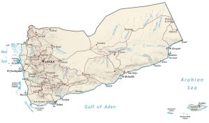
SATELLITE IMAGERY
Yemen Satellite Map
Yemen occupies a total area of 555,000 square kilometers (214,000 sq mi). Overall, it is the second-largest Arab sovereign state in the peninsula. The coastline stretches for about 2,000 kilometers (1,200 miles). Yemen is located at the southwestern tip of the Arabian Peninsula with Kuwait, Bahrain, Oman, Qatar, Saudi Arabia, and the United Arab Emirates.
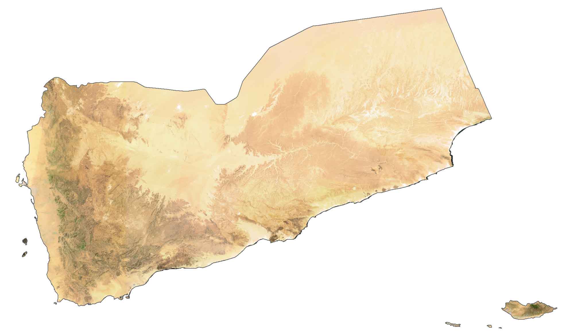
It also includes the Socotra Archipelago, which consists of four main islands in the Gulf of Aden. Additionally, it contains the Hadhramaut, which is the coastal plain area along the Red Sea. Overall, the climate in Yemen is mostly desert in the east, with extreme heat and dry conditions.
PHYSICAL MAP
Yemen Physical Map
Yemen’s terrain consists of flat-topped hills, rugged mountains, and desert plains. Although most of the Rub’ al Khali Desert is in Saudi Arabia, it accounts for the majority of the northeastern region of Yemen as well. This “empty quarter” is the largest continuous sand desert on Earth, which spans several countries in the Arabian Peninsula.
One area of high elevation is the Hadhramaut Mountains (Mahrat Mountains) which lie along the south coast near the Gulf of Aden. Its other mountain range is the Haraz-Sarawat Mountains to the west, which contains Yemen’s highest point, Jabal An-Nabi Shu’ayb (Jabal Hadhur) at a height of 3,666 meters (12,028 ft).
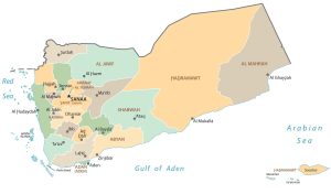
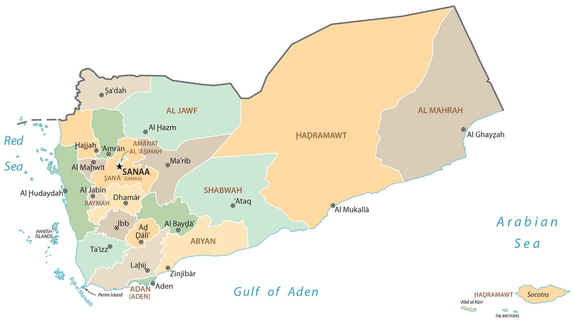
POLITICAL MAP
Yemen Governorates Map
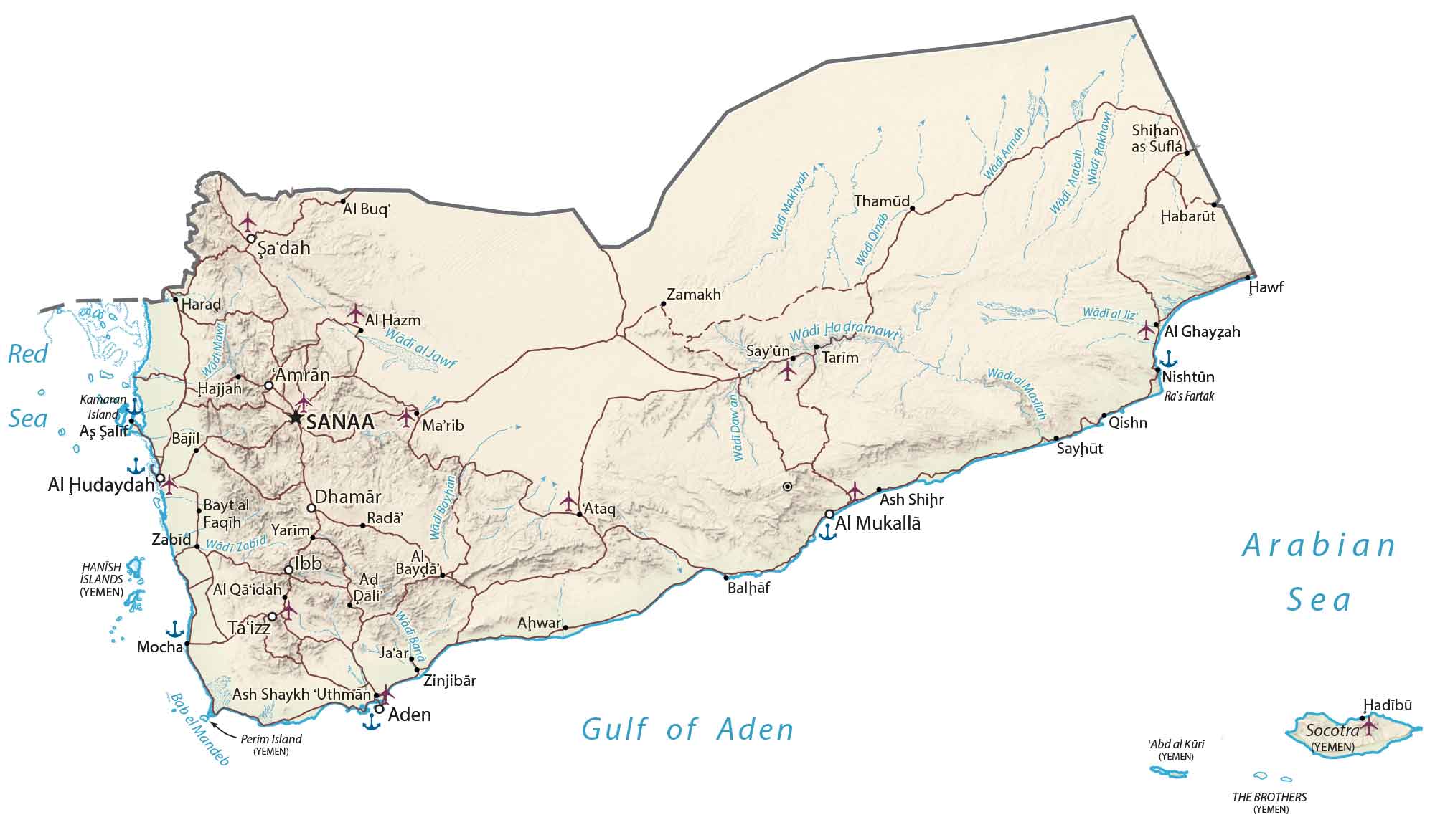
Governorates are the first-level administrative units in Yemen that are divided geographically and administratively. Currently, there are 21 governorates in Yemen. Additionally, there is also one municipality. Governorates are split up into districts, which are the second-level administrative unit in Yemen.
Capital City
Sanaa
Major cities and towns
Aden
Al Hudaydah
Al Mukallā
Ash Shihr
Dhamār
Ibb
Sayün (Seiyun)
Ta’izz
Zinjibār
Cities, towns and villages
Ad Pali
Al Buq
Al Ghayzah
Al Hazm
Al Qaidah
Amrān
As-Salif
Ash Shaykh Uthman
Ataq
Bajil
Balḥāf
Bayda
Bayt al Faqih
Hajjah
Harad
Hawf
Ja’ar
Marib
Mocha
Qishn
Radā
Sayhūt
Sa’dah
Shihan as Suflá
Tarim
Thamud
Yarim
Zabid
Zamakh
Seas, rivers and gulfs
Arabian Sea
Bab el Mandeb
Gulf of Aden
Red Sea
Wadi al Jawf
Wadi al Jiz
Wadi Armah
Wadi Ba
Wadi Daw’an
Wadi Hadramawt
Wadi Makhyah
Wadi Mawr
Wadi Qinab
Wadi Rakhawt
Wadi Zabid
Wadi Arabah
Wadi Al Masilah
Islands
Abd al Küri
Hanish Islands
Kamaran Island
Perim Island
Socotra
The Brothers