Iraq Map – Cities and Roads
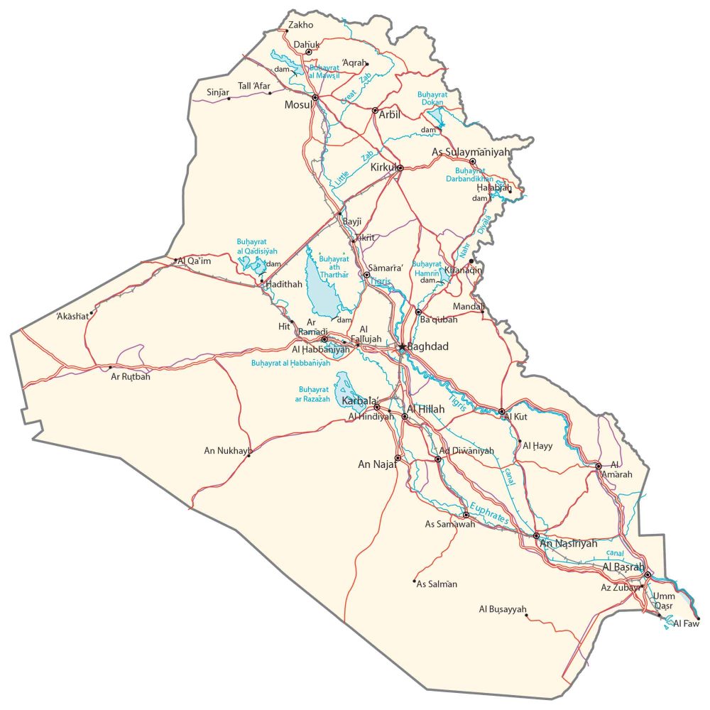
This map of Iraq displays major cities, towns, roads, lakes, and rivers. Satellite imagery and a terrain map show the Zagros mountain range and its desert-covered landscape.
Iraq map collection
You are free to use our Iraq map for educational and commercial uses. Attribution is required. How to attribute?
About the map
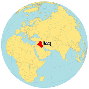
Iraq is located in the Middle East, bordering the Persian Gulf. The country of Iraq is situated between Iran to the east, and Syria to the west. It also borders Kuwait, Jordan, Turkey, and Saudi Arabia.
Iraq shares a coastline of 58 kilometers (36 mi) on the northern Persian Gulf. The people who live in Iraq are culturally diverse and it’s the fourth-highest populated in the Middle East. Baghdad is the capital and largest city of Iraq.
The region where Iraq is located is known as the Fertile Crescent. This region is important because it is where some of the world’s earliest civilizations developed. The Tigris and Euphrates rivers flow through Iraq, and these rivers were essential to the growth of these early civilizations.
SATELLITE IMAGERY
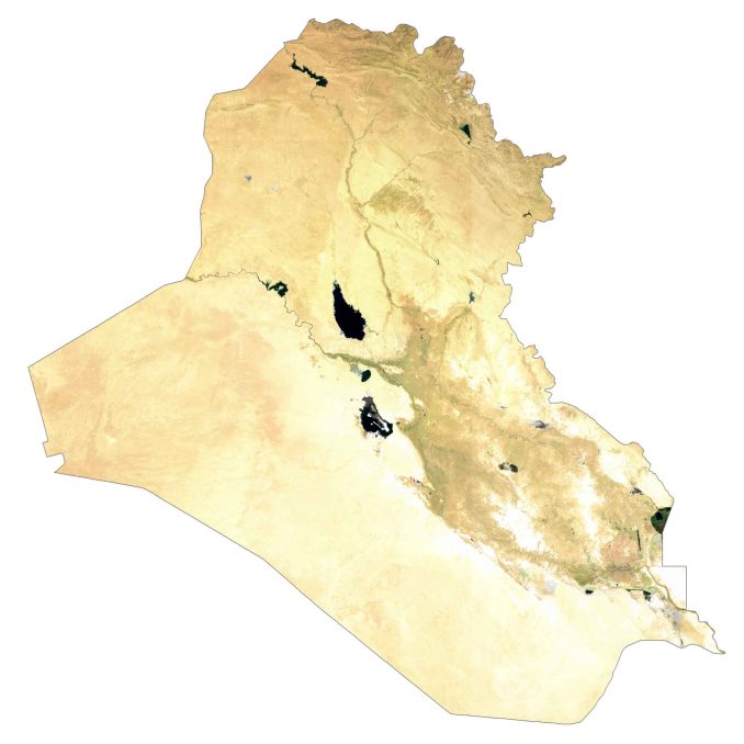
Iraq Satellite Map
Iraq occupies an area of 438,317 square kilometers (169,235 sq mi), which makes it similar in size to Morocco. Deserts cover a larger area in Iraq. For example, the Syrian Desert is a region of desert, semi-desert, and steppe within the interior of Iraq.
Whereas Mesopotamia is more of a historical region part of Iraq within the Tigris–Euphrates river system – the two longest rivers in Iraq. Lake Tharthar is an artificial lake and the largest water body in Iraq.
PHYSICAL MAP
Iraq Physical Map
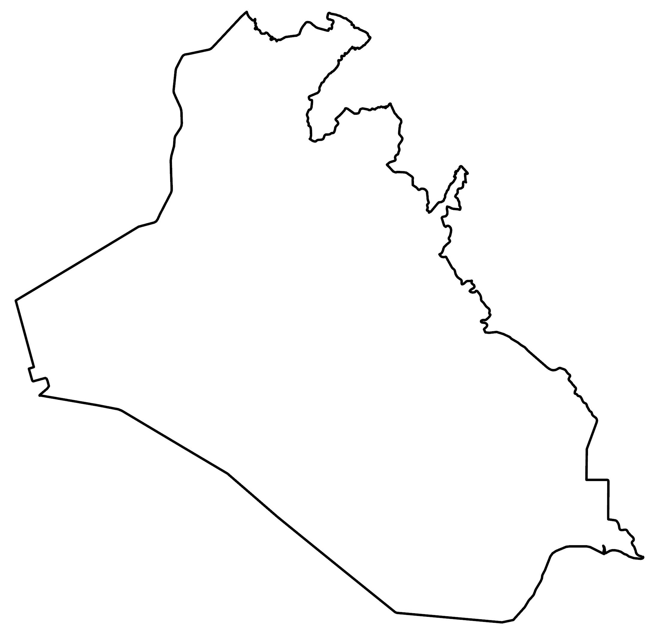
The terrain in Iraq is mostly broad plains and deserts throughout the country, making uninhabitable conditions for human settlement. Otherwise, its borders with Iran and Turkey are more rugged with the Zagros Mountains.
At 3,611 m (11,847 ft) in height, Cheekha Dar (which means “Black Tent”) is the highest point in Iraq. This mountain is located on the border with Iran in the northeast region.
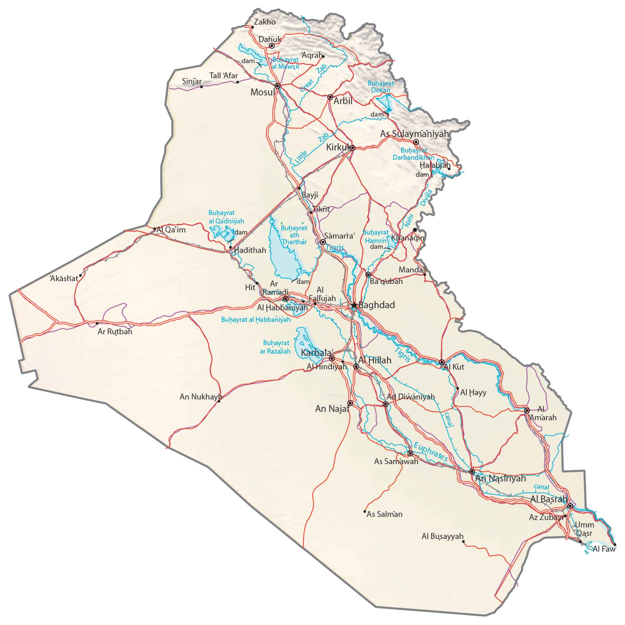
Capital City
Baghdad
Major cities
Arbil
Basrah
Karbala
Kirkuk
Mosul
Najaf
Nasiriyah
Sulaymaniyah
Cities, towns and villages
Akashat
Al Diwaniyah
Al-Busayyah
Al-Fallujah
Al-Faw
Al-Hayy
Amarah
An-Nukhayb
As-Salman
Az-Zubayr
Baqubah
Bayji
Dahuk
Hadithah
Halabjah
Hillah
Hindiyah
Hit
Kut
Mandali
Qa’im
Ramadi
Rutbah
Samarra
Samawah
Sinjar
Tall ‘Afar
Tikrit
Umm Qasr
Zakho
Lakes, rivers and creeks
Darbandikhan Lake
Diyala River
Dukan Lake
Euphrates River
Great Zab River
Habbaniyah Lake
Hamrin Lake
Little Zab River
Therthar Lake
Tigris River