Comoros Map – Islands and Roads

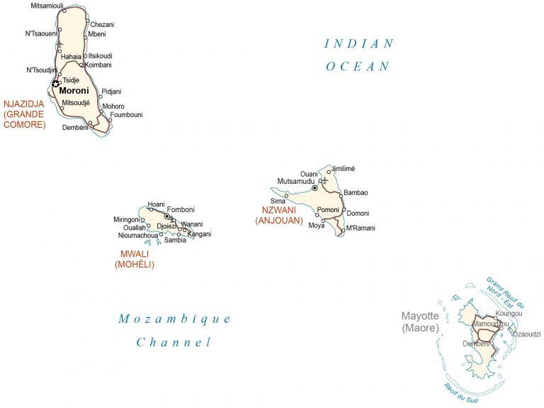
This Comoros map displays populated places, islands, airports, and roads. An elevation map and satellite imagery highlight the volcanic origin of the Comoros archipelago.
Comoros map collection
You are free to use our Comoros map for educational and commercial uses. Attribution is required. How to attribute?
About the map

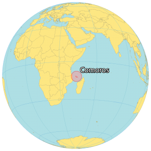
Comoros is an island country off the southeast coast of Africa in the Indian Ocean. It’s sandwiched between Madagascar to the east as well as Mozambique and Tanzania to the west. Comoros consists of various islets and three main islands – Ngazidja (Grande Comore), Ndzuani (Anjouan), and Mwali (Mohéli).
Additionally, it’s the fourth smallest African nation at only 1,861 square kilometers (719 sq mi) in size. With an estimated population of 850,000, the majority of people live in the capital city of Moroni. Otherwise, its other major cities and towns include Moutsamoudou, Fomboni, and Domoni.
SATELLITE IMAGERY
Comoros Satellite Map
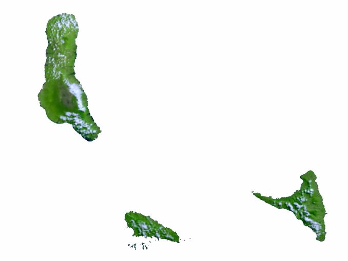
The volcanic archipelago of Comoros is situated off Africa’s east coast. It’s part of the Indian Ocean and within the Mozambique Channel. First, the largest island is the Grande Comore (Ngazidja), which is surrounded by beaches along the outer edge.

Lava once flowed from this active Mount Karthala volcano but is still active today. Next, Anjouanis (Ndzuwani) is the second-largest island and is the remnants of an old shield volcano. Finally, Mwali (Mohéli) is the smallest of the three islands and contains Mohéli Marine Park, the first protected area in Comoros.
PHYSICAL MAP
Comoros Elevation Map
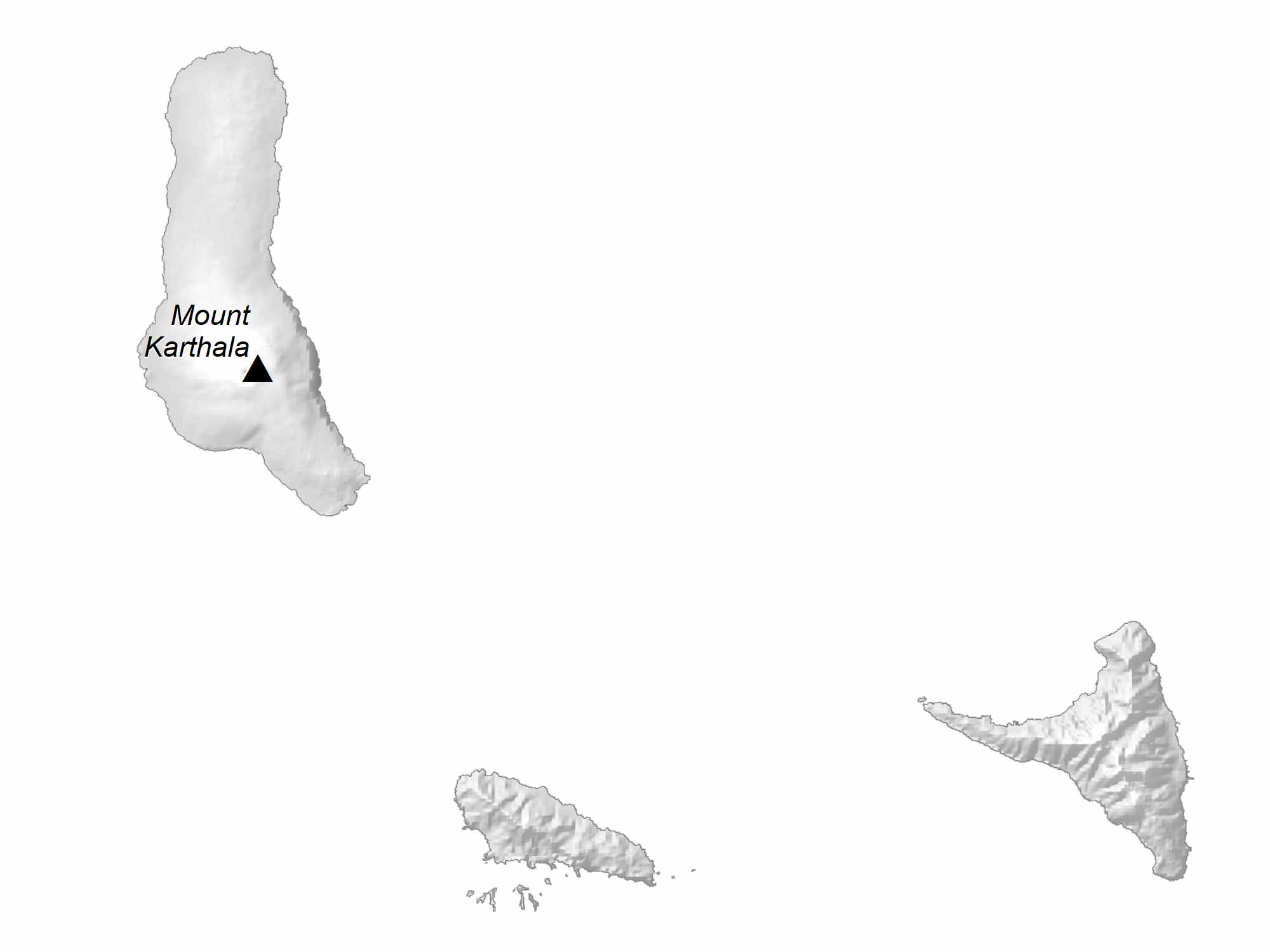
As an archipelago in the Indian Ocean, the terrain in Comoros is mountainous with steep hills. At 2,361 m (7,746 ft), its highest point is Mount Karthala. This active shield volcano is located on Ngazidja and is part of Karthala National Park.
In fact, it’s still one of the most active volcanoes in the world today. The climate is mostly tropical and mild with two distinct seasons determined by their amount of raininess.

Capital City
Moroni
Islands and archipelagos
Mayotte (Maore)
Ngazidja (Grande Comore)
Mwali (Mohéli)
Nzwani (Anjouan)
Major cities and towns
Dembéni
Fomboni
Mamoudzou
Mutsamudu
Populated places
Bambao
Chezani
Domoni
Foumbouni
Hahaia Itsikoudi
Hoani
Jimilimé
Koimbani
Mbeni
Miringonio
N’Tsoudjini
N’Tsaoueni
Nioumachoua
Ouallah Djoiez Wanani
Ouani
Pomoni
Tsidje
Reefs and water features
Indian Ocean
Mozambique Channel
Great Eastern Reef
Great Southern Reef


