Map of Montserrat with Exclusive Zone
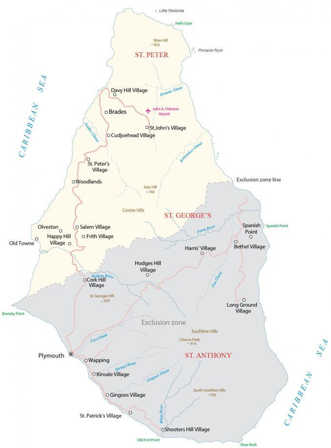
This Montserrat map displays the British Overseas Territory and island in the Caribbean Sea. It features satellite imagery, settlements, exclusive zone, islands, points, highways, roads, streams, mountains, and airports.
Montserrat map collection
You are free to use our Montserrat map for educational and commercial uses. Attribution is required. How to attribute?
About the map
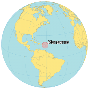
Montserrat is an island and British Overseas Territory in the Caribbean Sea. It consists of one large single island, that is split by the “exclusion zone” due to volcanic activity.
On September 22, 1997, the eruption of the Soufrière Hills volcano destroyed the southern half of the island including its roads, capital city, and airport. As a result, more than half of the Montserrat people abandoned the island.
Montserrat occupies a total area of 102 square kilometers (39 sq mi). In comparison, it’s larger than Anguilla but smaller than the British Virgin Islands. Montserrat includes several small off-shore islands, like Little Redonda to the north and Pinnacle Rock and Statue Rock to the east.
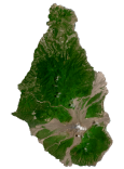
SATELLITE IMAGERY
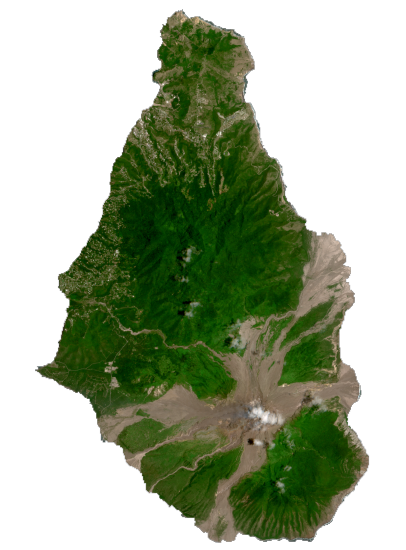
Montserrat Satellite Map
The island measures approximately 16 kilometers (10 mi) in length and 11 kilometers (7 mi) in width, with approximately 40 km (25 mi) of coastline. It’s part of the Leeward Islands, within the Lesser Antilles and West Indies. Overall, the interior is mountainous with its major mountain ranges Silver Hill and Katy Hill within the Center Hills Range. At 1,050 meters (3,440 ft), Soufrière Hills volcano is the highest peak on the island in the south of Montserrat Island.
Capital City
Plymouth
Parishes
St. Anthony
St. George’s
St. Peter
Populated places
Bethel Village
Brades
Cork Hill Village
Cudjoehead Village
Davy Hill Village
Frith Village
Gingoes Village
Happy Hill Village
Harris’ Village
Hodges Hill Village
Kinsale Village
Long Ground Village
Old Towne
Olveston
Salem Village
Shooters Hill Village
St. Georges Hill
St. John’s Village
St. Patrick’s Village
St. Peter’s Village
Wapping
Woodlands
Places of interest
Exclusion Zone Line
Hell’s Gate
John A. Osborne Airport
Shoe Rock
Lakes, rivers and creeks
Belham River
Bottomless Ghaut
Brimms Ghaut
Caribbean Sea
Farm River
Fort Ghaut
Gingoes Ghaut
Pea Ghaut
Soldier Ghaut
Spring Ghaut
White River
Points
Bransby Point
Old Fort Point
Spanish Point
Islands
Little Redonda
Pinnacle Rock
Landforms and geography
Centre Hills
Chance Peak
Katy Hill
Silver Hill
Soufrière Hills
South Soufrière Hills
Caribbean


