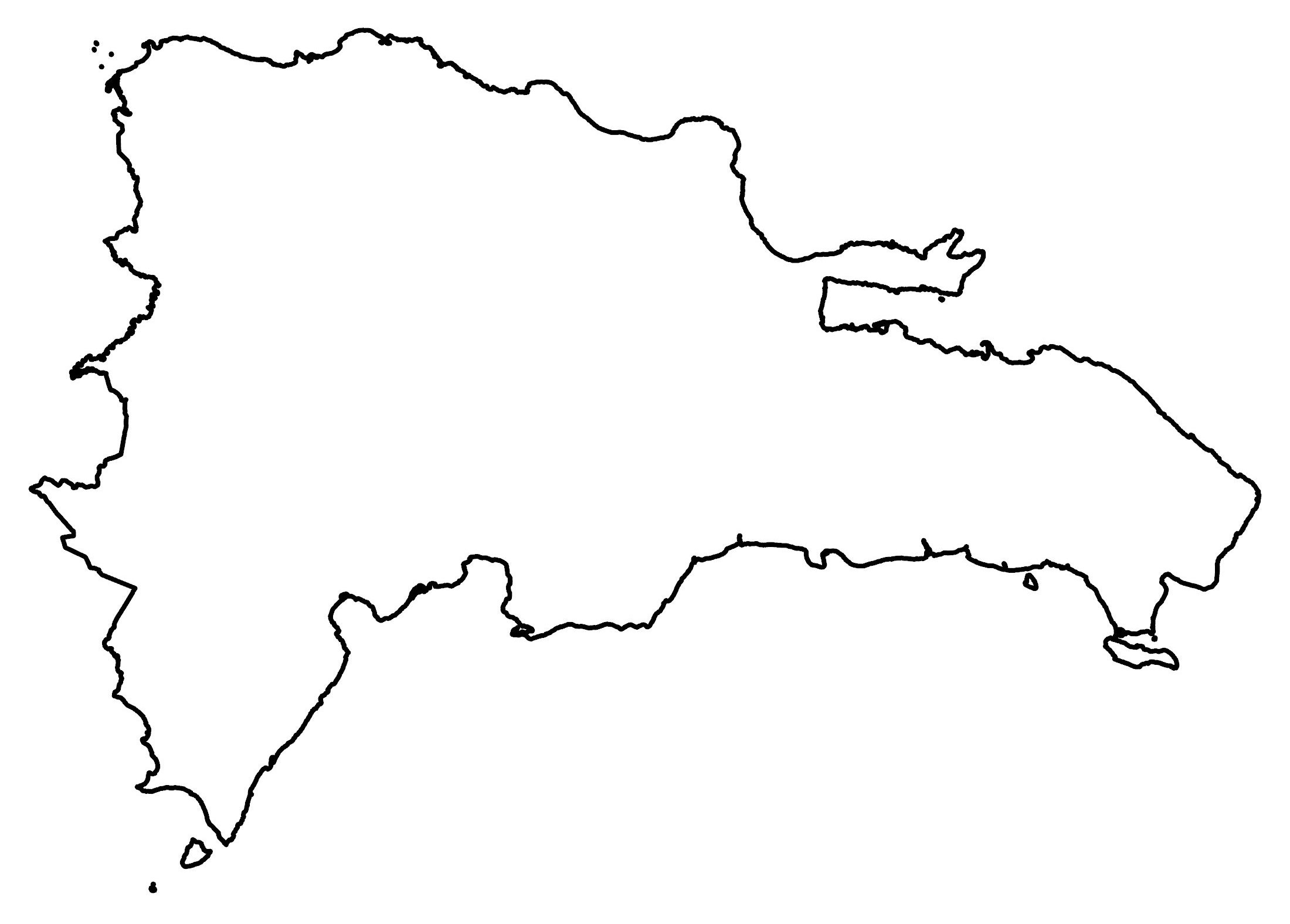
Map of Dominican Republic
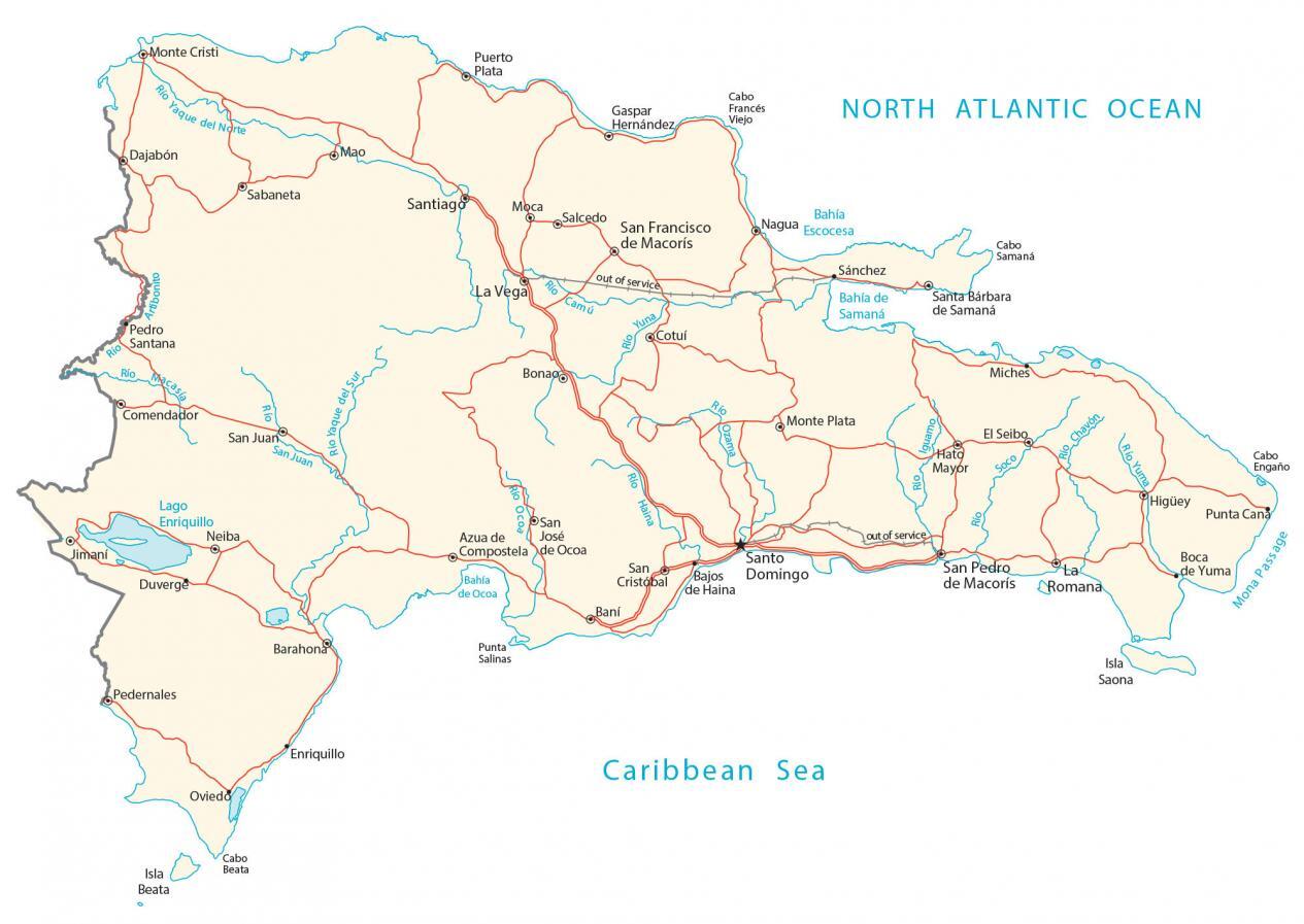
This map of the Dominican Republic features a reference map, satellite imagery, and a physical map. It includes everything from cities, and highways, to lakes and rivers.
Dominican Republic map collection
You are free to use our Dominican Republic map for educational and commercial uses. Attribution is required. How to attribute?
About the map
The Dominican Republic is an island located in the Caribbean within the Greater Antilles archipelago. It’s situated on Hispaniola Island, next to Haiti to the west. Also, it’s close to Puerto Rico to the east and is just 133 kilometers (83 mi) away. Whereas the Bahamas are to the northwest, and Venezuela is to the south.
Altogether, the country occupies an area of 48,671 square kilometers (18,792 sq mi) which is slightly smaller than Costa Rica. In comparison to Haiti to the west, the Dominican Republic makes up about two-thirds of the landmass. Santo Domingo is the capital and largest city, located along the southern coastline.
SATELLITE IMAGERY
Dominican Republic Satellite Map
The Dominican Republic is an island located in the Caribbean within the Greater Antilles archipelago. It’s situated on Hispaniola Island, next to Haiti to the west. Also, it’s close to Puerto Rico to the east and is just 133 kilometers (83 mi) away. Whereas the Bahamas are to the northwest, and Venezuela is to the south.
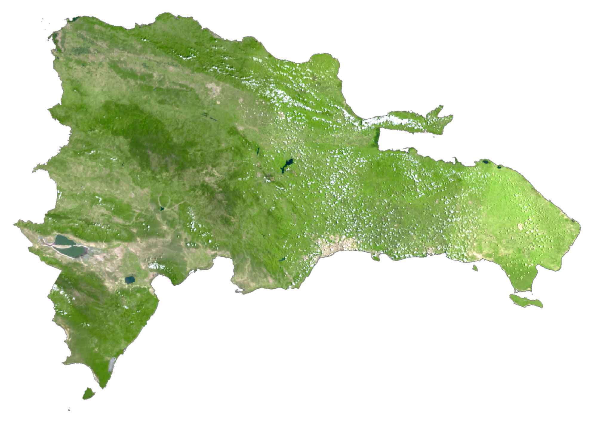
Altogether, the country occupies an area of 48,671 square kilometers (18,792 sq mi) which is slightly smaller than Costa Rica. In comparison to Haiti to the west, the Dominican Republic makes up about two-thirds of the landmass. Santo Domingo is the capital and largest city, located along the southern coastline.
PHYSICAL MAP
Dominican Republic Physical Map
The Dominican Republic has a diverse terrain with not only the highest mountain peak in the Caribbean but also the lowest point as well. At 3,098 m (10,164 ft), Pico Duarte is its highest point, which lies in the Central Cordillera.
Whereas Lake Enriquillo in the west is the country’s lowest point. At 47 square kilometers, it is the largest body of fresh water in the country. Its other major mountain chain is the Bahoruco Mountain Range, located in the southwest.
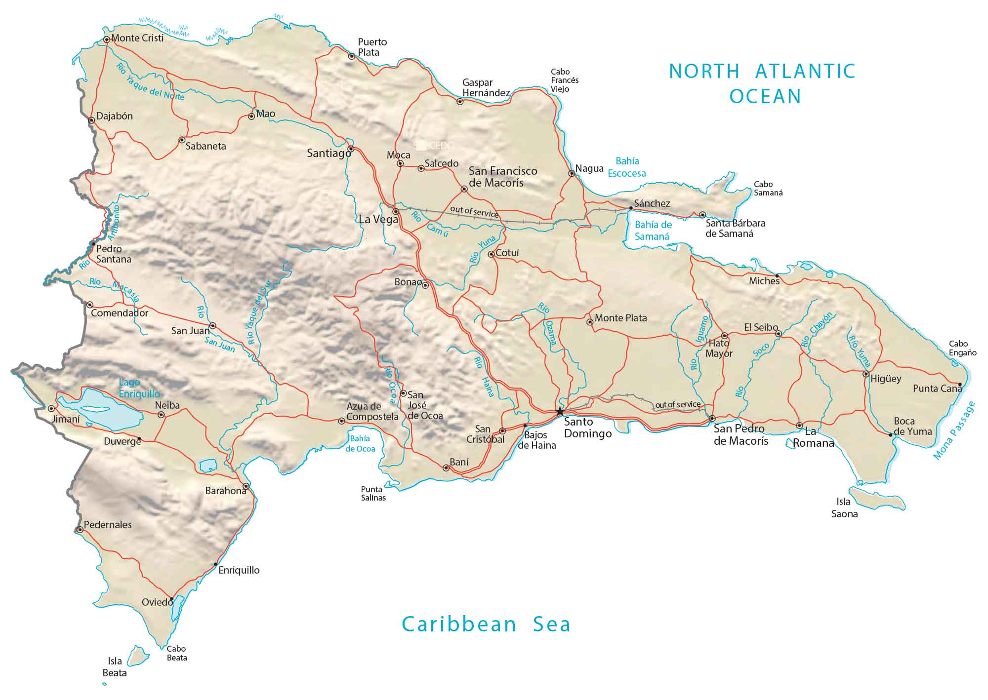
Capital City
Santo Domingo
Major cities and towns
La Romana
La Vega
Puerto Plata
Santiago
San Cristóbal
San Francisco de Macorís
San Juan
San Pedro de Macorís
Cities, towns and villages
Azua de Compostela
Bahía
Bahía de Samaná
Bahia Escocesa
Baní
Barahona
Bajos de Haina
Boca de Yuma
Bonao
Cotuí
Dajabón
Comendador
Duverge
El Seibo
Gaspar Hernández
Hato Mayor
Higüey
Jimaní
Mao
Miches
Monte Cristi
Monte Plata
Nagua
Neiba
Oviedo
Pedernales
Pedro Santana
Punta Cana
Sabaneta
Salcedo
Sánchez
Santa Bárbara de Samaná
Lakes, rivers and water
Chavón River
Lake Enriquillo
Halna River
Iguamo River
Ocoa River
Ozama River
Camu River
Yaque del Norte River
San Juan River
Soco River
Yuna River
Caribbean Sea
Mona Passage
Yuma River
North Atlantic Ocean
Islands and points
Isla Beata
Isla Saona
Punta Salinas
Cabo Engaño
Cabo Francés Viejo
Cabo Samaná
Caribbean


Where is Sosua? It is the most popular city in the country. It has a larger GDP than the majority of the cities you listed. You intentionally left it out, thereby misleading your readers. You should be ashamed!
I agree
Best anywhere!