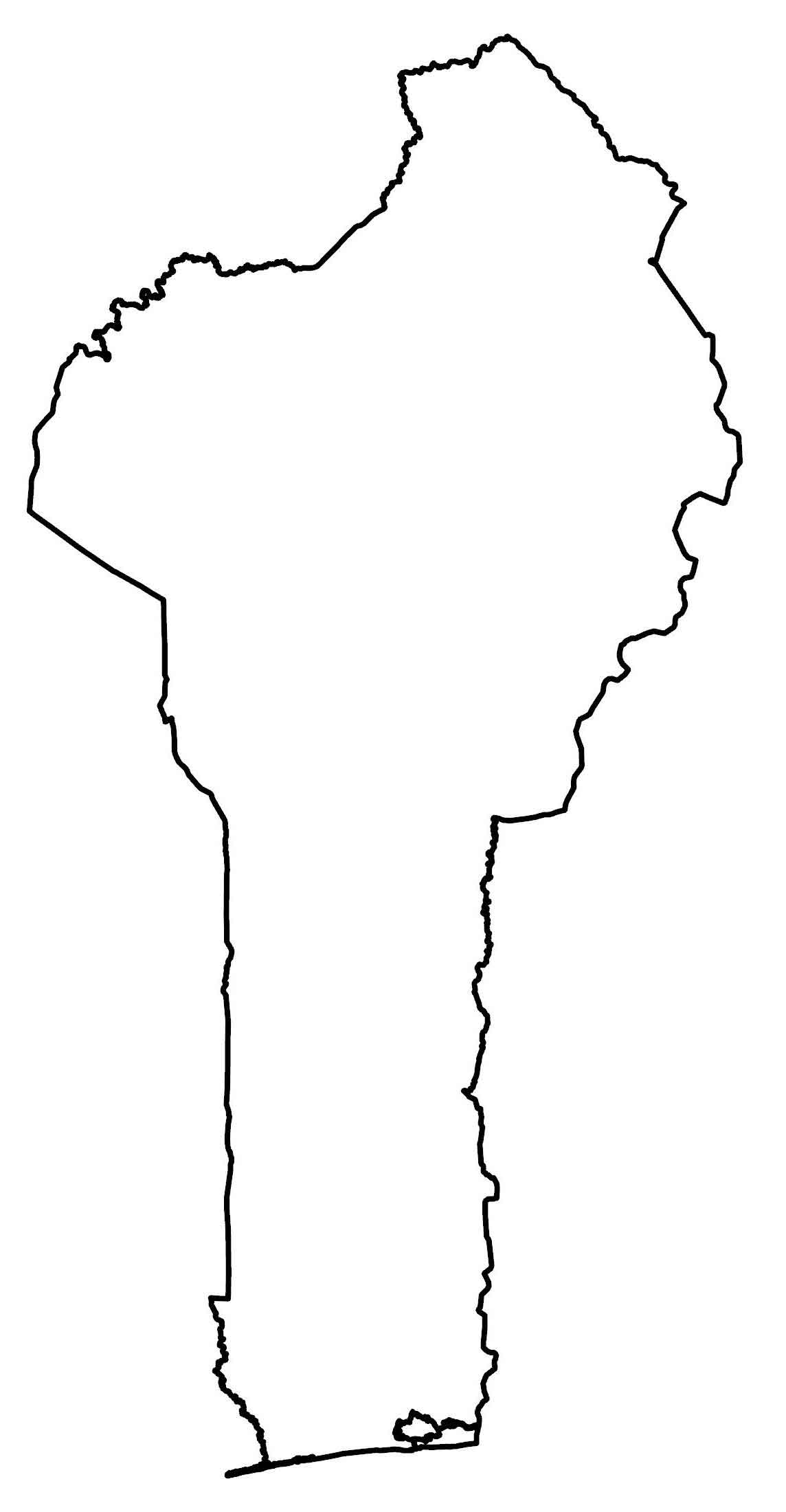
Benin Map
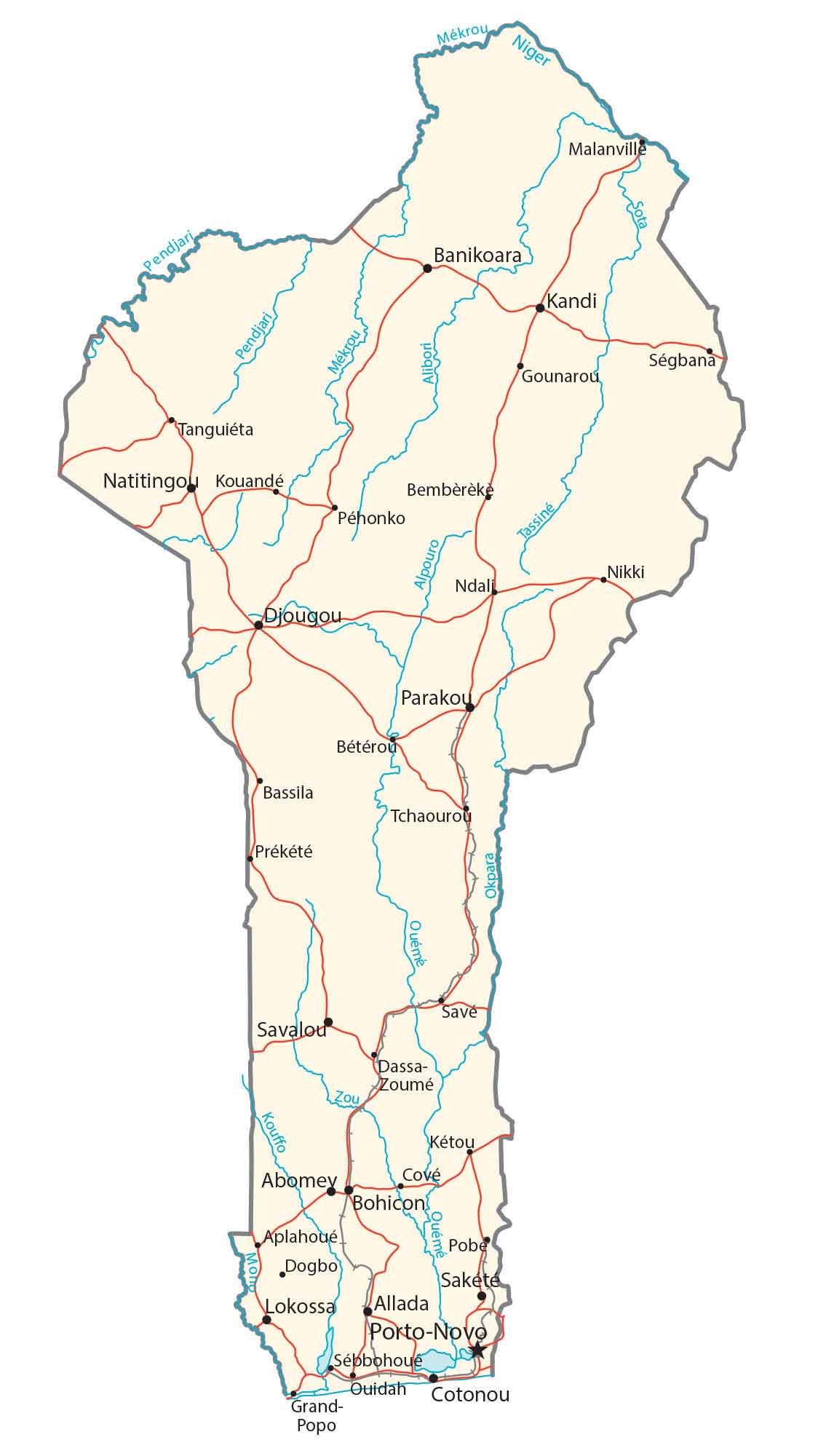
This map of Benin displays major cities, towns, roads, and rivers. It includes a satellite and physical map to view its forests and topography. Finally, a department map shows its administrative units.

You are free to use our Benin map for educational and commercial uses. Attribution is required. How to attribute?
About the map
Benin is located in Western Africa, along the Gulf of Guinea to the south. It borders just 4 other African countries including Nigeria to the east, Togo to the west, Burkina Faso to the northwest, and Niger to the northeast.
The Bight of Benin is home to several large cities. This includes Cotonou, the largest city in Benin and the seat of government. But Porto-Novo is Benin’s capital, also in the southern region of Benin.
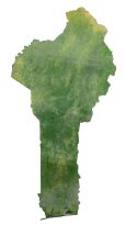
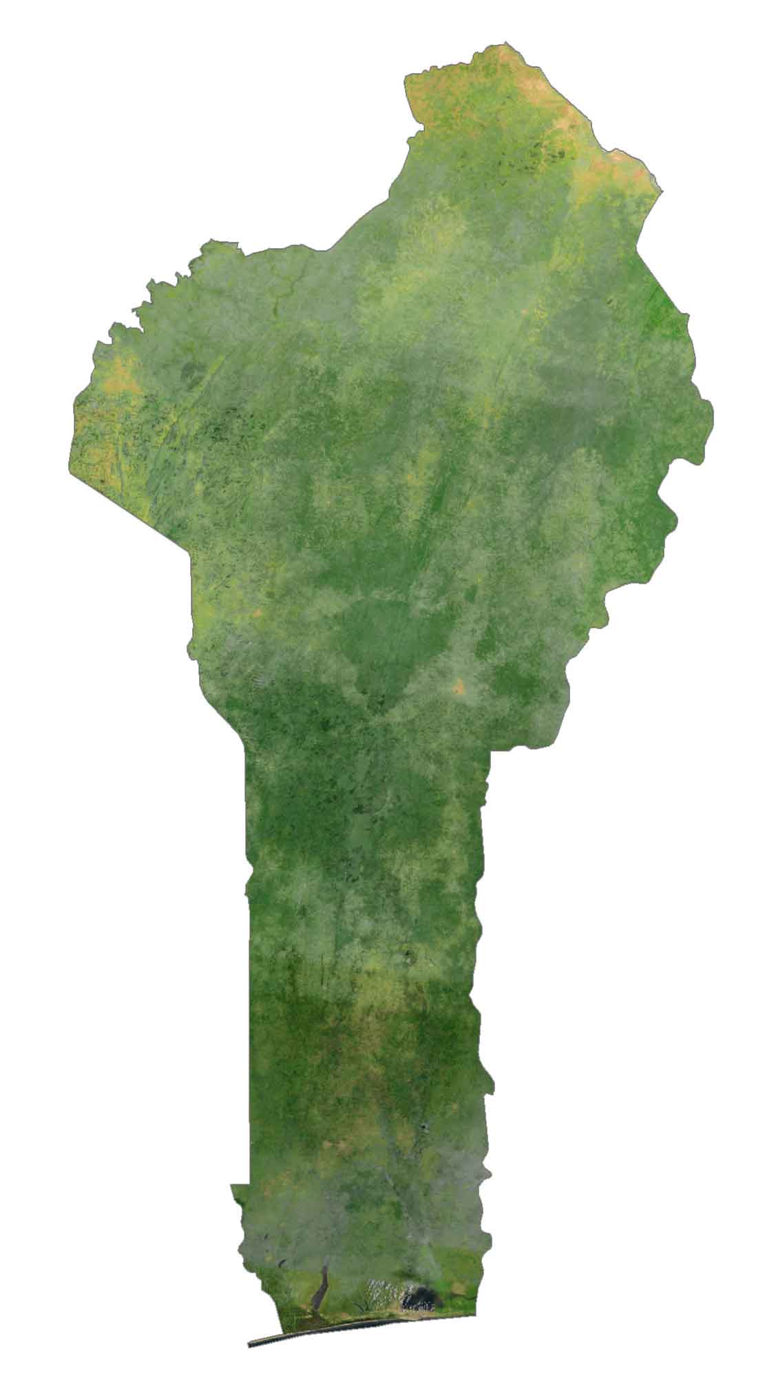
SATELLITE IMAGERY
Benin Satellite Map
The country of Benin occupies an area of 114,763 square kilometers (44,310 sq mi), which makes it one of the smallest countries in Africa. Benin is elongated in the north-south direction, slightly bulging in the northern region. Benin is located just above the equator between 6° and 13°N latitudes.
Unlike its neighbors to the north, the Sahara Desert does not extend as far as Benin. Instead, land types that are characteristic of Benin include savannah, fallow, mangroves, and remnant forests. Although deforestation is ongoing in Benin, forests cover a bit more than an estimated 40% of Benin.
PHYSICAL MAP
Benin Physical Map
The country of Benin is primarily flat with some undulating plains and rolling hills. Its highest point is Mont Sokbaro which reaches 658 meters (2,159 ft) in height. This hill is situated in the western region of the country next to Togo.
Some of its highest geographic regions are the plateaus of southern Benin, which reach a height of 20 to 200 m (66 to 656 ft). Finally, the Altacora Range extends from Ghana in the northeast direction towards Benin.
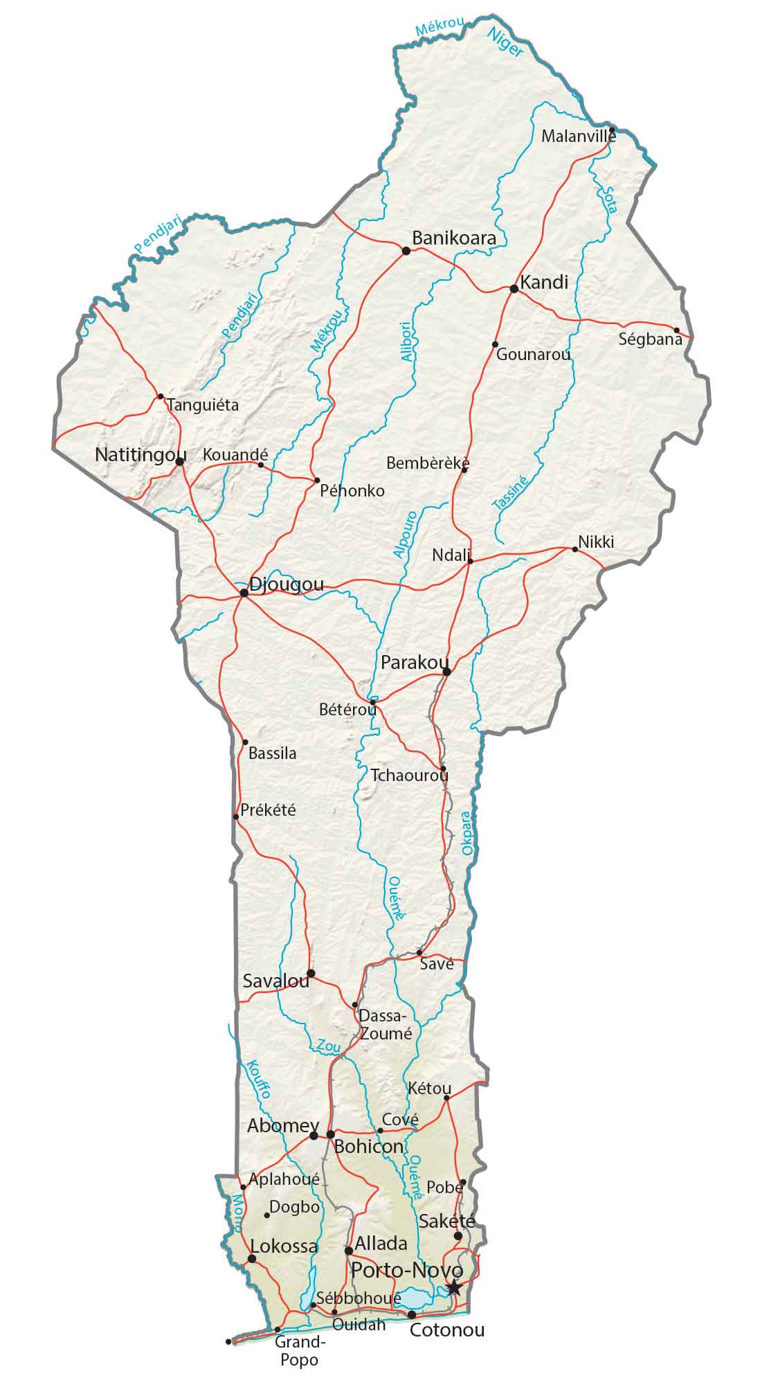
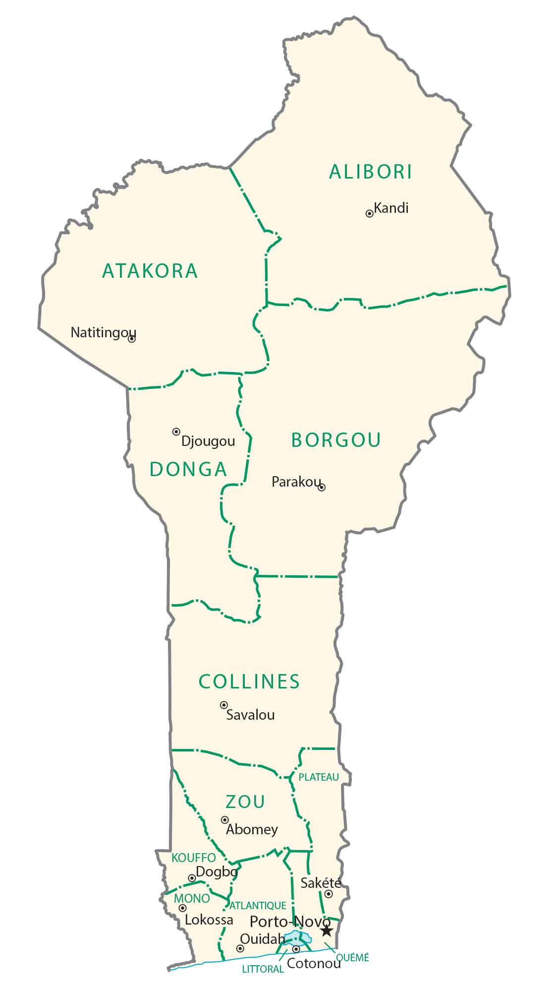
POLITICAL MAP
Benin Departments Map
Benin divides its administrative units into 12. Then, it subdivides departments further into communes. In 1999, Benin split its previous six departments. In turn, this doubled its count of departments and currently, Benin has 12 departments in total. Its largest city Cotonou is part of the Littoral, which is the smallest department in size.
Capital City
Porto-Novo
Major cities and towns
Djougou
Natitingo
Banikoara
Kandi
Parakou
Savalou
Abomey
Bohicon
Sakete
Lokossa
Allada
Cotonou
Cities, towns and villages
Tanguieta
Kouande
Pehonko
Bassila
Beterou
Grand-Popo
Malanville
Bembereke
Ndali
Tchaourou
Prekete
Dassa-Zoume
Ketou
Aplahoue
Dogbo
Pobe
Sebbohoue
Ouidah
Rivers and creeks
Pendjari River
Mekrou River
Sota River
Niger River
Zou River
Okpara River


