Map of Western Sahara
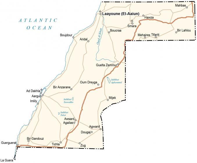
This Western Sahara map shows the disputed region in Northwest Africa. It includes a reference map, satellite imagery, and an elevation map of the Western Sahara.
Western Sahara map collection
About the map
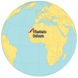
Western Sahara is a disputed territory along the northwest coast of Africa. While Morocco administers about 80% of the region, the partially-recognized Sahrawi Arab Democratic Republic administers the remaining one-fifth of Western Sahara.
The claimed capital is the largest city in Western Sahara, El Aaiún. But Tifariti is the temporary (de facto) capital close to its border with Mauritania. Altogether, it borders 3 nations including Morocco to the north, Algeria to the east, and Mauritania to the south.
You are free to use our Western Sahara map for educational and commercial uses. Attribution is required. How to attribute?
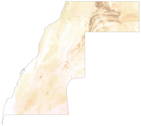
SATELLITE IMAGERY
Western Sahara Satellite Map
Altogether, Western Sahara occupies a total area of 266,000 square kilometers (103,000 sq mi). In comparison, this is approximately equivalent to Gabon. Because the region is mostly blanketed by the largest desert in the world, the Sahara Desert, it’s sparsely populated.
But it’s estimated that nearly 40% live in Laayoune, the largest city in Western Sahara. Although there are several wadis and intermittent streams, water is a scarce resource in Western Sahara.
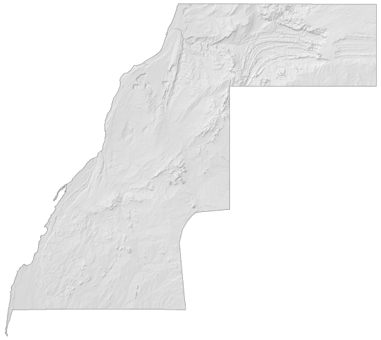
PHYSICAL MAP
Western Sahara Elevation Map
Western Sahara is one of the most inhospitable nations on Earth. It has a hot desert climate with an annual average rainfall of below 50 millimeters. The land cannot support Agriculture because its arable land is below a fraction of 1%. Its west coast is mostly low and flat desert.
But its terrain rises to the south and northeast with hills and low mountains. At 701 meters (2,300 ft), an unnamed point is the highest peak in Western Sahara. Whereas its lowest point is Sebjet Tah at −55 meters (−180 ft), which is a depression straddling the Morocco border.
Capital City
Laayoune (El-Aaiun)
Major cities and towns
Ad Dakhla
Boujdour
Smara
Cities, towns and villages
Agailaso
Agwanit
Aridal
Awsardo
Bir Anzarane
Bir Gandouz
Bir Lahlou
Boucraa
Dougajo
Guelta Zemmur
Guerguerat
Hawza
Imlily
Mahbas
Mehaires
Mijek
Oum Dreyga
Tichla
Tifariti
Zug
Lakes, rivers and water features
Atlantic Ocean
Oued Al Khatt
Subkhat Aghzoumal
Subkhat Tanwakka
Subkhat Tidsit


