Sierra Leone Map

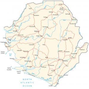
This Sierra Leone map collection contains a reference map, satellite imagery, and a physical map. Each map of Sierra Leone displays cities, towns, islands, rivers, highways, roads, and airports.
Sierra Leone map collection
You are free to use our Sierra Leone map for educational and commercial uses. Attribution is required. How to attribute?
About the map
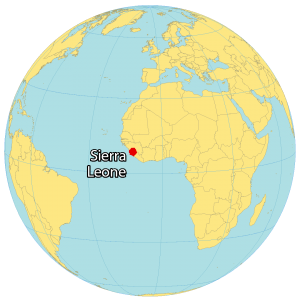
Sierra Leone is located in western Africa next to the Atlantic Ocean. It borders just 2 other African countries. First, Guinea surrounds Sierra Leone to the north and east. Secondly, Liberia is situated southwest of Sierra Leone.
Its coastline extends for 506 km along the North Atlantic Ocean with several islands like the Turtle Islands, Banana Islands, and Sherbro Island. Freetown is the capital and largest city of Sierra Leone. Other major cities in Sierra Leone are Bo, Kenema, and Koidu.
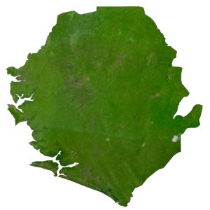
SATELLITE IMAGERY
Sierra Leone Satellite Map
From savannah to rainforests, Sierra Leone has a diverse mix of landscapes. One of the major characteristics of Sierra Leone is its rainfall. Overall, it’s one of the wettest countries in Western Africa, specifically along the coastal regions. But on the other hand, Sierra Leone also receives sand and dust storms from the blowing Sahara wind.
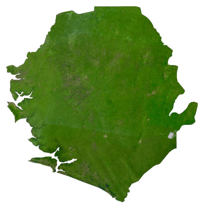
The country occupies a total area of 71,740 square kilometers (27,699 sq mi). In comparison, it’s larger than Togo but smaller than Benin. It lies between latitudes 7° and 10°N so the climate is tropical with a distinct rainy and dry season.
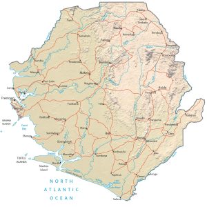
PHYSICAL MAP
Sierra Leone Elevation Map
There are four distinct geographical regions in Sierra Leone. First, the east of Sierra Leone has high mountains and plateaus. This region contains its highest peak, Mount Bintumani, which stands at 1,948 meters (6,391 ft).

The interior of Sierra Leone is mostly lowlands with forests and cultivated farmland. Whereas the north is part of the Guinean forest-savanna mosaic, which is a World Wildlife Fund ecoregion. Finally, the Atlantic Ocean coastal area has everything from mangroves, swampland to relaxed sandy beaches and the Sierra Leone Harbor.
Capital City
Freetown
Major cities and towns
Bo
Kabala
Kenema
Makeni
Cities, towns and villages
Bendugu
Blama
Boajibu
Bonthe
Bumbuna
Daru
Falaba
Fadugu
Gbangbatok
Gberia Timbako
Joru
Kambia
Kamakwie
Kamaron
Koinadugu
Koidu
Kurubonla
Kypr
Lungi
Lunsar
Magburaka
Mange
Mano
Momaligi
Moro
Moyamba
Panguma
Pendembu
Pendemb
Pujehun
Rotifunk
Sembehun
Sherbro
Shenge
Sumbuya
Waanje
Yana
Yele
Yengema
Yonibana
Zimmi
Lakes, rivers and bays
Bafi River
Bagbe River
Bagru River
Great Scarcies River
Jong River
Kittam River
Lake Mabesi
Lake Mape
Little Scarcies River
Meli River
Moa River
Mongo River
Morro River
Pampana River
Rokel River
Scarcies River
Sewa River
Sherbro River
Waanje River
Yawri Bay
Islands
Banana Islands
Sherbro Island
Turners Peninsula
Turtle Islands


