Somalia Map – Cities and Roads
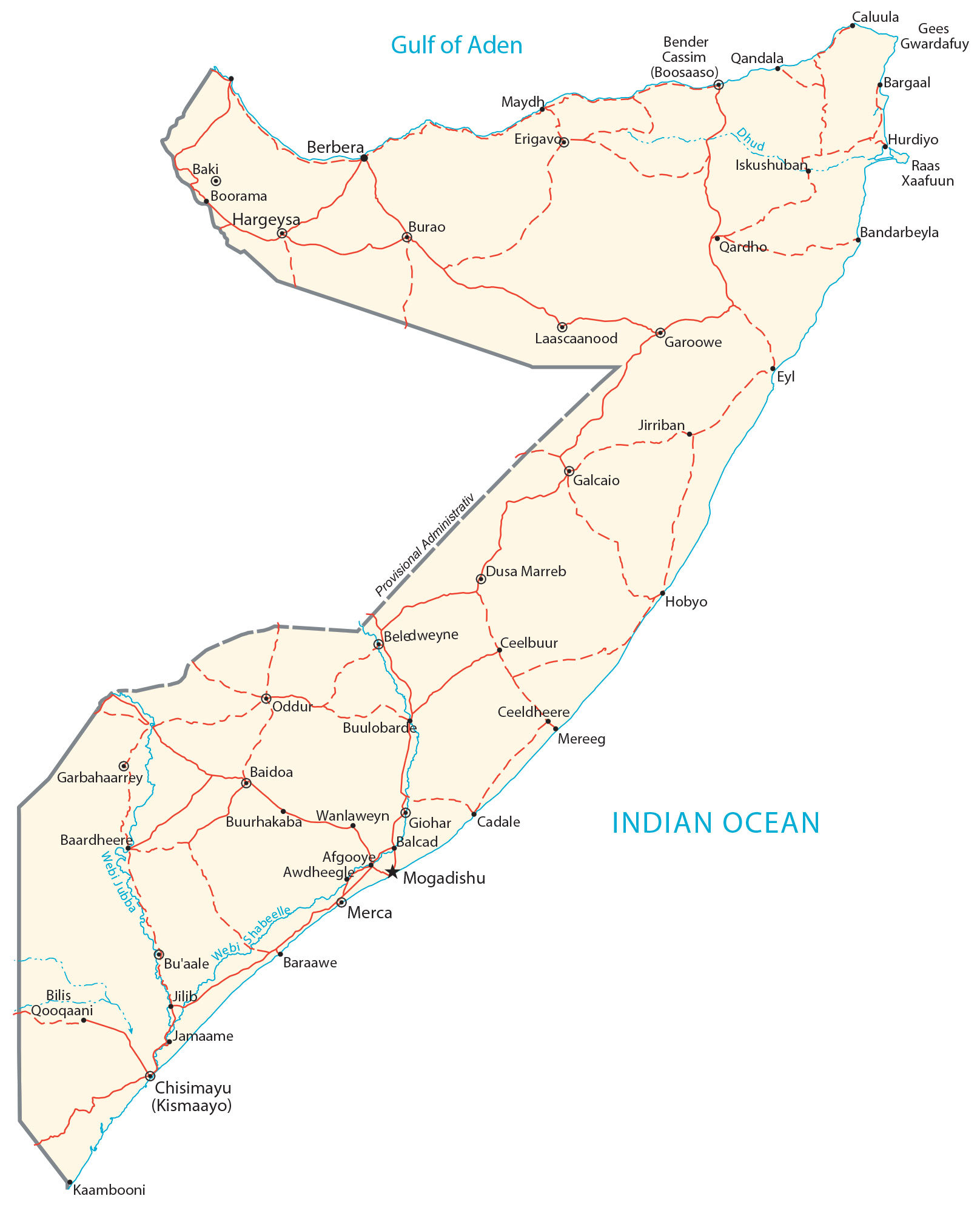
This map of Somalia displays major cities, towns, rivers, lakes, and roads. Satellite imagery and a terrain map reveal everything from the Ogo Mountains in the north to its central plains.
Somalia map collection

You are free to use our Somalia map for educational and commercial uses. Attribution is required. How to attribute?
About the map
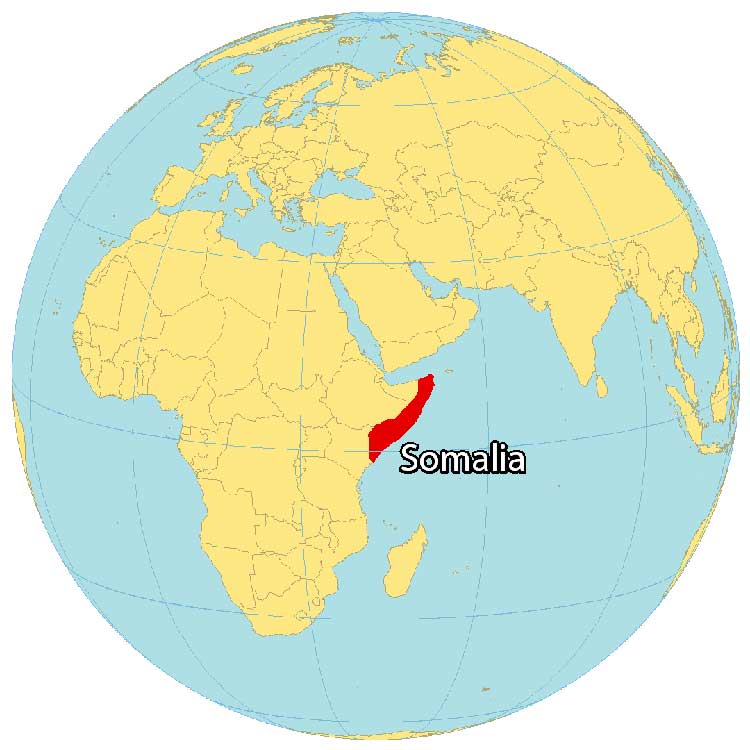
Somalia is in Eastern Africa within the Horn of Africa region. It borders 3 African countries including Kenya to the southwest, Ethiopia to the west, and Djibouti to the northwest. Somalia has the longest coastline of any other country in mainland Africa.
It measures a distance of 3,333 kilometers (2071 mi) along the Gulf of Aden and the Indian Ocean. Mogadishu is the capital and largest city. Other major cities are Beledweyne, Marka, and Jamaame. Overall, the shape of the country resembles the number “7”.
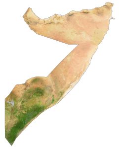
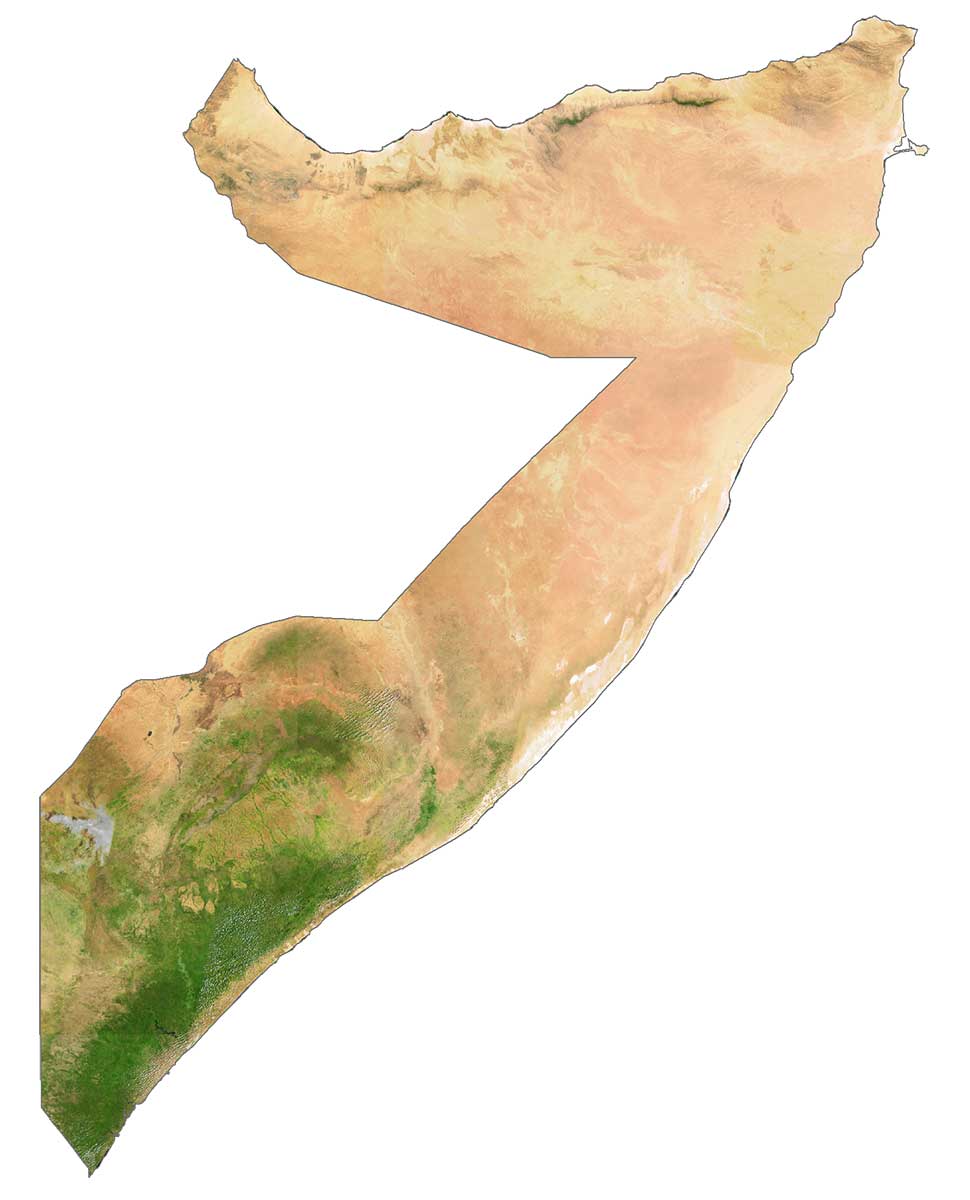
SATELLITE IMAGERY
Somalia Satellite Map
Somalia occupies an area of 637,657 square kilometers (246,201 sq mi). Its total area is smaller than South Sudan but larger than the Central African Republic. This includes its islands off the east coast such as the Bajuni Islands and the Sa’ad ad-Din Archipelago.
Semi-desert plains, savanna, and mountains are three types of landscapes that cover Somalia. One of the biggest challenges in Somalia is its recurrent droughts and irregular rainfall periods. It’s mainly desert, with dust storms in summer.
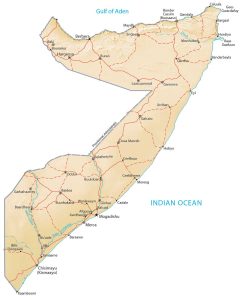
PHYSICAL MAP
Somalia Physical Map
The terrain in Somalia is mostly flat in the central region. But it contains plateaus and rising hills in the north from the Ogo Mountains, which run east-west. At 2,460 m (8,070 ft), Mount Shimbiris is the highest point in Somaliland, which is internationally recognized as part of Somalia. Whereas its lowest point is the Indian Ocean at 0 m (0 ft) sea level. At 1,130 km (702.1 mi), the Shebelle River is the longest in Somalia.

Capital City
Mogadishu
Major cities and towns
Baidoa
Beledweyne
Berbera
Boosaaso
Boorama
Burao
Galkayo
Garbahaarrey
Garoowe
Hargeysa
Cities, towns and villages
Afgooye
Awdheegle
Baardheere
Baki
Bal’ad
Bandarbeyla
Bargaal
Bender
Bu’aale
Buulobarde
Buurhakaba
Cadale
Cassim Qandala
Ceelbuur
Ceeldheere
Dhud
Dusa Marreb
Erigavoo
Eyl
Giohar
Hobyo
Hurdiyo
Iskushuban
Jamaame
Jilib
Jirriban
Kaambooni
Laascaanood
Merca
Maydh
Mereeg
Oddur
Qardho
Qooqaani
Wanlaweyn
Lakes, rivers and water features
Dhud River
Gees Gwardafuy
Gulf of Aden
Indian Ocean
Webi Jubba
Webi Shabeelle