Map of the Bahamas – Islands and Cays

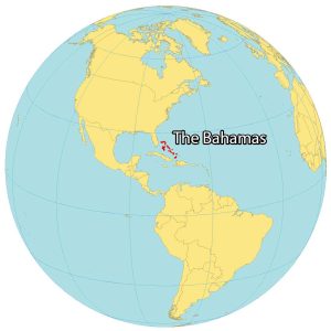
The Bahamas is a chain of 700 islands in the Caribbean Sea. This Bahamas map shows everything from major cities to airports, and seaports. Plus, it includes elevation and satellite imagery to help get more familiar with the Bahamas.
You are free to use our map of the Bahamas for educational and commercial uses. Attribution is required. How to attribute?
About the map

The Bahamas is a chain of islands located in the Caribbean Sea near the Straits of Florida. It consists of about 700 islands in the North Atlantic Ocean. But only 31 of them are inhabited. The chain of islands is roughly southeast of Florida and northeast of Cuba.
Nassau is the capital and largest city of The Bahamas and is on the island of New Providence. Its other main islands include Grand Bahama, Andros (the largest), and San Salvador Island.
It’s also only one of two countries to have the word “The” in its name. The other country is in Africa known as The Gambia. This linguistic peculiarity adds an interesting trivia tidbit to their identities and the global map.
Map of the Bahamas
The Bahamas is spread out over approximately 800 kilometers (500 mi) in the Atlantic Ocean. Altogether, the Bahamas occupy an area of 13,878 square kilometers (5,358 sq mi), which is similar in size to Puerto Rico. Forests cover over 50% of the Bahamas in a mostly tropical savanna climate. The Bahamas lie between latitudes 20° and 28°N so it doesn’t experience any winters.
In general, the Bahamas has a long and flat terrain. It has some low-rounded hills within its islands. But it mostly consists of low-lying topography without any true mountains. At just 63 meters (207 ft) Mount Alvernia (Como Hill) on Cat Island is its highest point. Whereas the Atlantic Ocean is at its lowest point. Unfortunately, the Bahamas is vulnerable to sea-level rise with social and economic impacts.
Capital City
Nassau
Major islands
Grand Bahama Island
Great Abaco
Cat Island
Eleuthera Island
Andros Island
San Salvador Island
Great Exuma Island
Long Island
Mayaguana
Crooked Island
Ragged Island
Acklins Island
Great Inagua Island
Little Inagua
Little San Salvador
North Bimini
Royal Island
Rose Island
Little Ragged Island
Cays
Norman Cay
Shroud Cay
Rum Cay
Hawksbill Cay
Fowl Cay
Samana Cay
Flamingo Cay
Plana Cays
Cay Verde
Cay Santo Domingo
Cat Cays
Pelican Cay
Finley Cay
Ship Channel Cay
Big Wood Cay
Hawksbill Cay
Fowl Cay
Seal Cay
Nurse Cay
Racoon Cay
Water
Straits of Florida
North Atlantic Ocean
Caribbean Sea


Season’s Greetings