Tanzania Map – Cities and Parks
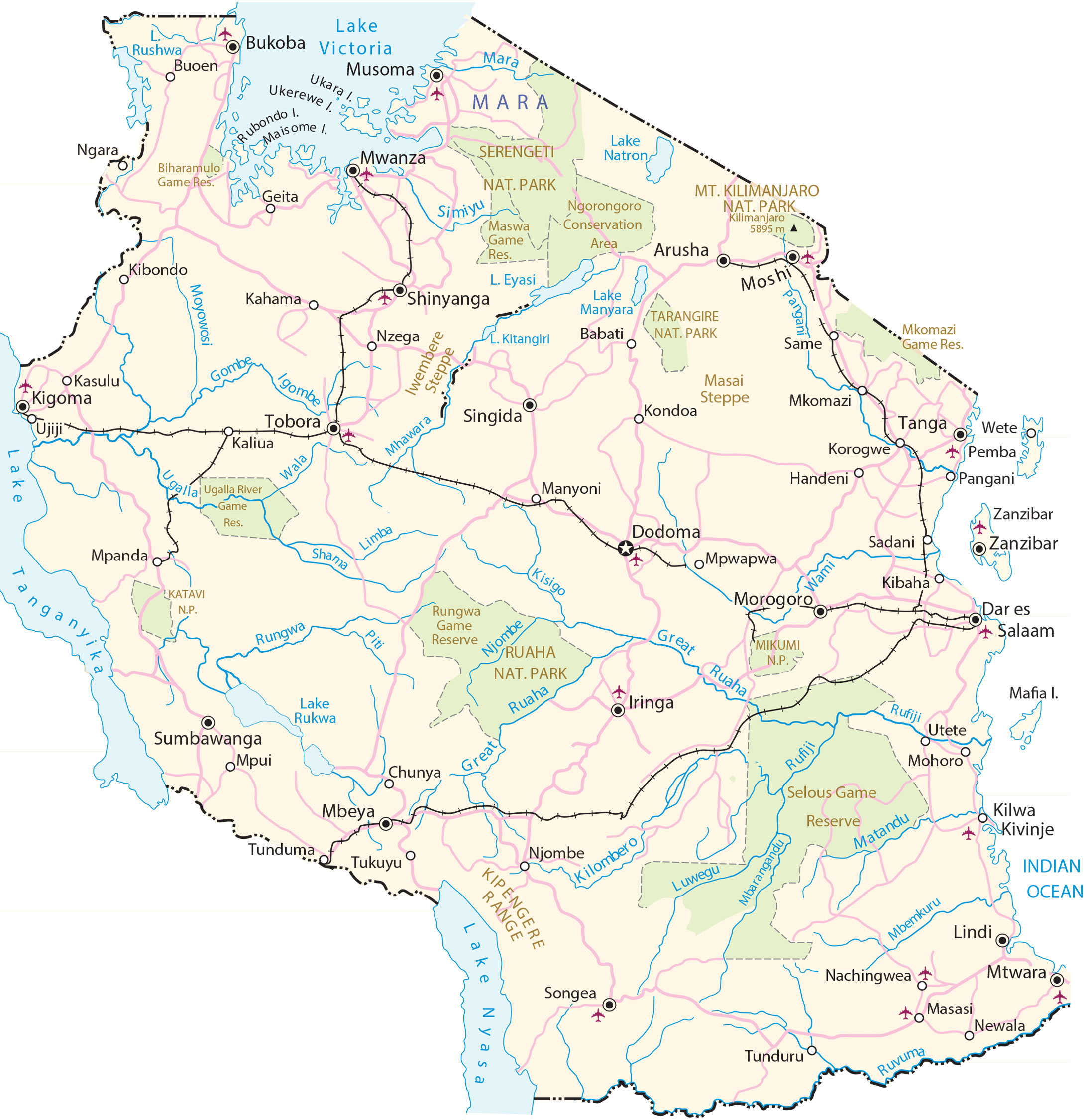
This reference map of Tanzania displays the iconic country known for Mount Kilimanjaro, the Serengeti, and Lake Victoria. It includes satellite imagery and an elevation map to view its mountains, valleys, plains, and plateaus.
Tanzania map collection

You are free to use our Tanzania map for educational and commercial uses. Attribution is required. How to attribute?
About the map
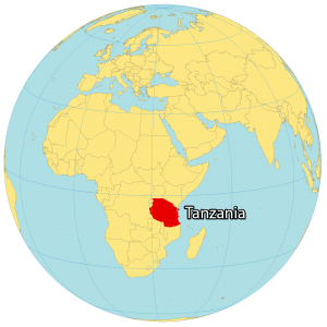
Tanzania is located in eastern Africa, along the Indian Ocean. The country is filled with memorable sites like Mount Kilimanjaro, the source of the Nile, the Serengeti, and Africa’s largest lake, Lake Victoria.
Also, it’s known for its wilderness, safaris, and Big Five game animals including the elephant, lion, leopard, buffalo, and rhino. It borders 8 African countries including Uganda, Kenya, Rwanda, Burundi, the Democratic Republic of Congo, Zambia, Malawi, and Mozambique.
The capital city is Dodoma, although the largest city and commercial hub is Dar es Salaam. Other major cities are Mwanza, Zanzibar, and Arusha. The geography of Tanzania is varied, with a central plateau and is bordered by mountains, including the Usambara and Uluguru ranges.
SATELLITE IMAGERY
Tanzania Satellite Map
Tanzania is part of the African Great Lakes region (Rift Valley Lakes). Lake Victoria is Africa’s largest lake, the second-largest freshwater lake by area, and a source of the Nile. Also, Tanzania is home to the world’s second-deepest lake, which is Lake Tanganyika in the west. Finally, Lake Nyasa (Lake Malawi) is 350 miles in length found in southwest Tanzania.
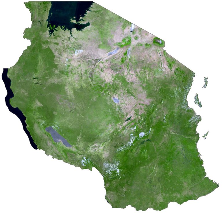
Overall, the Serengeti Plain spans the northern region of Tanzania and is home to the second-largest terrestrial mammal migration in the world. It’s the site of around 1.5 million wildebeest migrations, which makes it one of the Seven Natural Wonders of Africa and a natural travel wonder of the world.
PHYSICAL MAP
Tanzania Elevation Map
One of the most iconic landmarks in Tanzania is Mount Kilimanjaro. Not only is it the highest point in Africa, but it’s also only one of three mountain ranges with glaciers at the peak. Mount Kilimanjaro and Mount Meru stand in the northeast of Tanzania and both are inactive volcanoes. The terrain of Tanzania is diverse and is a mix of valleys, plateaus, plains, and mountains.

At the center of Tanzania is a large plateau with grassland and arable land to the north and south. Otherwise, the Ngorongoro Crater is a World Heritage Site in the Arusha Region to the north. Overall, Tanzania lies just below the equator with a hot and humid climate with two separate rainy seasons.
Capital City
Dodoma
Major cities and towns
Arusha
Dar Es Salaam
Kahama
Kasulu
Kigoma
Mbeya
Morogoro
Moshi
Mwanza
Sumbawanga
Tabora
Tanga
Zanzibar
Cities, towns and villages
Babati
Bukoba
Chunya
Geita
Handeni
Iringa
Kaliua
Kibaha
Kibondo
Kilwa Kivinje
Kondoa
Korogwe
Lindi
Masasi
Mpanda
Mpwapwa
Mwawara
Mtwara
Musoma
Nachingwea
Newala
Ngara
Njombe
Nzega
Pangani
Same
Shinyanga
Singida
Tukuyu
Tunduma
Tunduru
Utete
Wete
Lakes, rivers and water features
Gombe River
Great Ruaha River
Igombe River
Indian Ocean
Lake Eyasi
Lake Kitangiri
Lake Manyara
Lake Natron
Lake Nyasa
Lake Rukwa
Lake Rushwa
Lake Tanganyika
Lake Victoria
Limba River
Luwegu River
Mara River
Matandu River
Mbemkuru River
Mbarangandu River
Mhawara River
Moyowosi River
Pangani River
Piti River
Rufiji River
Shama River
Wala River
Wami River
Parks and reserves
Biharamulo Game Reserve
Gombe National Park
Katavi National Park
Kipengere Range
Maswa Game Reserve
Mkomazi Game Reserve
Mikumi National Park
Mt Kilimanjaro Nat. Park
Moyowosi Game Reserve
Ngorongoro Conservation Area
Ruaha National Park
Rungwa Game Reserve
Sadani National Park
Selous Game Reserve
Serengeti National Park
Tarangire National Park
Ugalla River Game Reserve
Islands
Mafia Island
Pemba Island
Rubondo Island
Ukara Island
Ukerewe Island
Mountain ranges and landforms
Kipengere Range
Mt. Kilimanjaro
Iwembere Steppe