Map of Turks and Caicos
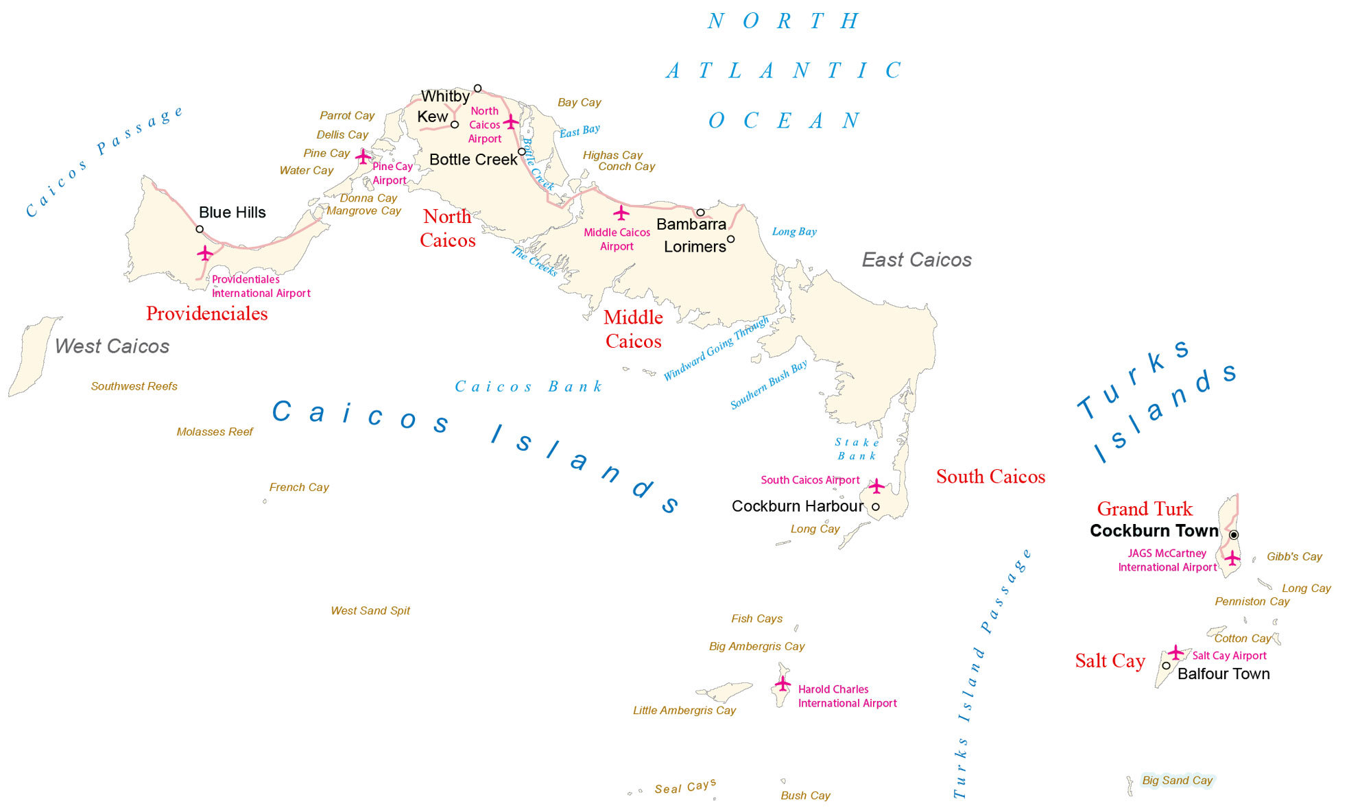
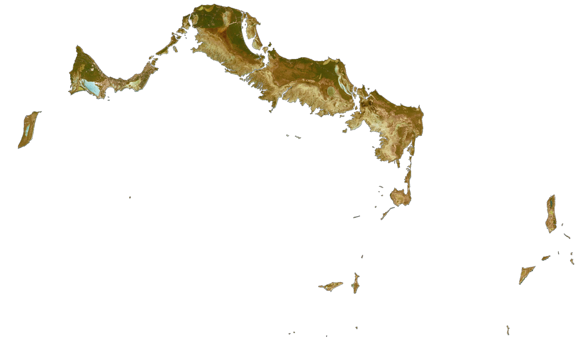
This map of Turks and Caicos displays its collection of islands in the Atlantic Ocean. It displays satellite imagery, settlements, roads, points, bays, and islands of both the Caicos Islands and Turks Islands.
Turks and Caicos map collection
You are free to use our map of Turks and Caicos for educational and commercial uses. Attribution is required. How to attribute?
About the map
Turks and Caicos are a British Overseas Territory in the Caribbean. It consists of two main groups of islands, the Turks Islands and the Caicos Islands. Altogether, there are 8 main islands and over 22 smaller islands.
Cockburn Town is the capital and is situated on the largest island, Grand Turk Island. But Providenciales is the most populous island with over two-thirds of the population, known for its exceptional beaches.
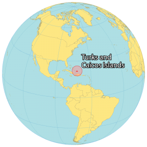
Not only is Turks and Caicos recognized for its tourism, but it’s also a hub for offshore financial centers. Turks and Caicos is located southeast of the Bahamas, northeast of Cuba, and north of Haiti and the Dominican Republic. Both main groups of islands are separated by the Turks Island Passage and surrounded by the Atlantic Ocean. The territory is part of the Lucayan Archipelago and the northern West Indies.
SATELLITE IMAGERY
Turks and Caicos Satellite Map
Altogether, the islands of Turks and Caicos occupy a combined land area of 430 square kilometers (170 sq mi). In comparison, it’s larger than Kiribati but smaller than São Tomé and Príncipe. The islands are mostly flat with marshes, mangroves, and swamps. It’s also rimmed with beaches. At 48 meters (157 ft), Flamingo Hills are the highest point on East Caicos. Additionally, the Blue Hills match the same height as Providenciales.
The only islands with permanent settlement in the Turks Islands are Grand Turk, which is the most densely populated area, as well as Salt Cay. Providenciales is the most populous island in the Caicos Islands. Also, there are settlements in North Caicos, South Caicos, Parrot Cay, East Caicos, and West Caicos. The islands are regularly sunny with a tropical savanna climate
Capital City
Cockburn Town
Main islands
Turks Islands
Caicos Islands
Islands
East Caicos
Grand Turk
Middle Caicos
North Caicos
Providentiales
South Caicos
West Caicos
Bay, banks, and water
Caicos Bank
Caicos Passage
East Bay
Long Bay
North Atlantic Ocean
Southern Bush Bay
Stake Bank
The Creeks
Turks Island Passage
Windward Going Through
Populated places
Balfour Town
Bambarra
Blue Hills
Cockburn Harbour
Kew
Lorimers
Whitby
Points of interest
Bottle Creek
Harold Charles International Airport
JAGS McCartney International Airport
Middle Caicos Airport
North Caicos Airport
Pine Cay Airport
Providenciales International Airport
Salt Cay Airport
South Caicos Airport
West Sand Spit
Cays and reefs
Bay Cay
Big Ambergris Cay
Big Sand Cay
Bush Cay
Conch Cay
Cotton Cay
Dellis Cay
Donna Cay
Fish Cays
French Cay
Gibb’s Cay
Highas Cay
Little Ambergris Cay
Long Cay
Long Cay
Mangrove Cay
Molasses Reef
Parrot Cay
Penniston Cay
Pine Cay
Salt Cay
Seal Cays
Southwest Reefs
Water Cay
Caribbean


