Papua New Guinea Map
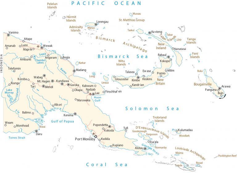
This map of Papua New Guinea shows cities, roads, and islands. Satellite imagery and elevation feature the topography, islands, and landscape of Papua New Guinea.
Papua New Guinea map collection

You are free to use our Papua New Guinea map for educational and commercial uses. Attribution is required. How to attribute?
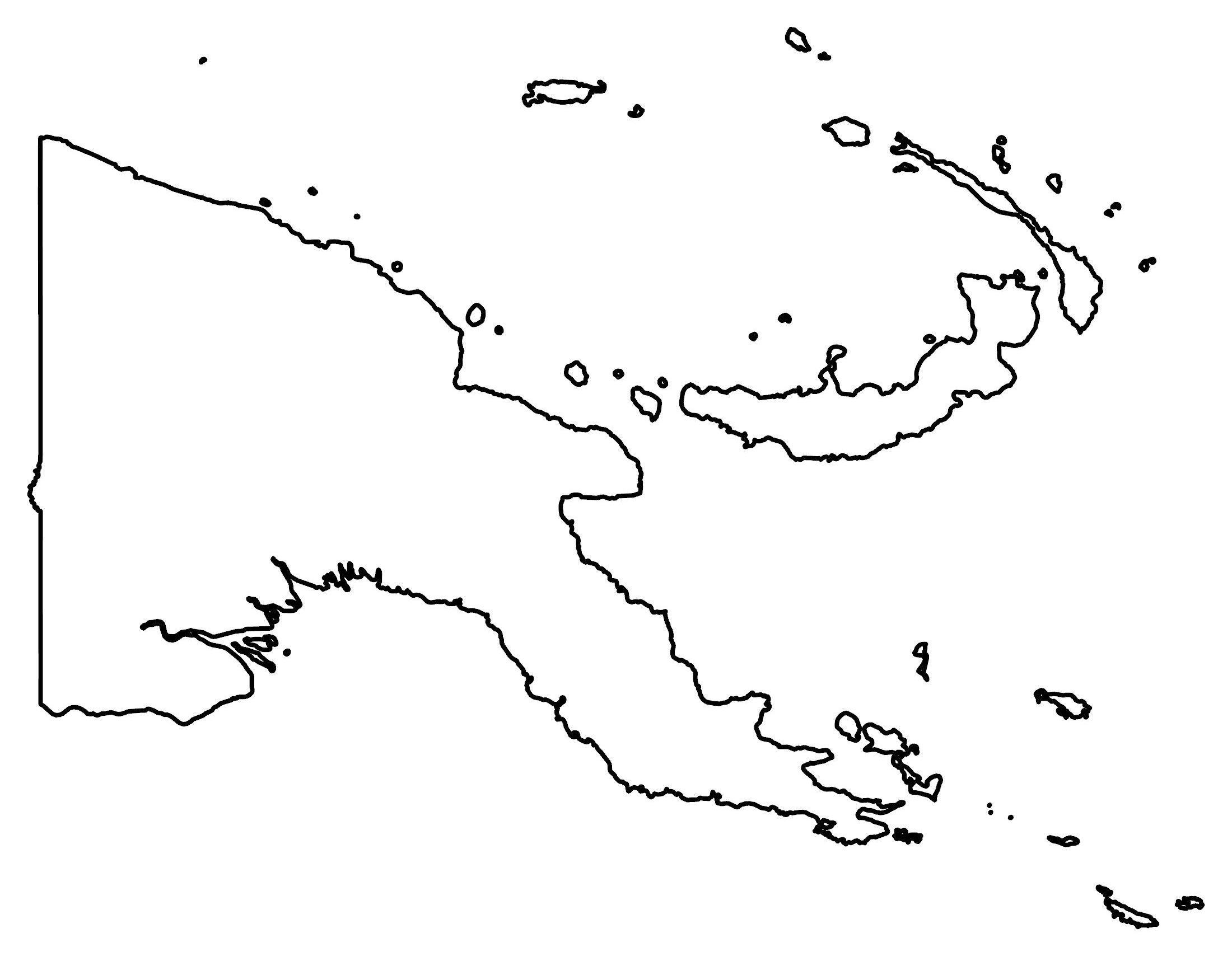
About the map
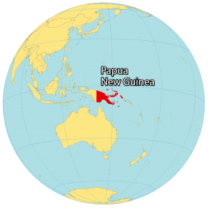
Papua New Guinea is a country in Oceania that consists of the eastern region of New Guinea and its offshore islands in the Pacific Ocean. Altogether, there are over 600 main islands but New Guinea itself contains 85% of its landmass.
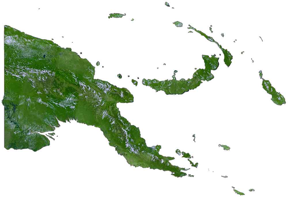
Further to the east, the Bismarck Sea separates New Britain Island from the Bismarck Archipelago. To its south, the Solomon Sea divides it from the Louisiade Archipelago and the D’Entrecasteaux Islands.
The capital and most populous city of Papua New Guinea is Port Moresby located on the mainland within the Gulf of Papua. Other major cities are Lae, Arawa, and Mount Hagen. The island of New Guinea is split between Indonesia.
SATELLITE IMAGERY
Papua New Guinea Satellite Map
Papua New Guinea occupies an area of 462,840 square kilometers (178,700 sq mi), which makes it the third-largest island country in the world. But the eastern portion of New Guinea, split in two with Indonesia, is the second-largest island in the world.
The country is covered in tropical rainforests with the majority still intact and undisturbed. It’s known for having the greatest plant diversity of any other island country in the world. The climate in Papua New Guinea is tropical with its rainy and monsoon season between December and March.
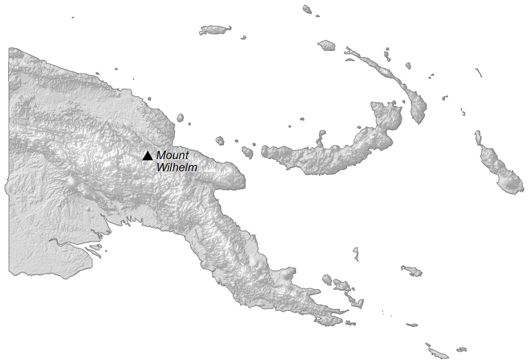
PHYSICAL MAP
Papua New Guinea Elevation Map
Papua New Guinea’s terrain is diverse but it’s mostly mountainous. For example, the New Guinea Highlands (Central Range) is the spine that extends through the main island. Although the Great Papuan Plateau has many high peaks, its highest peak is Mount Wilhelm at 4,509 meters (14,793 feet), which is in the Bismarck Range.
Its other major mountain chain on the mainland is the Owen Stanley Range to the southeast. Overall, the collision of the Australian and Pacific Tectonic Plates formed New Guinea. Most of its islands are volcanic in origin and have the most active volcanoes in the Southwest Pacific.
Capital City
Port Moresby
Major cities and towns
Aitape
Alotau
Arawa
Daru
Goroka
Kerema
Kimbe
Kokopo
Kundiawa
Lae
Lorengau
Madang
Mendi
Mt. Hagen
Popondetta
Rabaul
Wabag
Wewak
Populated places
Amanab
Ambunti
Angoram
Balimo
Bogia
Buin
Esa’ala
Ewase
Finschhafen
Gloucester
Hoskins
Kabwum
Kandrian
Kikori
Kiunga
Kokoda
Koroba
Kulumadau
Kupiano
Kwikila
Lumi
Mapriko
Marawaka
Milim
Morehead
Nadzab
Namatanai
Okapa
Panguna
Pomio
Talasea
Tari
Telefomin
Tufi
Vanimo
Weam
Islands
Admiralty Islands
Bismarck Archipelago
Bougainville Island
Buka Island
D’Entrecasteaux Islands
Feni Islands
Fergusson Island
Goodenough Island
Hermit Islands
Karkar Island
Kiwai Island
Lihir Island
Long Island
Louisiade Archipelago
Manus Island
Misima Island
Mussau Island
New Britain Island
New Ireland
Normanby Island
Pelelun Islands
Rossel Island
St. Matthias Group
Tabar Islands
Tagula Island
Tanga Islands
Taskul Island
Trobriand Islands
Umboi Island
Witu Islands
Woodlark Island
Lakes, rivers and water features
Bismarck Sea
Chambri Lakes
Coral Sea
Goschen Strait
Gulf of Papua
Huon Gulf
Lake Murray
Pacific Ocean
Pocklington Reef
Ramu River
Sepik River
Solomon Sea
Strickland River
Torres Strait


