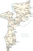
Map of Mozambique

This map of Mozambique contains cities, lakes, rivers, and roads. Satellite imagery and an elevation map display the Zambezi River, Mozambique Plateau, and Angolan Highlands.
Mozambique map collection


You are free to use our Mozambique map for educational and commercial uses. Attribution is required. How to attribute?
About the map
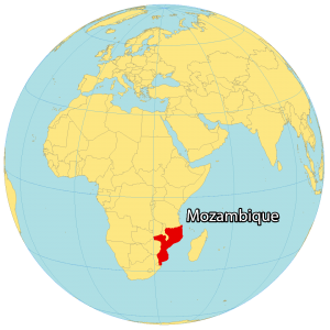
Mozambique is located in southern Africa, known for its coastline beaches, natural wildlife, and natural heritage. It borders six countries including Tanzania and Malawi to the north, Zambia to the northwest, Zimbabwe to the west, as well as Eswatini and South Africa to the southwest.
No other country in Africa has a longer coastline with the Indian Ocean than Mozambique, which is estimated to be 2,300 kilometers (1,430 mi) in length. Along this coast, the Mozambique Channel separates it from Madagascar about 425 kilometers (264 mi) in distance. The capital and largest city of Mozambique is Maputo (formerly Lourenço Marques).
SATELLITE IMAGERY
Mozambique Satellite Map
Mozambique occupies an area of 801,590 square kilometers (309,500 sq mi) which makes it close to the size of Turkey or Namibia. It lies between 11°S to 27°S latitudes with an elongated shape in the north-south direction. Because of its location in the southern hemisphere and its coastal influence, the climate is mostly tropical.
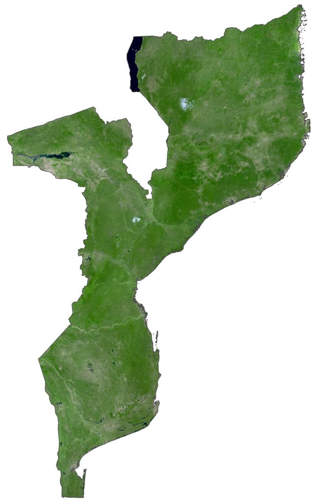
Its longest river is the Zambezi River. Its path through Mozambique is within Lake Cahora Bassa, where it eventually drains into the Indian Ocean. The country also shares the African Great Lake of Lake Nyasa (Lake Malawi) in the central-northern region with Malawi and Tanzania.
PHYSICAL MAP
Mozambique Elevation Map
The Zambezi River splits Mozambique into two distinct regions. First, the north is characterized by its rugged terrain with the Mozambique Plateau and Angolan Highlands. Secondly, south of the Zambezi River contains its lowland Mozambique Plains mixed with the Lebombo Mountains in the far south.
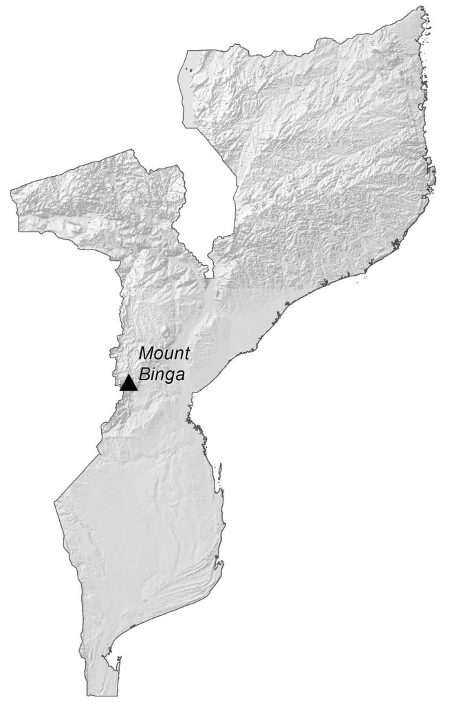
At 2,436 meters (7,992 feet), Mount Binga, part of the Chimoio Highlands, is the country’s highest peak. Whereas its lowest point is the Indian Ocean at sea level.
Capital City
Maputo
Major cities and towns
Beira
Chimoio
Lichinga
Matola
Mocuba
Nampula
Pemba
Quelimane
Tete
Cities, towns and villages
Ancuabe
Angoche
Bela Vista
Boane
Cahora Bassa
Chibabava
Chibuto
Chiconono
Chicualacuala
Chinde
Cuamba
Dondo
Erégo
Fingoè
Furancungo Coutinho
Gilé
Guijá
Guro
Homoíne
Inhambane
Inhárrime
Inhassôro
Inhaminga Velha
Junqueiro
Mueda
Mandimba
Marrupa
Maúa
Maganja
Magude
Manhiça
Manjacaze
Mapai
Marromeu
Massinga
Massingir
Matola
Mecula
Mecubúri
Meconta
Memba
Metangula
Milange
Mocimboa da Praia
Moatize
Mogincual
Mopeia
Moma
Montepuez
Morrumbala
Morrumbene
Mossuril
Namacurra
Namarrói
Nametil
Namuno
Namapa
Nacala
Nova Mambone
Palma
Panda
Pebane
Povuma
Quissico
Quissanga
Ribáué
Save
Vilanculos
Vila Gamito
Vila da Ligonha
Vilá Junqueiro
Xai-Xai
Zumbo
Lakes, rivers and creeks
Cahora Bassa Lake
Indian Ocean
Lake Nyasa
Lake Malawi
Limpopo River
Lúrio River
Mozambique Channel
Púngue River
Rovuma River
Save River
Zambezi River