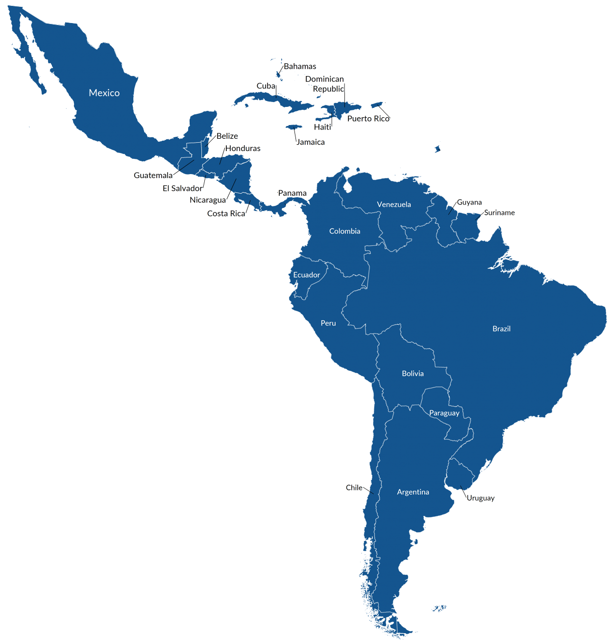
Latin America Map

Let’s dive into the region of Latin America. It’s a big region, and sometimes it can be a bit confusing to figure out exactly where it is and what countries are part of it. So, let’s break it down in a simple way.
Where is Latin America?
First things first, where is Latin America located? Imagine you’re looking at a map of the Western Hemisphere. Latin America is the big area that starts just below the United States.
It includes Mexico and stretches down to the bottom of South America. It’s like a long strip that covers a lot of ground.
Which Continents are Part of Latin America?
This is where it gets a bit tricky. Latin America is part of two continents: North America and South America. The countries in North America include Mexico and those in Central America (like Guatemala and Panama). Then, as you go further south, you enter South America, which includes countries like Brazil, Argentina, and Peru.
So, when you’re looking at a map and see all these countries below the United States, you’re looking at Latin America. It’s a region with a mix of different cultures, languages, and beautiful landscapes. Each country has its own unique story, but they all share a connection through this region called Latin America.
Jump To: North & Central America | South America | Caribbean


