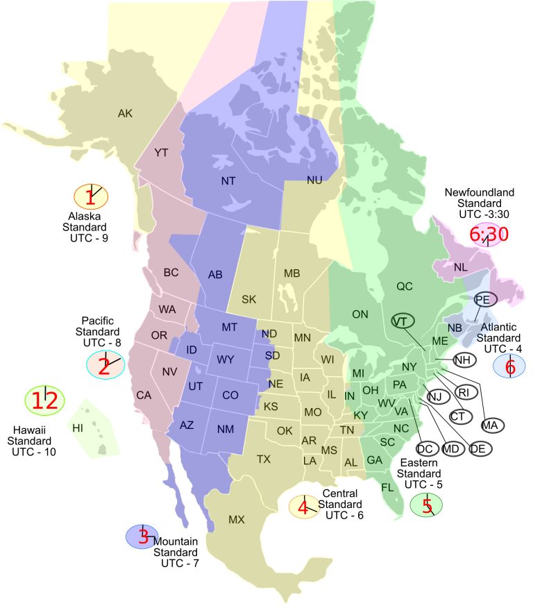
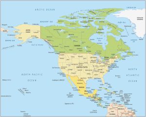
North America Time Zone Map
You are free to use our North America time zone map for educational and commercial uses. Attribution is required. How to attribute?
About the map
- Eastern Time Zone
- Central Time Zone
- Mountain Time Zone
- Pacific Time Zone
- Alaska Time Zone
- Hawaii-Aleutian Time Zone
- Atlantic Time Zone
- Newfoundland Time Zone
Eastern Standard Time Zone [UTC−05:00]
Central Standard Time Zone [UTC−06:00]
Mountain Standard Time Zone [UTC−07:00]
*Arizona does not use daily saving time, outside of Navajo Nation.
Pacific Standard Time Zone [UTC−08:00]
The following states and provinces fully use Pacific Standard time:
California
Nevada
Washington
Yukon
Alaska Time Zone [UTC−09:00]
The state of Alaska partially uses Alaska time.
Hawaii‑Aleutian Time Zone [UTC−10:00]
The state of Hawaii fully uses the Hawaii‑Aleutian time zone and Alaska partially uses the Alaska Hawaii‑Aleutian time zone.
*Hawaii does not use daily saving time
Atlantic Standard Time Zone [UTC−4:00]
The following provinces fully use Atlantic Standard time:
New Brunswick
Nova Scotia
Prince Edward Island
Newfoundland Standard Time Zone [UTC−03:30]
The province of Newfoundland and Labrador uses Newfoundland Standard time.
Time Zone Maps
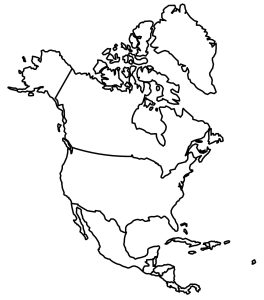
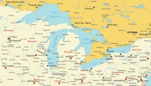
Atlas of North America
Interested in maps of North America? Our collection includes several choices. You’ll find country outlines and a map of the Great Lakes. Find out more by clicking on the map provided below.
I was actually looking for a place to make a comment, but you are correct. Yukon does not change time. And starting at this time change, BC will stay in the same time zone as well. Saskatchewan also only has one time and doesn’t change time. They have to update this map for time changes.
Saskatchewan, in Canada, does not use Daylight Saving Time. It is in Central Standard Time year round. Please correct this in your description.
This is a common misconception. Saskatchewan is not on Central Standard Time all year round. Rather it is on Mountain Daylight Saving Time year round. The province falls entirely in the Mountain Time zone, something that a glance at a time zone map makes readily apparent. Until the late 60’s they switched back and forth between standard time and daylight saving time, then decided to stay on daylight saving time year round. That meant that they were now observing Central Standard Time, but it is more accurate to say that they are on MDT year round rather than to say that they are on CST year round. British Columbia has just made a similar decision.
Your PDF version of the map doesn’t have Mexico on it, even though the jpg does. It’s a really good quality jpg though, so congrats there!
I checked and it looks like you’re correct. We’ll try to update it in the future.
Yukon is MST year-round. When Alaska is on AKST, there is a two-hour change at the border!
Would be great to have Saint Pierre and Miquelon too which is UTC-3(UTC-2). Especially easy to get people confused considering its relative position to Newfoundland.
Thank you for the work you do on this. It is a challenge to “get it right” all the time.
Might I add a couple of notes regarding Canada:
Firstly, if you care to add NS (Nova Scotia) it is that ‘thumbs down’ penninsula right above NH and beside NB. Not sure if you have the room, and it’s mostly to ensure it is included.
Secondly, the province of Saskatchewan is Central time but does not use daylight savings time.
Thank you again.
Even though this says “updated Jan 1, 2024”, this organization has not taken any of the above comments and made appropriate changes. Mexico is still missing as part of North America, Newfoundland time is still wrong, Nova Scotia and New Brunswick still mixed up, etc. This worthless and should not be used at all.
Hi Cathy. Sorry about the confusion, but the updated date was another change in this article. With that said, we’ve made the changes that you’ve listed. Mexico is added, Newfoundland time is corrected, and the New Brunswick label has been updated.
Please add Mexico (and Central América) to your list of “States and provinces”. Also please add info about which states, provinces, cities, or countries still follow DST. Mexico has not been following DST for over a year now, but a few border cities/states do for business purposes.
This site is free and, importantly, open to helpful feedback. Nothing is as valuable to improve as self improvement. Mistakes happen, Cathy. Take your comment, for example, “This worthless and should…”
They corrected your issue and offered an apology, to boot! I’ve found it much easier to keep everything in perspective. Exceedingly few matters in this life are genuinely due avowed vitriol. From someone with not many days left in this world and far too many foolish regrets, take everything in measurement. (…and be kind)
The Haida Gwaii (formerly Queen Charlotte Islands), just below the Alaska panhandle, are indicated as Alaska time in the map, but they are part of British Columbia, and use Pacific time.
Your map of eastern Canada is incorrect: you have labelled New Brunswick (NB) as Nova Scotia (NS). They are two separate provinces.
Thanks, Neil. Haida Gwaii is now Pacific Time like the rest of British Columbia.
This map is too confusing I can’t use it anymore
A geography website that doesn’t know Mexico is in North America 🤡
You don’t have Mexico or Central America, either. I believe they are part of North America, are they not?
Yes, they are part of North America. We’ve added Mexico but not Central America.
Mexico is CST
NL should be 6:30, not 7:30.
Yes, Newfoundland is now 6:30
Mexico, anyone?
Mexico has been added in. Thanks for the suggestion.
You obviously don’t know what “North America” means :-/
You have New Brunswick marked as Nova Scotia and nothing for Nova Scotia on the NA Time Zone Map.
Hi Gordon. Yes, these two labels were mixed up. This has been corrected in the latest version. Thanks for commenting.